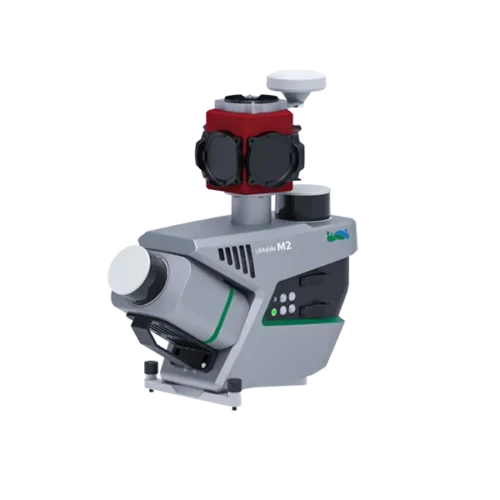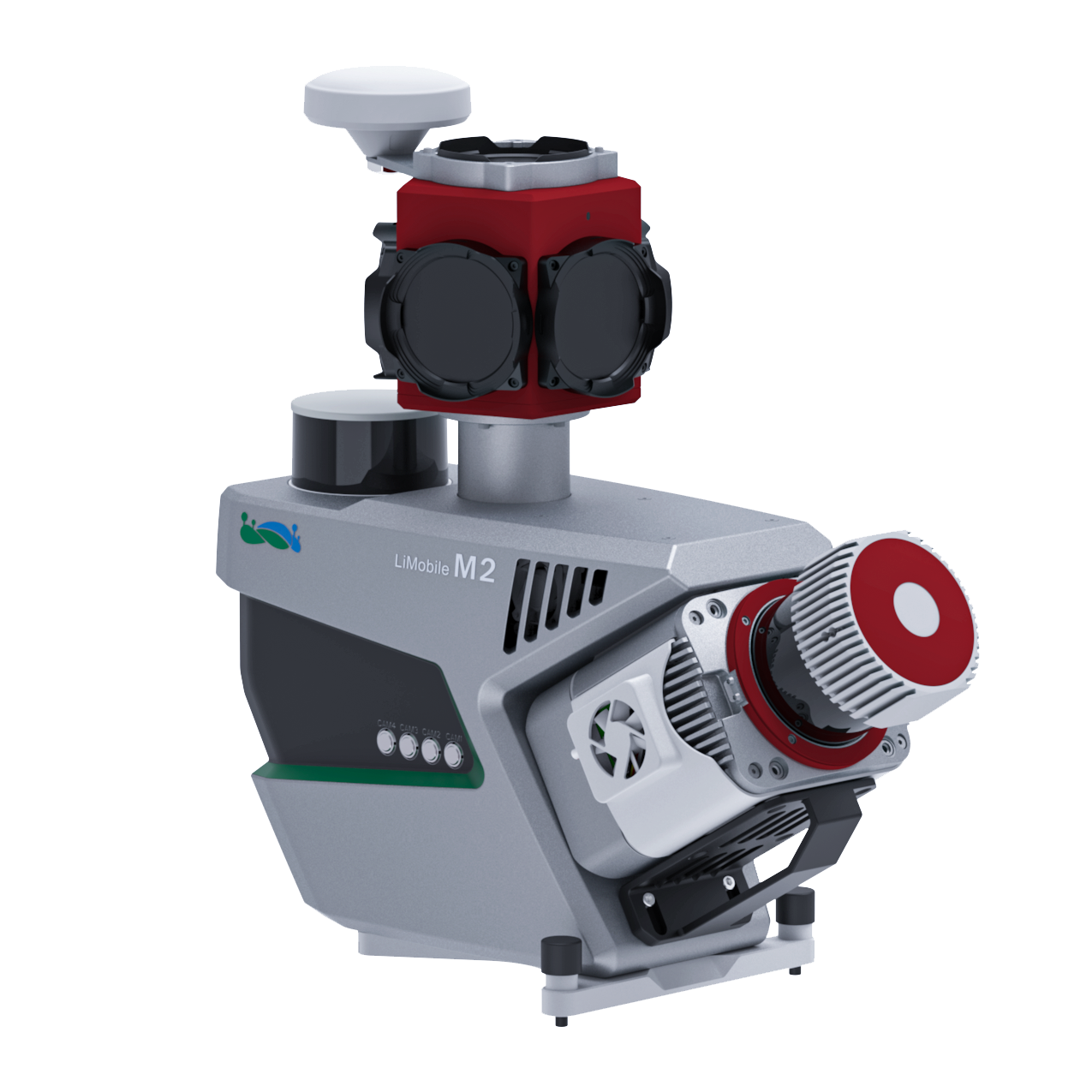
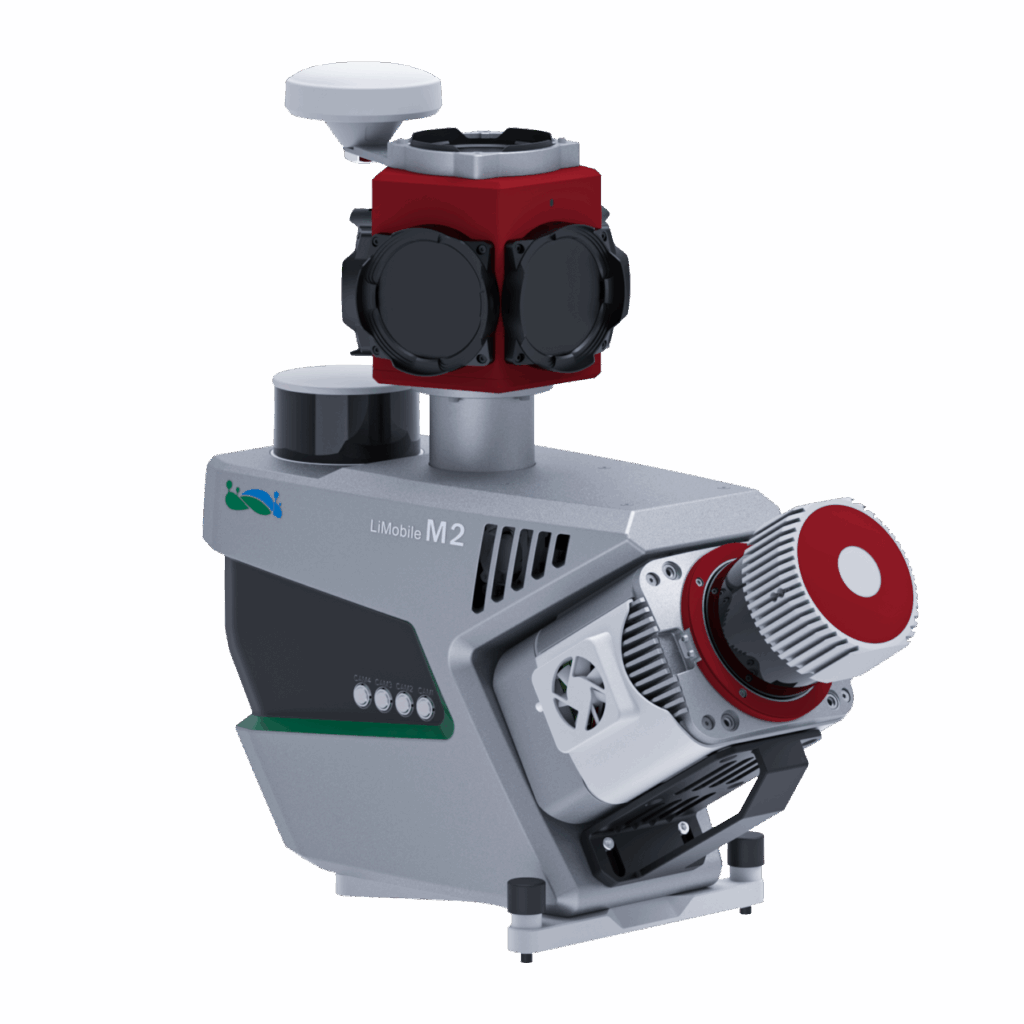
The LiMobile M2 Ultra integrates long-range LiDAR, GNSS/INS navigation, multi-channel SLAM LiDAR, and a high-resolution panoramic camera. With multi-expansion interfaces and vehicle adaptability, it supports one-stop data processing via LiDAR360MLS software for applications in road maintenance, GIS assets, smart transportation, HD mapping, and digital twins.


Range 475 m

Laser Pulse Repetition Rate Up to 1800 kHz

LiDAR Precision 3 mm

Absolute Accuracy ≤ 3 cm

Panorama Camera 30 MP

SLAM

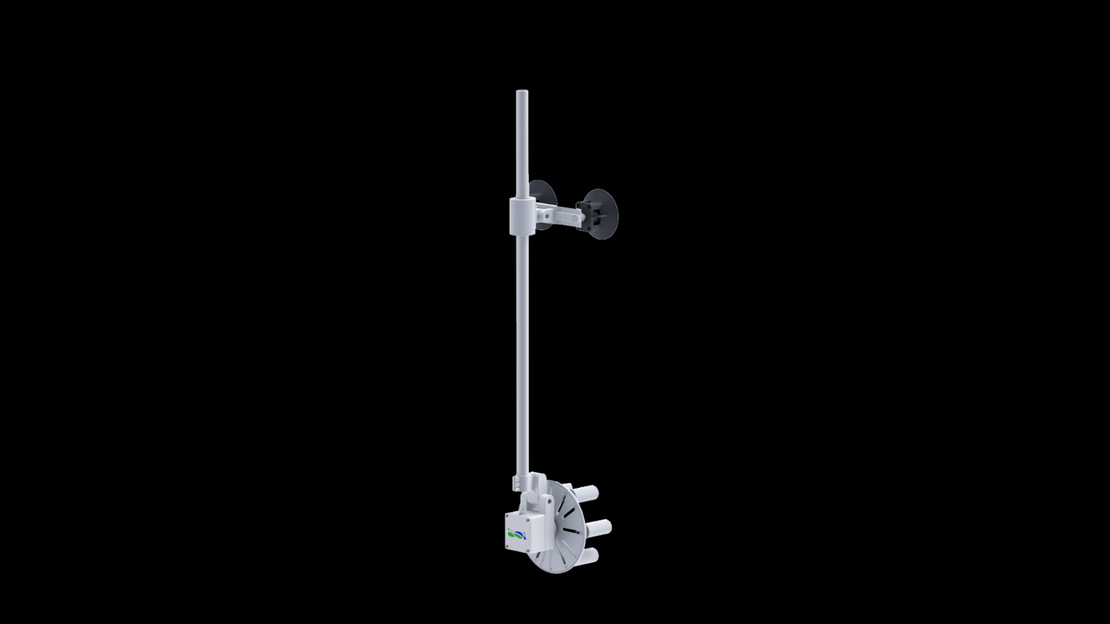
Abundant Expansion

AI Algorithm
The pavement camera focuses on the road surface for a detailed pavement analysis. The front camera captures traffic signs at high resolution.
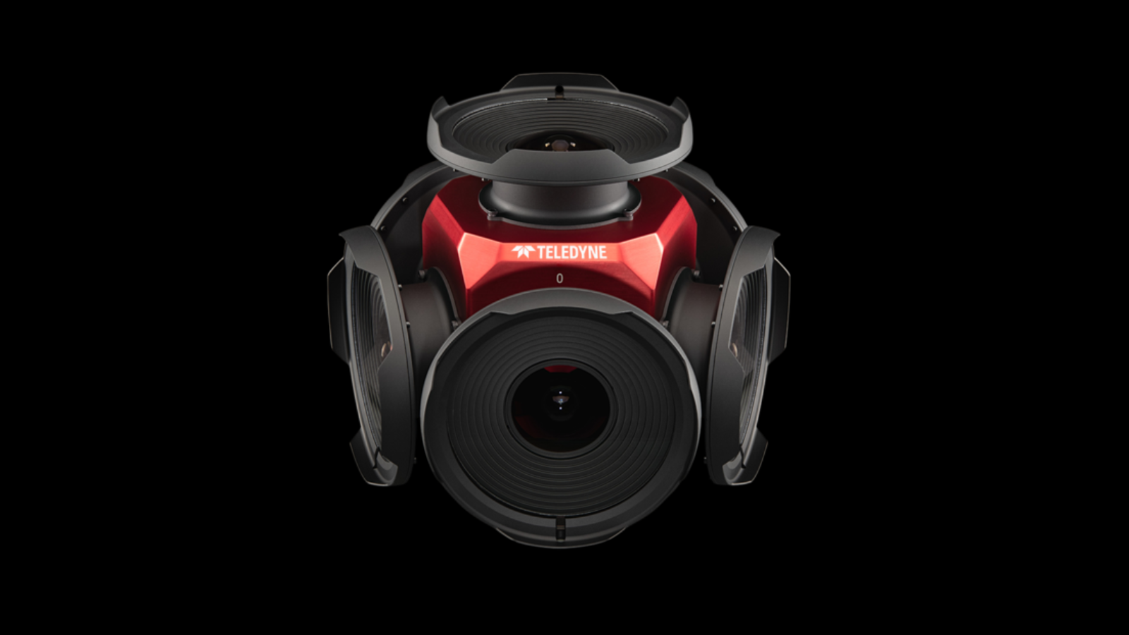
Get higher resolution panoramic images (72MP).
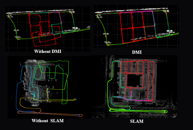
The DMI provides assistance when satellite signals are blocked or unavailable, improving system stability.
Integrated with a LiDAR offering millimeter-level accuracy, the system can achieve centimeter-level precision.
The system employs GNSS, IMU, DMI, and LiDAR SLAM technologies to easily handle various complex working conditions, accurately recreating 3D reality even in GPS-denied areas.
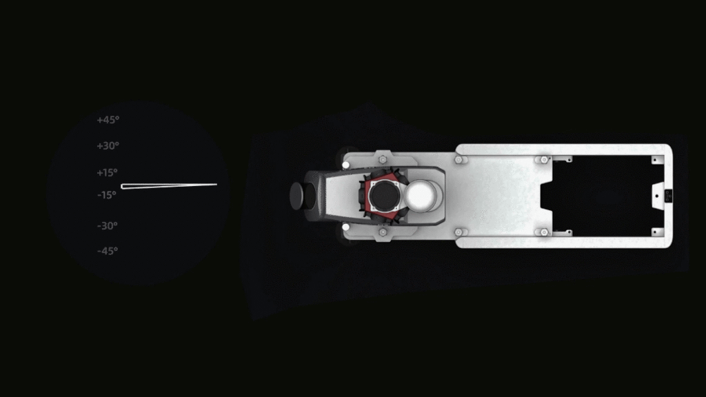
Integrated equipment with a quick-release design allows for rapid installation and removal. Seven predefined mounting angles (0°, ±15°, ±30°, ±45°) can be flexibly selected to meet the needs of different projects.
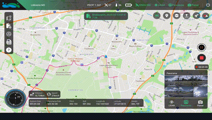
The newly designed data collection APP features a guided operational process, enabling real-time monitoring of data and location, and ensuring convenient access to all critical information.
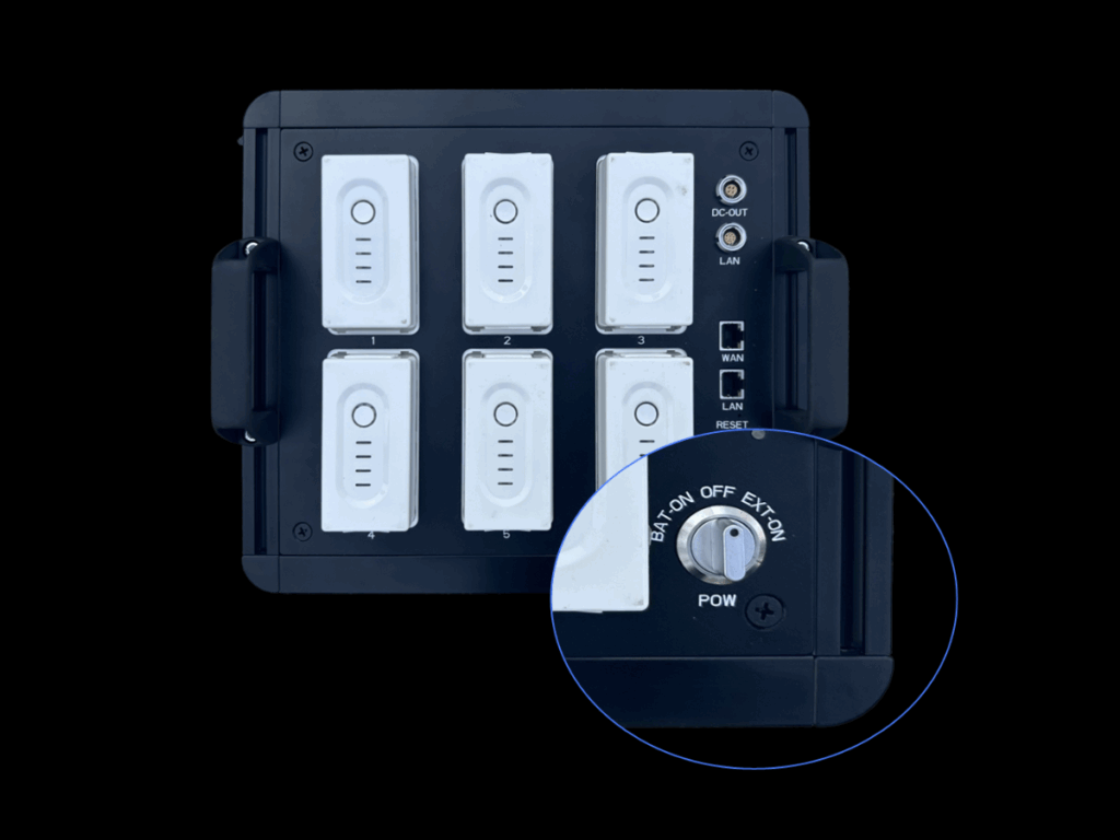
It supports an external power supply, enabling efficient and uninterrupted operation.
| Dimensions | 554×230×547 mm | Weight | 18 kg | |||
| Roof Rock Dimensions | 730×350×95 mm | Roof Rock Weight | 17.5 kg | |||
| Storage | 1 TB×2 | Battery Capacity | 6000 mAh×6 | |||
| Operating Time | ≥3 h | Port | LAN, ODO | |||
| Operating Temperature | -10 ℃ ~ 40 ℃ | IP Rating | IP65 | |||
| Power Consumption (Typical) | 120 W | Power Supply Input Voltage | 24 V-DC | |||
| Power Consumption (Max) | 150 W | Interface Connection | Wi-Fi / Ethernet | |||
LiDAR Sensor Parameters |
||||||
| Accuracy | 5 mm | Precision | 3 mm | |||
| Scan Rate | 10 – 250 revolutions per second, equivalent to 10 – 250 scans/sec |
FOV | 360° | |||
| Laser Pulse Repetition Rate | 300 kHz | 500 kHz | 1000 kHz | 1250 kHz | 1500 kHz | 1800 kHz |
| Maximum range, target reflectivity ≥ 10% |
170 m | 130 m | 85 m | |||
| Maximum range, target reflectivity ≥ 80% |
475 m | 370 m | 235 m | |||
Camera Parameters |
||||||
| Ladybug5+ | Ladybug6 (Optional) | Pavement / Front (Optional) | ||||
| Pixels | 30 MP (5 MP×6 Sensors) | 72 MP (12 MP×6 Sensors ) | 24 MP (12 MP×2 Sensors) | |||
| Maximum Frame Rate | 10 FPS | 5 FPS | 5 FPS (4096×2160) 3 FPS (4096×3000) |
|||
| Image Resolution | 8192×4096 | 12288×6144 | 4096×3000 | |||
| Sensor Type | CMOS | |||||
| Trigger Mode | Time / Distance Trigger | |||||
| Power Consumption | Maximum 13 W | 3.0 W @ 12 VDC | ||||
Positioning and Orientation System Parameters |
||||||
| GNSS System | GPS; GLONASS; GALILEO; BEIDOU; QZSS; SBAS | IMU Data Frequency | 100 Hz | |||
| Mechanical DMI (Optional) | Mechanical wheel odometer for road applications. | |||||
| Position Accuracy (RMS 1ơ)[1] | Horizontal: 0.01 m | Roll / Pitch Accuracy (RMS 1ơ)[1] | 0.005° | |||
| Vertical: 0.02 m | Heading Accuracy (RMS 1ơ)[1] | 0.01° | ||||
Data Output |
||||||
| Absolute Accuracy[2] | ≤3 cm | Point Cloud Data Format | LAS, LAZ, LiData | |||
Software |
||||||
| Data Collection | GreenValley APP | |||||
| Pre-Processing | LiDAR360MLS-Geo Module | Post-Processing | LiDAR360MLS (Optional) | |||
| [1] PPK performance in open-sky GNSS environment. [2] The accuracy is measured in a specific calibration field of GVI, with a vehicle speed of 40 km/h and LiDAR360MLS software. The accuracy may vary in different operating environments, so please refer to actual use. |
||||||
Inquire price for GreenValley LiMobile M2 Ultra High-precision Mobile Laser Scanning System