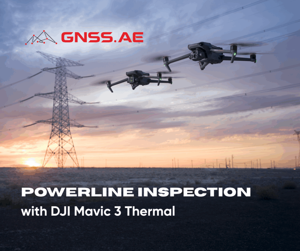
As global electricity demand continues to rise, utility companies face growing pressure to maintain reliable power delivery while ensuring the safety of their field teams. To meet these operational challenges and prevent service disruptions, many utility providers are turning to drone-based powerline inspections — a modern, efficient solution that enhances both safety and efficiency.
Traditional powerline inspections are labor-intensive, costly, and often require workers to operate in hazardous environments such as high elevations, rugged terrain, or near live electrical infrastructure. The DJI Mavic 3 Thermal provides a safer alternative, offering precise aerial imaging capabilities that help utilities detect and address potential issues before they lead to outages.
Drones streamline inspection workflows by:
Accelerating inspection cycles beyond standard compliance requirements.
Supporting emergency assessments and routine maintenance.
Reducing the need for dangerous manual inspections.
Delivering detailed visual and thermal data for improved asset management.
Enhancing grid reliability and safety in combination with vegetation management and system hardening programs.

Different materials and construction types demand different inspection approaches. Powerline infrastructure typically includes:
Wood Utility Poles – Prone to wood rot, cracking, and woodpecker holes.
Concrete Utility Poles – Susceptible to surface cracking and corrosion.
Steel Utility Poles – Require monitoring for rust and structural degradation.
Composite Utility Poles – Inspected for delamination or impact damage.
Key components to inspect include:
Insulators, cotter keys, cross-arms, lightning arrestors, transformers, and primary wires. Drones can detect early signs of wear such as corrosion, leaks, cracks, or any structural compromise — ensuring timely maintenance and improved grid reliability.
Proper preparation ensures safe and successful drone operations. Below is a sample equipment checklist for DJI Mavic 3T powerline inspections:
Whenever possible, scout the location in advance to identify potential obstacles, takeoff and landing zones, and local environmental conditions. Notifying nearby residents or businesses about upcoming drone operations can help reduce curiosity-driven interruptions during the mission.
If a site visit isn’t possible, utilize Google Earth or mapping tools to analyze terrain and obstacles virtually. Importing KML files can also assist in visualizing flight paths and understanding environmental constraints.

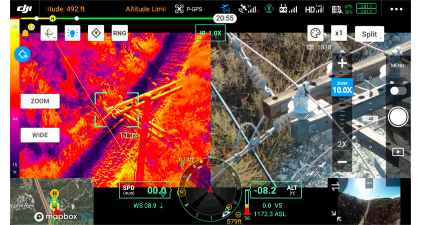
DJI Mavic 3 Thermal provides several advanced tools and modes designed specifically for utility inspections:
1. Manual Flight
Ideal for complex or irregular sites, manual flight allows pilots to control every aspect of the mission, capturing images or video as needed.
2. High-Resolution Grid Capture
With the High-Res Grid Photo function, operators can select an area of interest using the wide-angle camera. The zoom camera then automatically captures multiple detailed images of that area, stored alongside the overview photo — simplifying comprehensive documentation of utility poles.
3. Live Mission Record
The Live Mission Record feature enables pilots to record manual flight paths, gimbal movements, and camera actions to create a sample mission. These saved missions can later be automated for consistent and repeatable inspections.
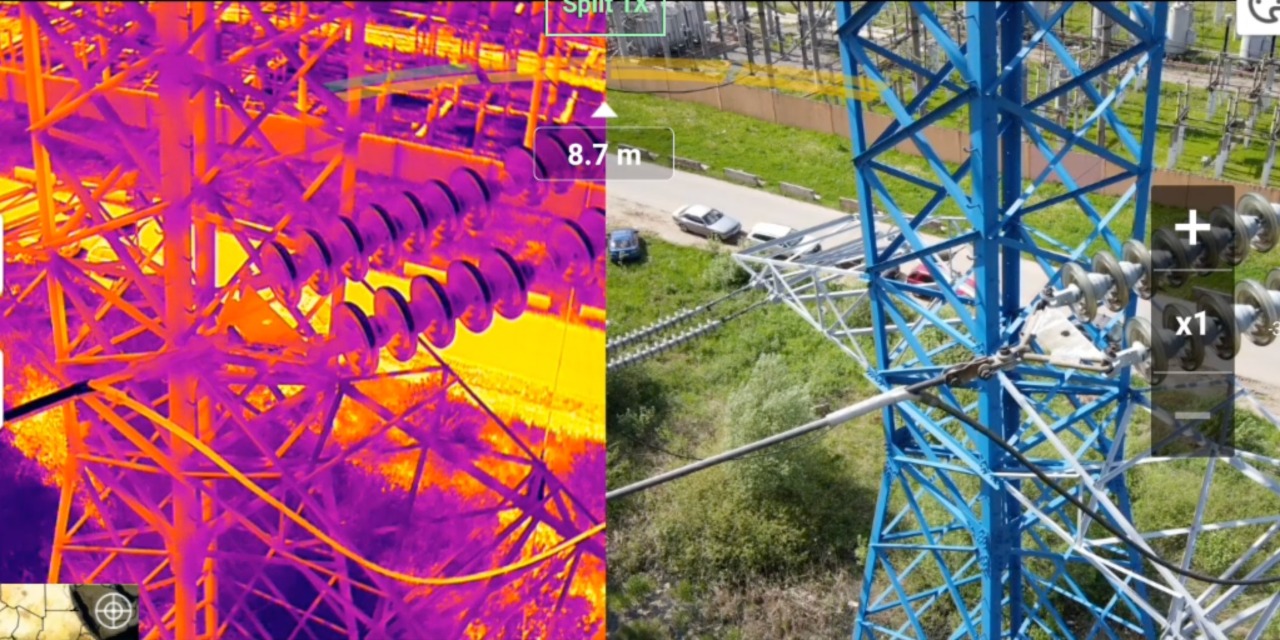
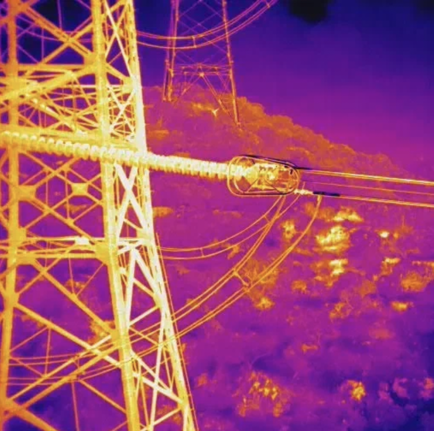
4. Infrared/Thermal Imaging
Thermal inspection is one of DJI Mavic 3T’s most valuable tools. The thermal camera detects heat signatures, enabling the identification of hot spots, overloaded components, and other anomalies invisible to the naked eye. Because thermal sensors capture data in both daylight and complete darkness, they are invaluable for 24/7 operations and emergency assessments.
Once image data is captured, processing and analysis become crucial. Platforms like DroneDeploy Aerial empower teams to:
By integrating DroneDeploy with DJI Mavic 3 Thermal operations, utilities can transition seamlessly from data capture to actionable insights — improving decision-making and maintenance scheduling.
Drone-based powerline inspection is no longer an emerging trend — it’s an essential tool in modern utility operations. DJI Mavic 3 Thermal offers an ideal balance of portability, precision, and intelligence, allowing teams to inspect assets safely and efficiently.
From pre-flight planning to data analysis, the combination of advanced imaging, automation, and AI-driven mapping software ensures utilities can maintain operational excellence while minimizing risk and downtime.
