Successful aerial mapping and surveying begin long before the drone leaves the ground. While flying may seem as simple as launching the aircraft and recording imagery, the quality, accuracy and reliability of the final dataset depend heavily on what happens during the planning phase.
Effective flight planning ensures operational safety, maximizes efficiency, reduces field time, and results in cleaner, more usable mapping outputs. This article outlines how to design and execute a high-quality drone mission—from defining the area of interest to processing data and collaborating with your team.
Every successful flight starts with a clear understanding of the area to be mapped or surveyed.
This includes identifying boundaries, obstacles, terrain variations, and access limitations.
A clearly defined Area of Interest helps determine critical flight parameters such as:
Accurate AOI planning helps avoid incomplete data, unnecessary re-flights, and battery shortages.
Different applications demand different levels of precision.
Construction sites require high-resolution imagery, lower altitudes and tighter overlaps.
Agricultural fields may be captured at higher altitudes with multispectral sensors to optimize coverage.
The required Ground Sampling Distance (GSD) directly influences:
By defining output requirements early, you ensure the drone captures data that meets project specifications.
Selecting the correct platform and payload is crucial for achieving accurate results.
Factors to consider include:
If you are unsure which system best meets your project needs, the GNSS.AE team can provide expert guidance on selecting the most suitable drone solution.

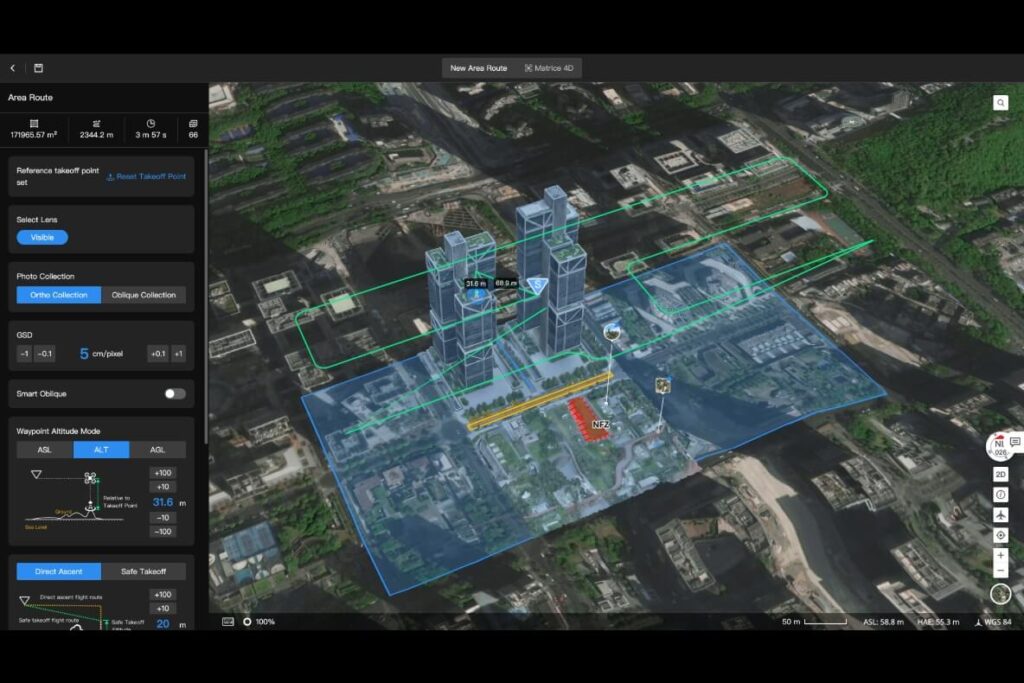
Flight patterns influence mapping accuracy and efficiency.
Common patterns include:
The best pattern depends on terrain shape, area of interest size and the required data structure.
Safety and regulatory compliance are critical components of flight planning, particularly in highly regulated environments such as the UAE.
The UAE enforces strict oversight of commercial drone operations. Depending on the mission type and procurement process, approvals may involve:
For an in-depth understanding, refer to our articles:
SORA is the globally recognized methodology for assessing and mitigating operational risks in drone flights, developed by JARUS (the Joint Authorities for Rulemaking on Unmanned Systems).
SORA helps operators identify:
The first stage is developing a Concept of Operations (CONOPS), describing the who, what and where of your mission, including organizational safety culture. It includes details on:
SORA’s Ground Risk Model (GRM) and Air Risk Model (ARM) ensure operators identify risks and implement mitigations before flight.
UAE law requires commercial drone liability insurance, protecting operators and businesses in case of property damage or personal injury. Proper insurance underscores responsible, compliant flight operations.
With a solid plan in place, the mission can begin. Modern drones can autonomously follow predefined routes—removing the need for manual piloting during mapping operations.
A variety of software platforms enable automated mission planning and execution, including:
These tools allow operators to:
During flight, software tools track:
Live telemetry ensures smooth operations and early identification of potential issues.
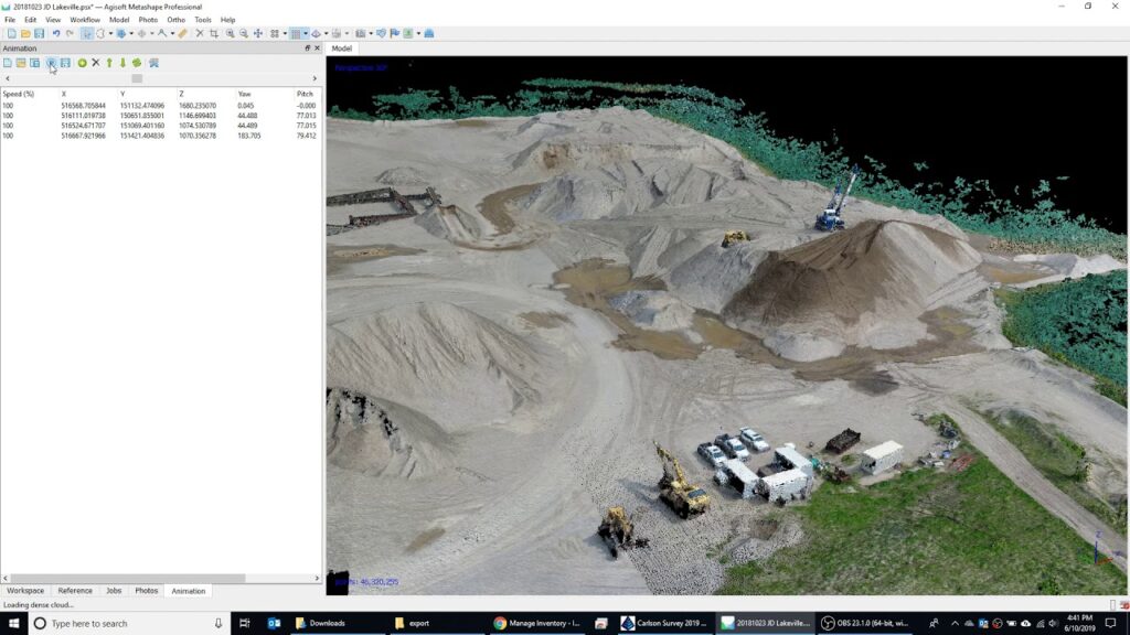
Once the mission is complete, the next step is data processing.
Images must be uploaded into a mapping or photogrammetry platform such as:
These platforms allow you to:
Proper data management ensures consistent, repeatable and high-quality outcomes.
Optimizing drone flight planning is the foundation of successful mapping and surveying operations. By clearly defining your AOI, selecting the right equipment, following safe practices, and leveraging automation and data processing tools, organizations can significantly improve data quality and operational efficiency.
For professional drone solutions, regulatory guidance, and tailored consultations, GNSS.AE is here to support your projects from planning to final deliverables. Whether you are scaling your drone program or enhancing mission accuracy, our team ensures you operate safely, efficiently and in full compliance with UAE regulations.