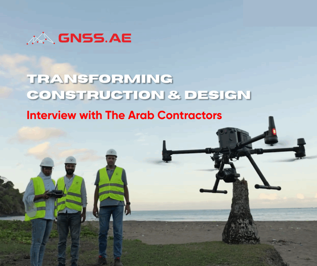
The Arab Contractors is a leading Egyptian construction and contracting company, established in 1955. With a strong presence across the Middle East and Africa, the company has become a cornerstone of the region’s infrastructure development.
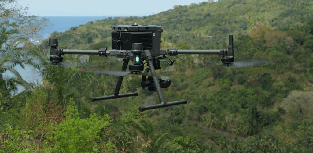
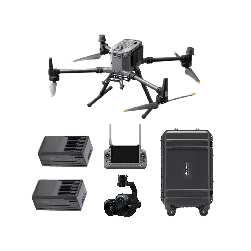
As part of a regional project in Comoros, GNSS.AE delivered and deployed a professional DJI drone package — DJI Matrice M350 RTK with DJI Zenmuse P1 camera and DJI Terra software — and conducted onsite training within the framework of a real infrastructure project.
We spoke with The Arab Contractors (Comoros) team to explore their experience with implementing drone technology across different phases of construction.
GNSS.AE: Could you tell us about the motivation and decision to adopt the drone technology into your project?
The Arab Contractors:
Our decision to adopt drone technology, specifically the DJI Matrice M350RTK paired with the Zenmuse P1 camera, was driven by the need for greater efficiency, accuracy, and safety in our project operations. With drones, we saw an opportunity to streamline these processes, allowing us to capture high-resolution aerial data in a fraction of the time while maintaining precision and minimizing risks to personnel.
Additionally, the integration of advanced features like RTK positioning and the P1 camera’s full-frame sensor offered a significant leap in data accuracy and quality, which is crucial for large-scale construction and infrastructure projects. This technology enables us to better visualize the terrain, make informed decisions, and maintain a high standard of quality
GNSS.AE: What specific tasks or projects have you planned to use the drone for?
The Arab Contractors:
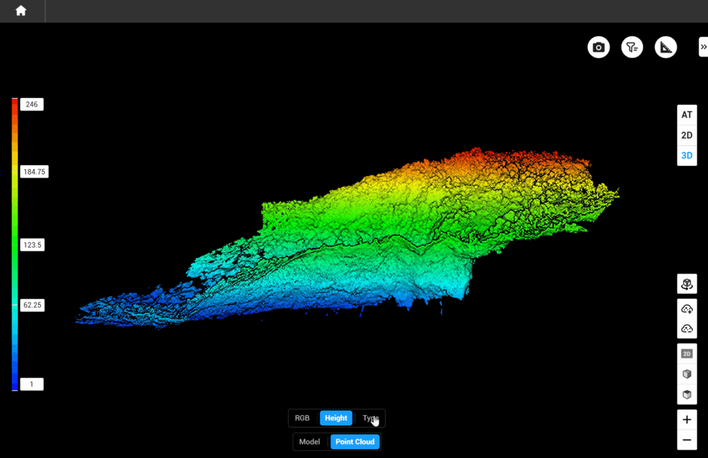
First and foremost, we plan to utilize the drone for topographic surveys and site mapping. The accuracy of the Drone Surveying Package: M350 RTK Drone with P1 camera, allows us to create highly detailed, centimetre-level accurate maps, which are critical for pre-construction planning and ongoing site analysis.
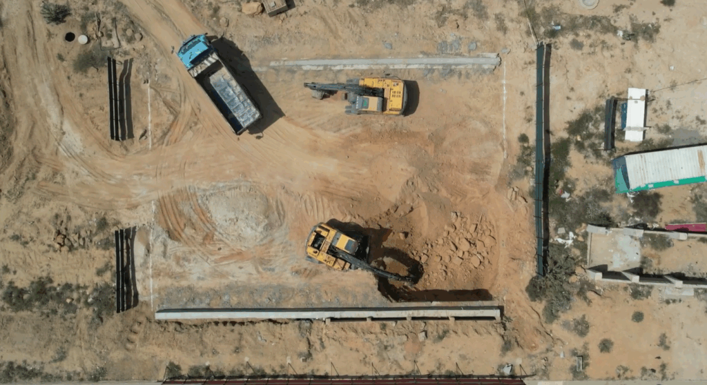
In addition, we’ll be using the drone for progress monitoring and reporting, for inspections of hard-to-reach areas, such as high-rise buildings, bridges, and other complex structures.
GNSS.AE: How would you describe the technological advantages of the Matrice M350 with the P1 camera compared to traditional surveying methods?
The Arab Contractors:
The technological advantages are transformative when compared to traditional surveying methods.
Firstly, the efficiency is unmatched. The Matrice M350 with the P1 camera can survey vast areas in a fraction of the time, capturing high-resolution data that would otherwise take days or even weeks.
Another key advantage is the precision.
The RTK system on the M350 provides real-time, centimetre-level accuracy, and when combined with the 45MP full-frame P1 camera, it produces detailed photogrammetry outputs that are incredibly reliable. It will significantly enhance the speed, accuracy, and safety of our surveying operations compared to traditional methods.”
GNSS.AE: Have you noticed improvements in efficiency or accuracy with the drone during your site inspections or surveys?
The Arab Contractors:
With the drone, we anticipate completing the same project task in a fraction of the time while capturing far more detailed data. In terms of accuracy, the RTK technology directly enhances the quality of the data we collect. This precision is crucial for creating high-resolution 2D and 3D Data Outputs. Overall, the improvements in both efficiency and accuracy are believed to be substantial, helping us meet project deadlines more effectively while delivering highly reliable survey data.”
GNSS.AE: In what types of construction projects or stages have you found the drone to be most useful?
The Arab Contractors:
During the initial site surveys and feasibility studies, the drone’s ability to quickly map large areas provides us with precise topographical data, which is essential for planning and design. As the project progresses, we’ve used the drone for monitoring site progress and conducting inspections, especially in hard-to-reach or hazardous areas. It helps us verify that work is proceeding according to the plan and provides documentation that can be shared with stakeholders or regulatory authorities. Additionally, during the post-construction phase, we’ve found the drone to be useful for creating as-built surveys and verifying that the final structures align with the original design specifications.
GNSS.AE: How has the P1 camera improved your ability to capture high-resolution data or imagery for your projects?
The Arab Contractors:
One of the key advantages of the P1 is its full-frame sensor, which allows us to capture highly detailed and accurate images, even over large areas. This level of detail is crucial when we are conducting topographical surveys or monitoring construction progress, as it ensures that every aspect of the site is captured with precision. Additionally, the high-resolution imagery provided by the P1 has been essential for generating detailed 3D models, Orthomosaic, and other deliverables that can be used for project planning, inspections, and reporting to stakeholders.
GNSS.AE: Has the drone helped reduce time spent on certain tasks such as site mapping, inspections, or progress monitoring?
The Arab Contractors:
Absolutely, the drone technology has significantly reduced the time spent on tasks like site mapping, inspections, and progress monitoring. Traditionally, these tasks would require extensive manual labor, multiple team members, and days—sometimes weeks—of fieldwork. However, with the drone, we can complete site mapping in just a few hours and generate accurate models and maps that would otherwise take much longer using conventional methods.
For inspections, the drone allows us to capture aerial perspectives that are often difficult or dangerous to access manually, eliminating the need for scaffolding or other equipment. We can inspect large areas in a single flight and immediately identify issues, which saves considerable time and resources. The real-time data capture also means we can conduct progress monitoring on a regular basis without interrupting the ongoing work on-site.
GNSS.AE: Were there any challenges or learning curves when integrating the drone technology into your workflows?
The Arab Contractors:
Like with any new technology, there were certainly challenges and a learning curve when integrating drone technology into our workflows. Initially, we identified that our team needs to be properly trained to operate the drone safely and effectively, learning the flight controls, camera settings, and data capture techniques to ensure we were using the technology to its fullest potential.
Another learning curve, as we move forward is to find ways to integrate the drone data into our existing project management and planning workflows. This meant working closely with our GIS and CAD teams to streamline data transfer and interpretation.
Additionally, there are regulatory considerations when flying drones in certain areas, so we had to ensure compliance with all legal and safety regulations, which added an extra layer of planning.
The efficiencies gained in data collection, site monitoring, and inspection far outweighed the early challenges, and now the drone technology is a critical part of our daily operations.”
GNSS.AE: Do you see the Matrice M350 and P1 camera becoming a long-term tool in your operations, and if so, how do you envision its future applications?
The Arab Contractors:
“Absolutely, we see it becoming an essential, long-term tool in our operations. The technological advantages they offer, especially in terms of high-resolution data capture, precision, and efficiency, have already demonstrated their value across various stages of our projects. We envision their use expanding significantly as we continue to integrate more advanced digital workflows and data-driven decision-making into our construction processes and also would recommend and ask our other contractors in the region, our subcontractors, consultants to consider implementing the same drone technology into their projects and reap the benefits.
Additionally, with advancements in AI and machine learning, we could potentially leverage the drone data for predictive analysis, helping us optimize scheduling, reduce material waste, and enhance safety on the job site. The versatility of the drone, from initial surveys to ongoing inspections and even post-construction monitoring, ensures it will be a cornerstone of our operations for years to come
GNSS.AE: Could you tell us about your experience in dealing with us as a vendor who helped and assisted in providing you with the drone hardware, software, consultancy and training?
The Arab Contractors:
Our experience working with you as a vendor has been exceptional.
From the very beginning since February 2024, your team demonstrated a deep understanding of our project needs and provided us with valuable guidance on selecting the right drone hardware and software for our operations.
The DJI Matrice M350 and P1 camera package, combined with DJI Terra Pro software, have proven to be a perfect fit for our surveying and data-capture requirements, and your expertise played a critical role in helping us make that decision.
The consultancy and training services you provided were equally impressive. Your team walked us through every step, from initial setup and system integration to advanced techniques for aerial data collection and processing.
Your team’s partnership has been instrumental in helping us achieve our project goals, and we look forward to continuing this collaboration as we explore further applications of drone technology
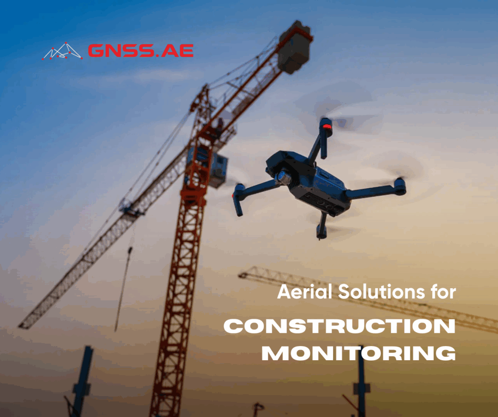
The adoption of the DJI Matrice M350 RTK with DJI Zenmuse P1 camera and the DJI Terra Software has enabled Arab Contractors (Comoros) to transform their construction workflows — significantly improving efficiency, accuracy, safety and data transparency. From early-stage surveys to ongoing monitoring and post-construction validation, drone technology is now an integral part of their operations.
This success reflects a wider shift across the construction industry: drone solutions are becoming essential tools for modern project management — replacing complex manual processes with fast, precise and scalable data capture.
As more companies across the region move toward digital transformation, the role of drones will only grow. At GNSS.AE, we are proud to have supported Arab Contractors with the the solution deployment, training, and consultancy to drive this transition — and we’re ready to help others do the same.
This interview was conducted and written by the GNSS.AE team and was approved by The Arab Contractors.