Search

South Insight V2

Inquire Now

    By submitting this message, you agree with the privacy policy and the processing of personal data.


    * - required fields

    Available on back-order

    Features

    Fast and Preclse AR Stakeout

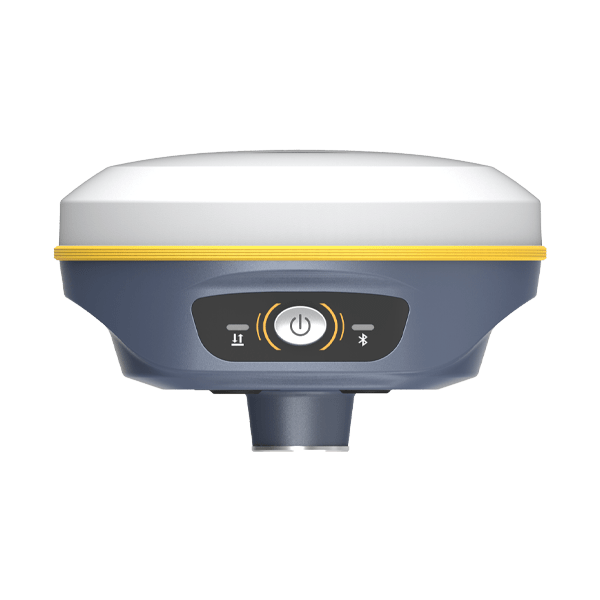
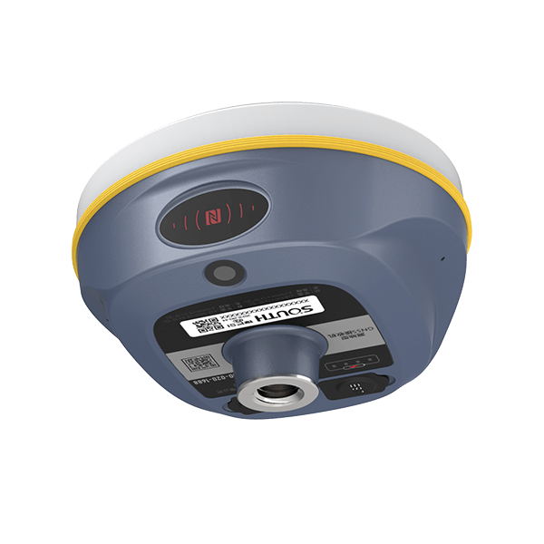
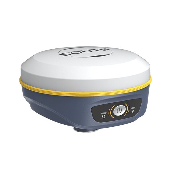
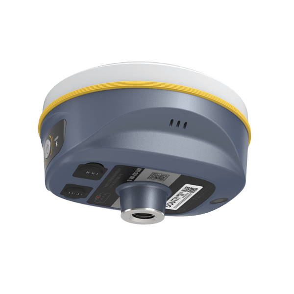
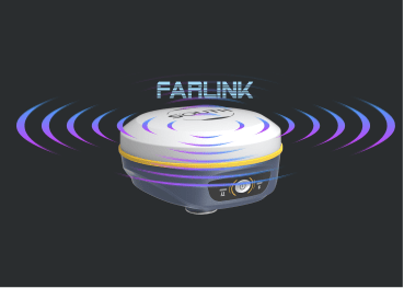
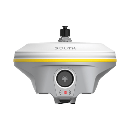
    SOUTH new palm-size RTK receiver-Insight V2, seamlessly integrated with GNSS, IMU sensor and a camera, bringing RTK surveying and stakeout into a new era.

    Based on integrated technology of GNSS positioning, IMU compensation, imaging, and calculating the real-time receiver’s altitude, Insight V2 provides live visual data that results in the stakeout target accurately displayed on the screen hence precise and distinct navigation to the targets; moreover, without leveling bubble.

    Virtual Guideline to Targets

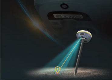
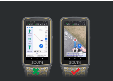
    AR technology superimposes a virtual guideline and distances from the target on the real-time image display; therefore, the field software can guide you to the points by live-view images that no need to worry about identifying directions, which saves time and effort.

    Advanced Algorithm for Positioning

    V2 exploits the SoC-type GNSS board with 1598 channels for multi-constellation and multi-frequency tracking, efficiently suppresses the interference signals, and obtains higher-quality observation data from GNSS constellations. V2 will bring a leap- forward experience of RTK performance, even in harsh environments.

    Superlor Endurance

    Benefiting from the SoC board and intelligent power management plan, the built-in 6800 mAh high-performance battery can support V2 continuously working for a whole daytime. And the power volume is indicated at the bottom of the receiver. Meanwhile, V2 adopts the mainstream Type-C interface, which supports web interface login and fast charging.

    Powerful Internal UHF

    Insight V2 equips with a new self-developed digital radio module that utilizes “Farlink” communication technology, which increases signal sensitivity and transmission efficiency to achieve an ultra-long working range.

    Brilliant Inertial Measurement Unit

    Built-in high-performance IMU automatic compensator corrects the coordinates to the pole tip, assisting you to quickly and accurately measure or stake out points at will without strictly leveling the receiver. Coupling with the latest sensor program, the IMU can initiate rapidly and easily by walking a few steps only.

    Specification

    GNSS Features Channels 1598
    GPS L1C/A, L2C, L2P, L5
    GLONASS L1C/A, L1P, L2C/A, L2P
    BDS B1, B2, B3
    GALILEO E1, E5A, E5B, E5AltBOC*, E6
    SBAS L1C/A, L5 (Just for the satellites supporting L5)
    IRNSS L5
    QZSS L1C/A, L2C, L5
    L-Band BDS-PPP, GALILEO-HAS*
    Positioning output rate 1Hz~20Hz
    Initialization time < 10s
    Initialization reliability > 99.99%
    Positioning Precision Code Differential GNSS Positioning Horizontal: 0.25 m + 1 ppm RMS
    Vertical: 0.50 m + 1 ppm RMS
    GNSS Static Horizontal: 2.5 mm + 0.5 ppm RMS
    Vertical: 5 mm + 0.5 ppm RMS
    Static (long observations) Horizontal: 2.5mm+0.1 ppm RMS
    Vertical: 3mm+0.4 ppm RMS
    Real-Time Kinematic
    (Baseline<30km)
    Horizontal: 8 mm + 1 ppm RMS
    Vertical: 15 mm + 1 ppm RMS
    RTK NTRIP Horizontal: 8mm+0.5 ppm RMS
    Vertical: 15mm+0.5 ppm RMS
    PPK Horizontal: 3mm+1 ppm RMS
    Vertical: 5mm+1 ppm RMS
    SBAS positioning Typically < 5m 3DRMS
    RTK initialization time < 10s
    IMU tilt compensation Additional horizontal pole tip uncertainty typically less than 8mm + 0.7 mm/°tilt down to 30°, 1.8m pole height
    IMU tilt angle 0° ~ 60°
    Hardware Performance Dimension 131mm(φ)× 80mm(H)
    Weight 800g (battery included)
    Material Magnesium aluminum alloy shell
    Operating temperature -45℃ ~ +75℃
    Storage temperature -55℃ ~ +85℃
    Humidity 100% Non-condensing
    Waterproof/Dustproof IP68 standard, protected from long time immersion to depth of 2m
    IP68 standard, fully protected against blowing dust
    Shock/Vibration Withstand 2 meters pole drop onto the cement ground naturally
    Power consumption 4W
    Power supply 6-28V DC, overvoltage protection
    Battery Built-in 7.4 V 6800mAh rechargeable
    Lithium-ion battery
    Battery life 16h (static mode)
    10h (internal UHF base mode)
    12h (rover mode)
    Camera 2 MP
    FOV 75°
    WIFI Modem 802.11 b/g standard
    WIFI hotspot Receiver broadcasts its hotspot form web UI accessing with any mobile terminals
    WIFI datalink Receiver can transmit and receive correction data stream via WiFi datalink
    Communications I/O Port UHF antenna interface
    Type-C
    Internal UHF 2W radio receiver and transmitter
    Frequency range 410 – 470MHz
    Communication protocol Farlink, Trimtalk450s, SOUTH, HUACE, ZHD
    Communication range Typically 8km with Farlink protocol
    Bluetooth BLEBluetooth 4.2 standard, Bluetooth 2.1 + EDR
    NFC Communication Realizing close range (shorter than 10cm) automatic pair between receiver and controller (controller requires NFC wireless communication module else)
    Data Storage/Transmission Storage 4GB SSD internal storage standard, extendable up to 32GB
    Automatic cycle storage (The earliest data files will be removed automatically while the memory is not enough)
    Support external USB storage
    Data transmission The customizable sample interval is up to 20Hz (Reserve)
    Plug and play mode of USB data transmission
    Supports FTP/HTTP data download
    Data format Static data format: STH, Rinex2.01, Rinex3.02 and etc.
    Differential data format: RTCM 2.x, RTCM 3.x
    GPS output data format: NMEA 0183, PJK plane coordinate, Binary code
    Network model support: VRS, FKP, MAC, fully support NTRIP protocol
    Sensors Electronic bubble Controller software can display electronic bubble, checking leveling status of the carbon pole in real-time
    IMU Built-in IMU module, calibration-free and immune to magnetic interference
    Thermometer Built-in thermometer sensor, adopting intelligent temperature control technology, monitoring and adjusting the receiver temperature
    User Interaction Operating system Linux
    Buttons Single button
    Indicators 3 color LED indicators, and Battery indicator
    Web interaction With the access of the internal web interface management via WiFi or USB connection, users are able to monitor the receiver status and change the configurations freely
    Voice guidance The intelligent voice technology provides status and operation voice guidance, supports Chinese/English/Korean/Spanish/Portuguese/Russian/Turkish
    Secondary development Provides secondary development package, and opens the OpenSIC observation data format and interaction interface definition
    Cloud service The powerful cloud platform provides online services like remote manage, firmware update, online register and etc.

    Items marked with * will be upgraded along with the update of assigned firmware version.

    The data comes from the SOUTH GNSS product laboratory, and the specific situation is subject to local usage.
    The measurement accuracy, precision and reliability are associated with various factors, including the number of satellite tracking, observation time, multi-path, etc.

    Download brochure

      By submitting this message, you agree with the privacy policy and the processing of personal data.


      * - required fields

      Inquire price for South Insight V2