Search

South Galaxy G3

Inquire Now

      I agree with the privacy policy and the processing of personal data

    Features

    Colourful LED indicators

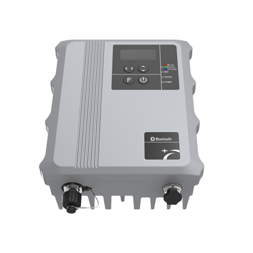
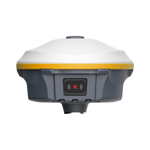
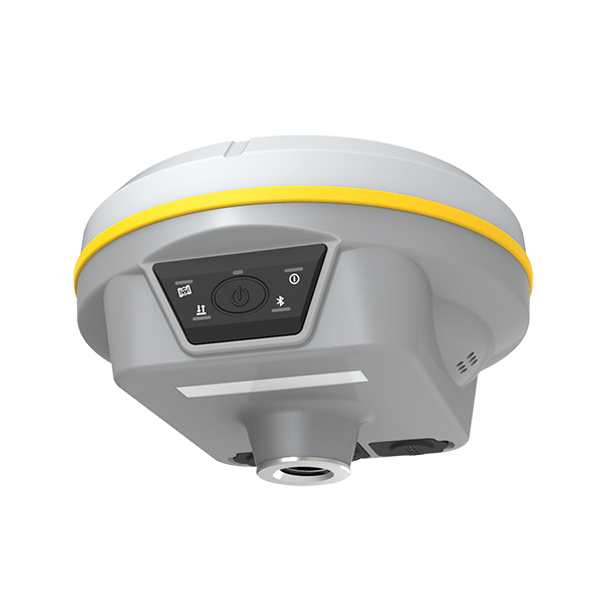
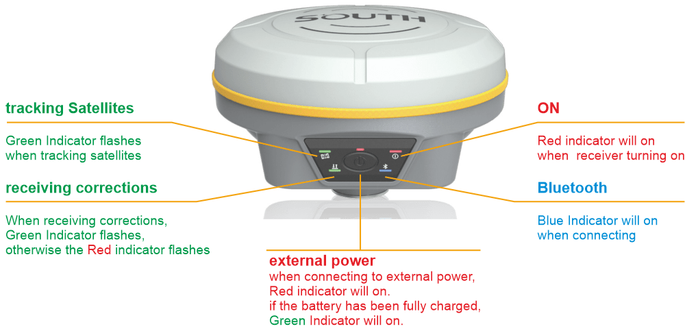
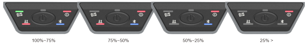
    The colorful LED indicators can briefly show the current status.

    Battery life checking:

    we can quickly check the battery life by pressing the button, after pressing the button, some of the Indicators will turn on.

    Lighter and Faster

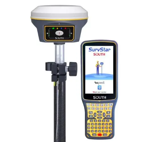
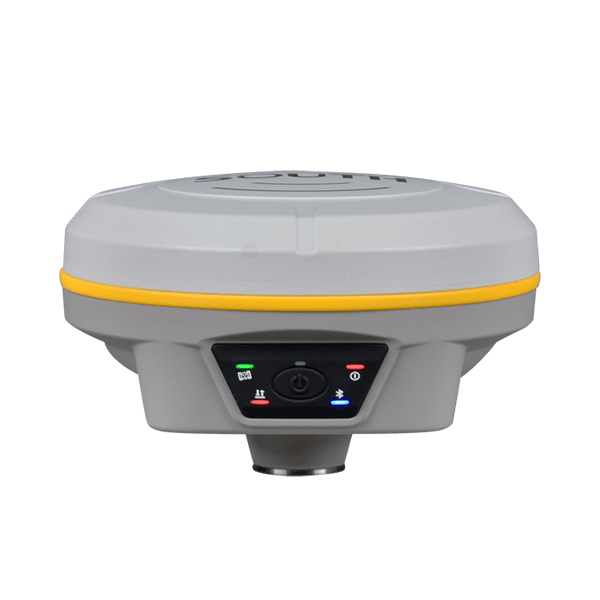
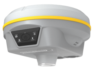
    Only 790g in weight, G3 is still packaged with the magnesium alloy shell.

    Highly intergrated design, smaller and lighter, easy to use in the field.

    Supercharged by SoC technology

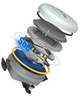
    Galaxy G3 is a new product from SOUTH SoC platform, most components of G3 (GNSS module, Wi-Fi, Bluetooth, etc.) are integrated on one circuit board. G3 has lower power consumption, and efficiently improves the ability of receiving higher quality satellites signals.

    Powerd by the new SoC GNSS board, new generation sensitivity satellite antenna, new ROS platform and GNSS RTK engine, G3 can fully track GPS, GLONASS, BDS, GALILEO and QZSS toobtain centimeter-level positioning in few seconds.

    Now G3 supports the BeiDou-3 B2b L-band BDS-PPP and Galileo High Accuracy Service (Galileo-HAS), it can get real-time high-precision positioning even there is no base receiver.

    Thanks to the new function “Fixed-keep”, now it is possible for G3 to keep centimeter-level accuracy for few minutes when the RTK corrections is missing.

    IMU for tilt survey

    IMU for tilt survey Galaxy G3 is intergrated with the latest Inertial Measurement Unit (IMU). Featured with anti-magnetic chracteristic, you can start the tilt survey in any place. Shaking to initialize the IMU sensor, no need to calibrate. Up to 200Hz IMU data output rate, boosting the speed of field work.

    Specification


    GNSS FeaturesChannels1598
    GPSL1, L1C, L2C, L2P, L5
    GLONASSL1C/A,L1P,L2C/A,L2P,L3*
    BDSBDS-2: B1I, B2I, B3I
    BDS-3: B1I, B3I, B1C, B2a, B2b*
    GALILEOE1, E5A, E5B, E6C, AltBOC*
    SBAS(WAAS/MSAS/EGNOS/GAGAN)L1*
    IRNSSL5*
    QZSSL1, L2C, L5*
    MSS L-BandBDS-PPP, GALILEO-HAS*
    Positioning output rate1Hz~20Hz
    Initialization time< 10s
    Initialization reliability> 99.99%
    Positioning PrecisionCode differential GNSS positioningHorizontal: 0.25 m + 1 ppm RMS
    Vertical: 0.50 m + 1 ppm RMS
    Static(long observations)Horizontal: 2.5 mm + 1 ppm RMS
    Vertical: 3 mm + 0.4 ppm RMS
    StaticHorizontal: 2.5 mm + 0.5 ppm RMS
    Vertical: 3.5 mm + 0.5 ppm RMS
    Rapid staticHorizontal: 2.5 mm + 0.5 ppm RMS
    Vertical: 5 mm + 0.5 ppm RMS
    PPKHorizontal: 3 mm + 1 ppm RMS
    Vertical: 5 mm + 1 ppm RMS
    RTK(UHF)Horizontal: 8 mm + 1 ppm RMS
    Vertical: 15 mm + 1 ppm RMS
    RTK(NTRIP)Horizontal: 8 mm + 0.5 ppm RMS
    Vertical: 15 mm + 0.5 ppm RMS
    RTK initialization time2 ~ 8s
    SBAS positioningTypically < 5m 3DRMS
    BANDA-LHorizontal: 5-10cm (5-30min)
    Vertical: 10-30cm (5-30min)
    IMULess than 10mm + 0.7 mm/° tilt to 30°
    IMU tilt angle0° ~ 60°
    Hardware PerformanceDimension130mm(W) ×130mm(L) × 80mm(H)
    Weight790g (battery included)
    MaterialMagnesium aluminum alloy shell
    Operating temperature-45℃ ~ +65℃
    Storage temperature-45℃ ~ +85℃
    Humidity100% Non-condensing
    Waterproof/DustproofIP68 standard, protected from long time immersion to depth of 1m IP68 standard, fully protected against
    blowing dust
    Shock/VibrationWithstand 2 meters pole drop onto the cement ground naturally
    MIL-STD 810G
    Power supply6-28V DC, overvoltage protection
    BatteryInbuilt 7.2V 6800mAh rechargeable, Li-ion battery
    Battery life15h (Rover Bluetooth mode)
    CommunicationsI/O Port5-PIN LEMO external power port + RS232 Type-C (charge, OTG to USB disk, data transfer with PC or phone, Ethernet)
    1 UHF antenna TNC interface
    Internal UHF2W radio, receive and transmit, radio router and radio repeater
    Frequency range410 – 470MHz
    Communication protocolFarlink, Trimtalk450s, SOUTH, HUACE, Hi-target, Satel
    Communication rangeTypically 8km with Farlink protocol
    NFC CommunicationRealizing close range (shorter than 10cm) automatic pair between receiver and controller (controller requires NFC wireless communication module else)
    BluetoothBluetooth 3.0/4.1 standard, Bluetooth 2.1 + EDR
    WIFIModem802.11 b/g standard
    WIFI hotspotAP mode, Receiver broadcasts its hotspot form web UI accessing with any mobile terminals
    WIFI datalinkClient mode, Receiver can transmit and receive correction data stream via WiFi datalink
    Data Storage/TransmissionStorage4GB SSD Automatic cycle storage (The earliest data files will be removed automatically while the memory is not enough)
    Support external USB storage
    Data transmissionPlug and play mode of USB data transmission
    Supports FTP/HTTP data download
    Data formatStatic data format: STH, Rinex2.01, Rinex3.02 and etc.
    Differential format: RTCM 2.3, RTCM 3.0, RTCM 3.1, RTCM 3.2
    GPS output data format: NMEA 0183, PJK plane coordinate, SOUTH Binary code
    Network model support: VRS, FKP, MAC, fully support NTRIP protocol
    SensorsElectronic bubbleController software can display electronic bubble, checking leveling status of the carbon pole in real-time
    IMUBuilt-in IMU module, calibration-free and immue to magnetic interference
    ThermometerBuilt-in thermometer sensor, adopting intelligent temperature control technology, monitoring and adjusting the receiver temperature
    User InteractionOperating systemLinux
    ButtonsOne button
    Indicators5 LED indicators(Satellite, Charging, Power, Datalink, Bluetooth)
    Web interactionWith the access of the internal web interface management via WiFi or USB connection, users are able to monitor the receiver status and change the configurations freely
    Voice guidanceIt provides status and operation voice guidance, and supports Chinese/English/Korean/Spanish/Portuguese/Russian/Turkish
    Secondary developmentProvides secondary development kit, and opens the OpenSIC observation data format and interaction interface definition
    Cloud serviceThe powerful cloud platform provides online services like remote manage, firmware update, online register and etc.

    Items marked with * will be upgraded with the update of the firmware version

    The data comes from the SOUTH GNSS product laboratory, and the specific situation is subject to local actual usage. The measurement accuracy, precision and reliability are associated to various factors, including number of satellite tracking, observation time, multi-path, etc.

    Download brochure

      Inquire price for South Galaxy G3

          I agree with the privacy policy and the processing of personal data

          I agree with the privacy policy and the processing of personal data