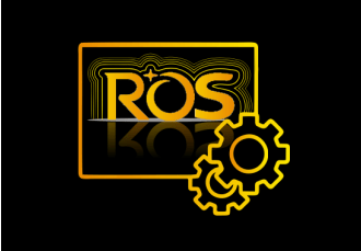
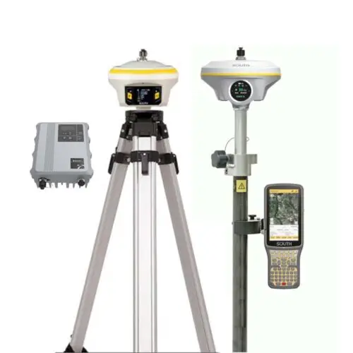
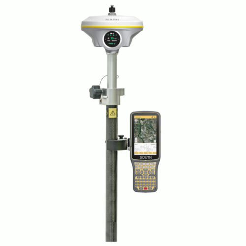
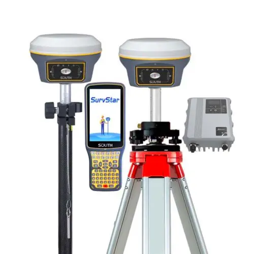
The G9 rover integrates advanced technologies, including Intelligent Base signal locking, RTK integration, and Farlink protocol, enhancing the convenience of field surveying. Its UHF module with Farlink communication enables an impressive 10km working range. The Smart ROS system optimizes hardware components, ensuring efficient and reliable tilt measurement with a wide angle range. The built-in high-performance IMU compensator improves accuracy and productivity, allowing users to continue surveying even after a fixed solution is lost. The dual-battery system design provides a 15-hour working time in Rover+Bluetooth mode, with hot replaceable batteries for uninterrupted field work.
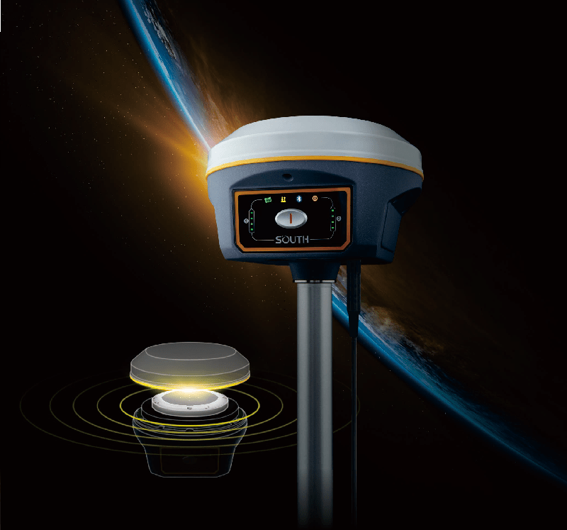
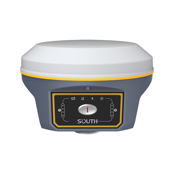
Carrying a new RTK integration technology, Bluetooth, WIFI, GSM antennas are highly integrated into GNSS antenna, that brings you an unprecedented experience of field surveying, making the field work more convenient and easier.
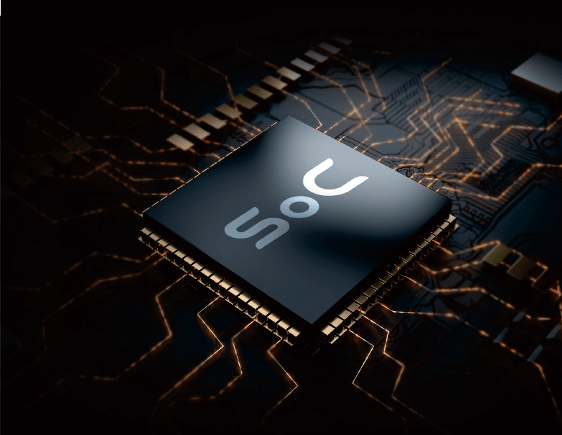
The GNSS board of G9 is upgraded to the most advanced SoC which is a high integration chip that has 1598 channels for multi-constellation and multi-frequency tracking, efficiently suppresses the interference signals, and obtains higher quality observation data from GNSS constellations.

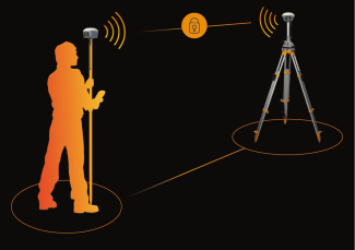
Using one-to-one signal tracking and locking technology, and the independent frequency under Farlink protocol, the G9 rover can continuously lock and capture the target base station signal to reduce cross-frequency interference even though other base stations are working nearby with the same channel.
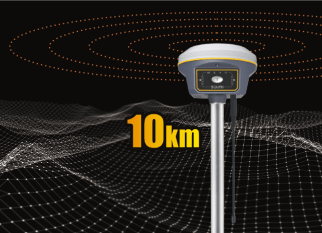
The G9 breaks through the constraints on wavelengths based on a SOUTH high-performance UHF module with Farlink communication technology, which increases signal sensitivity and transmission efficiency, and really achieves the goal of 10km ultra-long-distance working range.
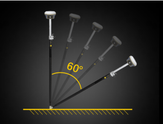
Built-in high-performance IMU automatic compensator co rects the coordinates to the pole tip, assisting users to quickly and accurately measure or stake out points at will without strict leveling the receiver. The tilt angle range can achieve up to 60°
Furthermore, the compensation is still available even tho gh the fixed solution is lost for a short time. Users can continue the survey after the fixed solution recovers without initializing the IMU module again, which helps surveyors boost productivity by 30 percent.
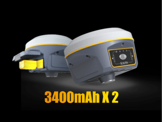
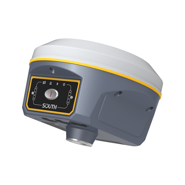
G9 also adopts a dual-battery system design so that it can achieve longer battery life while maintaining strong performance. The hot replaceable function allows you to change the battery one by one when power is low. You can continue with work without switching off the receiver.
The G9 receiver is able to continuously work for about 15 hours in Rover+Bluetooth mode with 2 batteries. Power volume is visible synchronously on the control panel.
| GNSS Features | Channels | 1598 |
| GPS | L1C/A, L2C, L2P, L5 | |
| GLONASS | L1C/A,L1P,L2C/A,L2P,L3* | |
| BDS | BDS-2: B1I, B2I, B3I BDS-3: B1I, B3I, B1C, B2a, B2b* |
|
| GALILEO | E1, E5A, E5B, E6C, AltBOC* | |
| SBAS(WAAS/MSAS/EGNOS/GAGAN) | L1C/A, L5* | |
| IRNSS | L5* | |
| QZSS | L1, L2C, L5* | |
| MSS L-Band | BDS-PPP | |
| Positioning output rate | 1Hz~20Hz | |
| Initialization time | < 10s | |
| Initialization reliability | > 99.99% | |
| Positioning Precision | Code differential GNSS | Horizontal: 0.25 m + 1 ppm RMS Vertical: 0.50 m + 1 ppm RMS |
| Static(long observations) | Horizontal: 2.5 mm + 0.1 ppm RMS Vertical: 3 mm + 0.4 ppm RMS |
|
| Static | Horizontal: 2.5 mm + 0.5 ppm RMS Vertical: 3.5 mm + 0.5 ppm RMS |
|
| Rapid static | Horizontal: 2.5 mm + 0.5 ppm RMS Vertical: 5 mm + 0.5 ppm RMS |
|
| PPK | Horizontal: 3 mm + 1 ppm RMS Vertical: 5 mm + 1 ppm RMS |
|
| RTK(UHF) | Horizontal: 8 mm + 1 ppm RMS Vertical: 15 mm + 1 ppm RMS |
|
| RTK(NTRIP) | Horizontal: 8 mm + 0.5 ppm RMS Vertical: 15 mm + 0.5 ppm RMS |
|
| RTK initialization time | 2 ~ 8s | |
| SBAS positioning | Typically < 5m 3DRMS | |
| IMU | Less than 10mm + 0.7 mm/° tilt to 30° | |
| IMU tilt angle | 0° ~ 60° | |
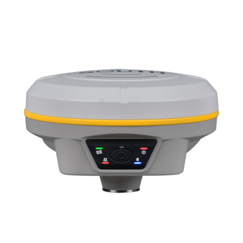
| Hardware Performance | Dimension | 154mm(φ)× 106mm(H) |
| Weight | 1.3kg (battery included) | |
| Material | Magnesium aluminum alloy shell | |
| Operating temperature | -45℃ ~ +65℃ | |
| Storage temperature | -45℃ ~ +85℃ | |
| Humidity | 100% Non-condensing | |
| Waterproof/Dustproof | IP68 standard, protected from long time immersion to depth of 1m IP68 standard, fully protected against blowing dust |
|
| Shock/Vibration | Withstand 2 meters pole drop onto the cement ground naturally | |
| Power consumption | 2W | |
| Power supply | 6-28V DC, overvoltage protection | |
| Battery | 7.4V 3400mAh x 2 rechargeable, removable Li-ion battery | |
| Battery life(Dual-battery) | 15h(Rover Bluetooth mode) | |
| WIFI | Modem | 802.11 b/g standard |
| WIFI hotspot | AP mode, Receiver broadcasts its hotspot form web UI accessing with any mobile terminals | |
| WIFI datalink | Client mode, Receiver can transmit and receive correction data stream via WiFi datalink | |
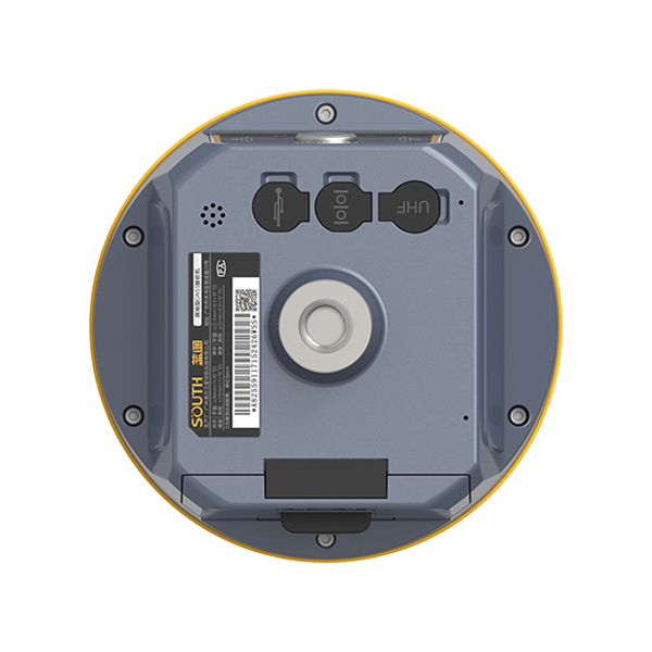
| Communications | I/O Port | 5-PIN LEMO external power port + RS232 7-PIN LEMO(USB, OTG and Ethernet) 1 PPS data interface SIM card slot(standard) |
| Internal UHF | Receiver and transmitter 1/2/3W (Just receiver 0.01W for Russia) | |
| Frequency range | 410 – 470MHz | |
| Communication protocol | Farlink, Trimtalk450s, SOUTH, HUACE, ZHD | |
| Communication range | Typically 10km with Farlink protocol | |
| Cellular mobile network | 4G network communication module | |
| Bluetooth | BLEBluetooth 4.0 standard, Bluetooth 2.1 + EDR | |
| NFC Communication | Realizing close range (shorter than 10cm) automatic pair between receiver and controller (controller requires NFC wireless communication module else) | |
| Data Storage/Transmission | Storage | 16GB SSD Automatic cycle storage (The earliest data files will be removed automatically while the memory is not enough) Support external USB storage |
| Data transmission | Plug and play mode of USB data transmission Supports FTP/HTTP data download |
|
| Data format | Static data format: STH, Rinex2.01, Rinex3.02, etc. Differential format: CMR(GPS only), CMR+(GPS only), RTCM 2.3, RTCM 3.0, RTCM 3.1, RTCM 3.2 Navigation data format: NMEA 0183, PJK, Binary code Network model support: VRS, FKP, MAC, fully support NTRIP protocol |
|
| Sensors | Electronic bubble | Controller software can display electronic bubble, checking leveling status of the carbon pole in real-time |
| IMU | Built-in IMU module, calibration-free and immune to magnetic interference | |
| Thermometer | Built-in thermometer sensor, adopting intelligent temperature control technology, monitoring and adjusting the receiver temperature | |
| User Interaction | Operating system | Linux |
| Buttons | Single button | |
| Indicators | 4 color LED indicators, Battery indicator | |
| Web interaction | With the access of the internal web interface management via WiFi or USB connection, users are able to monitor the receiver status and change the configurations freely | |
| Voice guidance | It provides status and operation voice guidance, and supports Chinese/English/Korean/Spanish/Portuguese/Russian/Turkish | |
| Secondary development | Provides secondary development kit, and opens the OpenSIC observation data format and interaction interface definition | |
| Cloud service | The powerful cloud platform provides online services like remote manage, firmware update, online register and etc. |
Items marked with * will be upgraded with the update of the firmware version
The data comes from the SOUTH GNSS product laboratory, and the specific situation is subject to local actual usage. The measurement accuracy, precision and reliability are associated to various factors, including number of satellite tracking, observation time, multi-path, etc.
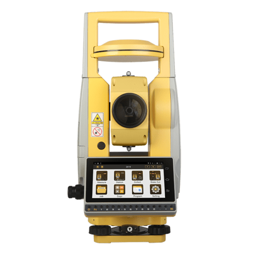
Inquire price for South G9