Global Navigation Satellite Systems (GNSS) have transformed the field of surveying by enabling professionals to obtain precise coordinates using satellite signals. From basic mapping to high-precision engineering projects, GNSS methods support a range of accuracy requirements through different surveying techniques. This article examines the core GNSS surveying methods, compares their levels of accuracy, outlines practical surveying steps, and highlights why Real-Time Kinematic (RTK) stands out among them.
GNSS surveying relies on satellite signals to determine location coordinates. The primary methods used include Single Point Positioning (SPP), Differential GNSS (DGPS), Real-Time Kinematic (RTK), and Post-Processing Kinematic (PPK). Each offers a different balance between accuracy, workflow complexity, and equipment requirements.
SPP is the simplest form of GNSS surveying. A single GNSS receiver determines its location by collecting signals from multiple satellites. This method is limited in accuracy—typically within several meters—due to factors such as atmospheric interference and satellite geometry. It is suitable for applications that do not require high precision, such as general mapping or open-area positioning.
DGPS enhances accuracy by using a reference station at a known location. It compares satellite signal data between the reference and rover receivers to correct positioning errors caused by atmospheric conditions and satellite inconsistencies. DGPS offers sub-meter to decimeter-level accuracy, making it ideal for navigation, agriculture, and construction tasks.
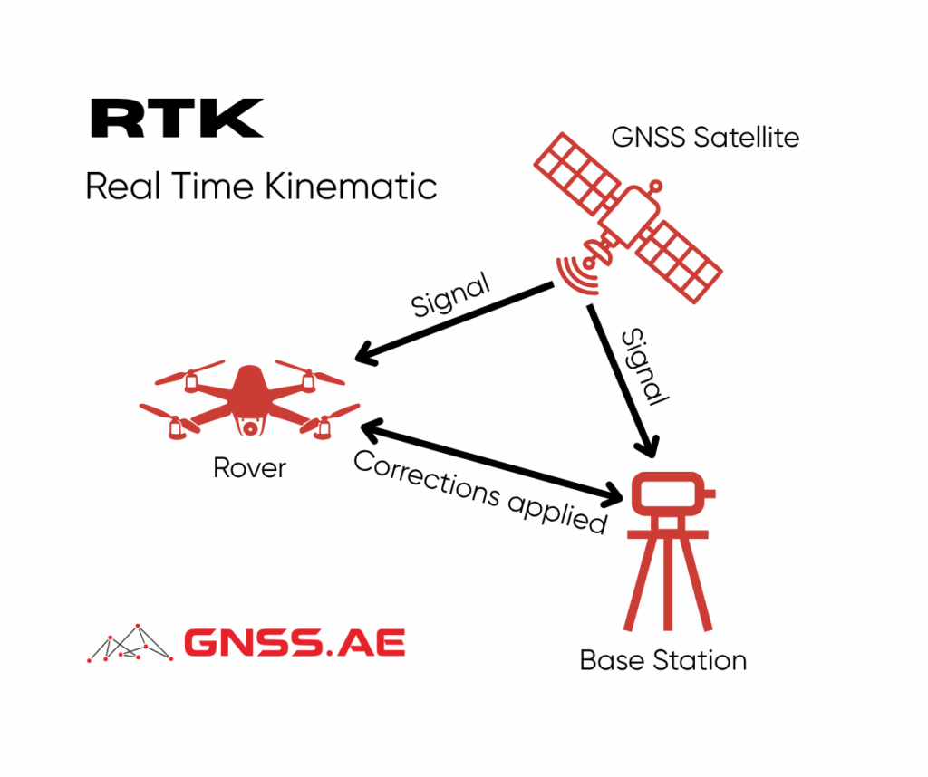
RTK uses a base station and one or more rover units to achieve centimeter-level accuracy in real time. The base station receives satellite signals and transmits correction data to the rover, which calculates precise coordinates. This method is particularly suitable for applications that require high precision, such as cadastral surveys and construction staking.
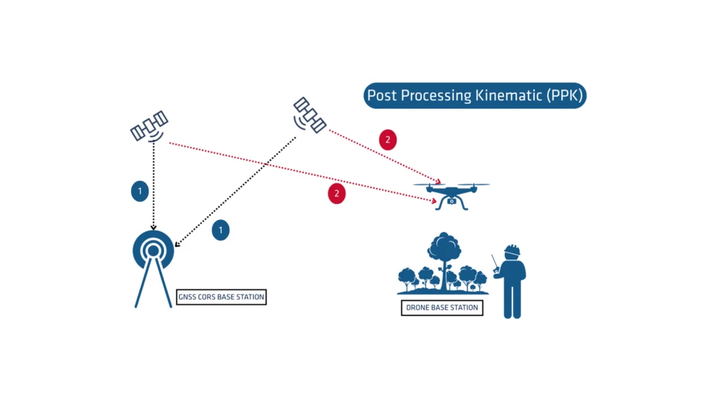
PPK involves collecting GNSS data during the survey and processing it later using base station or virtual reference station data. Although it offers accuracy comparable to RTK, PPK requires additional time for post-processing, which can be a limiting factor for real-time applications.
Each GNSS method delivers a different level of accuracy:
SPP: Accuracy within several meters. Best for low-precision tasks.
DGPS: Sub-meter to decimeter accuracy. Suitable for mid-level precision applications.
RTK: Centimeter-level precision in real time. Ideal for high-accuracy requirements.
PPK: Centimeter-level precision with post-processing. Comparable to RTK but less time-efficient.
Conducting a GNSS survey involves several steps, regardless of the method employed:
Equipment Required:
Preparation and Setup:
Data Collection:
Data Processing:
RTK surpasses DGPS in terms of precision and efficiency for several reasons:
Real-Time Corrections:
RTK delivers real-time correction data from the base to the rover, compensating for errors like ionospheric and tropospheric delays. DGPS relies on corrections that are often subject to time lag, reducing accuracy.
Simplified Setup:
RTK systems can operate without a dedicated physical base station when using correction networks. This simplifies deployment and reduces operational overhead.
Minimal Latency:
RTK provides immediate feedback, enabling real-time adjustments on-site. DGPS, with its reliance on post-processing, may not be suitable for time-sensitive tasks.
Elevate your surveying precision with GNSS RTK Base and Rover Receivers. Perfect for land surveying, topographical surveying, mining, cadastral surveys, and land management, our receivers ensure accurate and reliable data collection. Designed for efficiency and high performance, these advanced GNSS systems enhance your project outcomes.
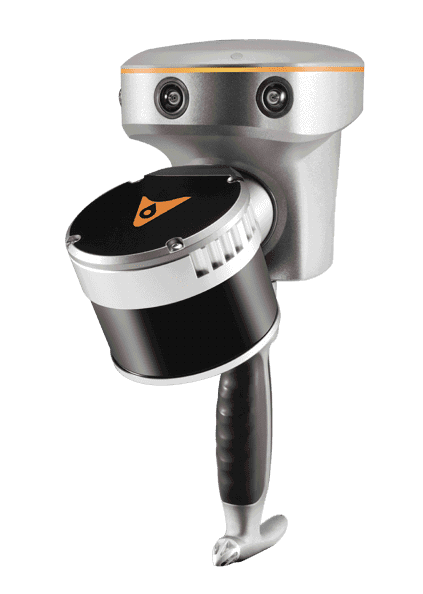
Featured Product: CHCNAV RS10
The CHCNAV RS10 combines GNSS RTK, laser scanning, and visual SLAM technologies for precise 3D scanning and surveying across diverse environments. This powerful integration offers unmatched versatility and accuracy for professionals in surveying, civil engineering, construction, and mining.
Engineered from CHCNAV’s deep expertise in GNSS development, the RS10 features a 4th generation air dielectric GNSS antenna, delivering RTK positioning accuracy better than 3 cm, even in challenging conditions. Coupled with its high-precision LiDAR and three HD cameras, the RS10 achieves absolute measurement accuracy of 5 cm by fusing RTK, laser, and visual SLAM technologies.
From detailed architectural documentation to complex infrastructure mapping, the RS10 equips professionals with a comprehensive tool for fast, reliable, and rich data collection.
GNSS surveying encompasses a range of techniques designed to meet diverse precision requirements. While SPP provides basic functionality, DGPS enhances accuracy, and RTK and PPK achieve the highest levels of precision. RTK stands out for its real-time capability, minimal latency, and simplified workflow. By selecting the appropriate surveying method and leveraging high-end GNSS equipment, professionals can ensure accurate, reliable results across mapping, construction, agriculture, and land management applications.