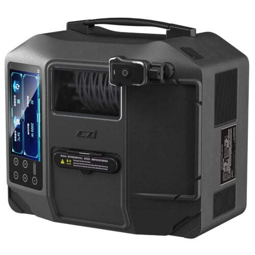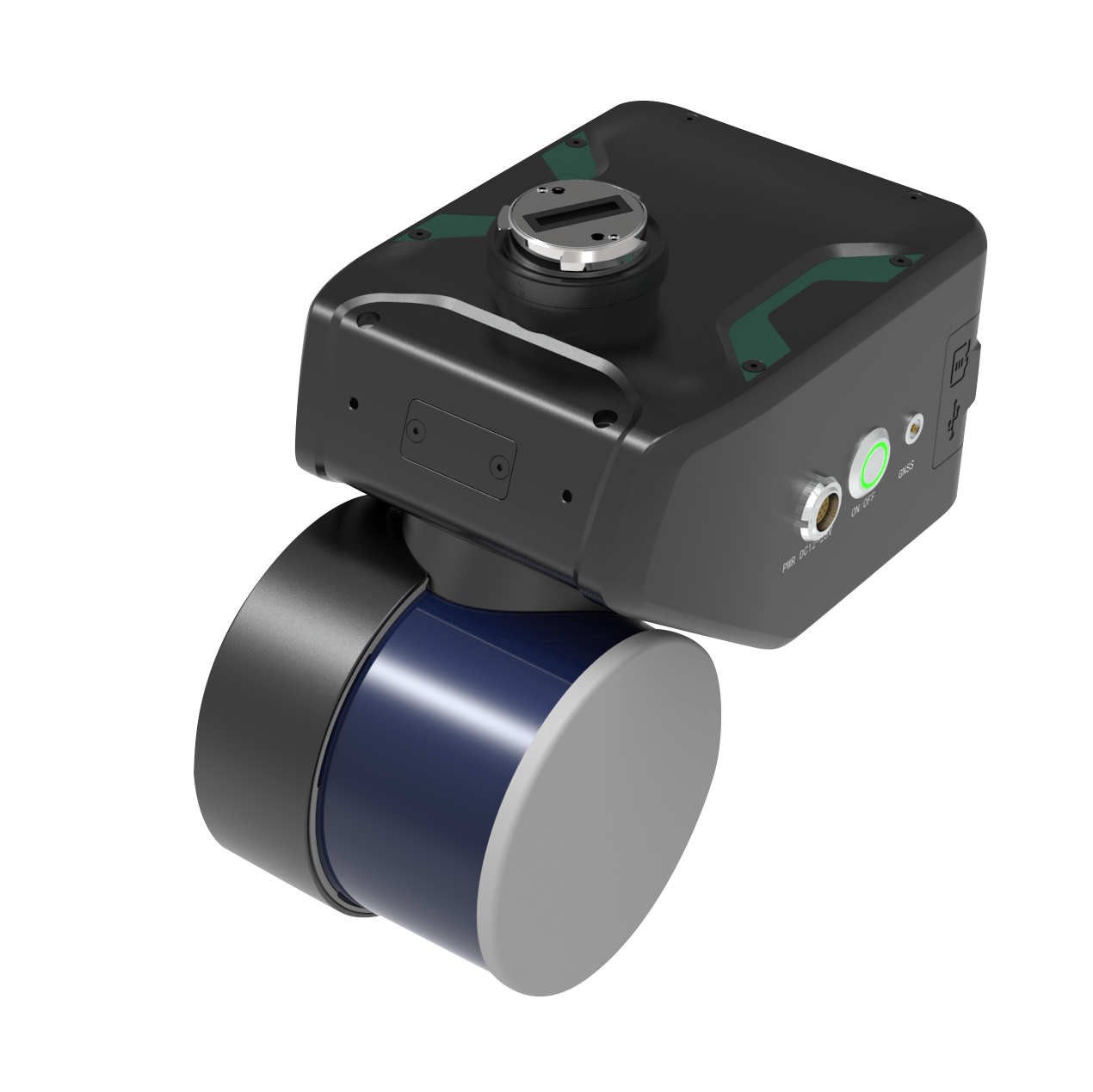
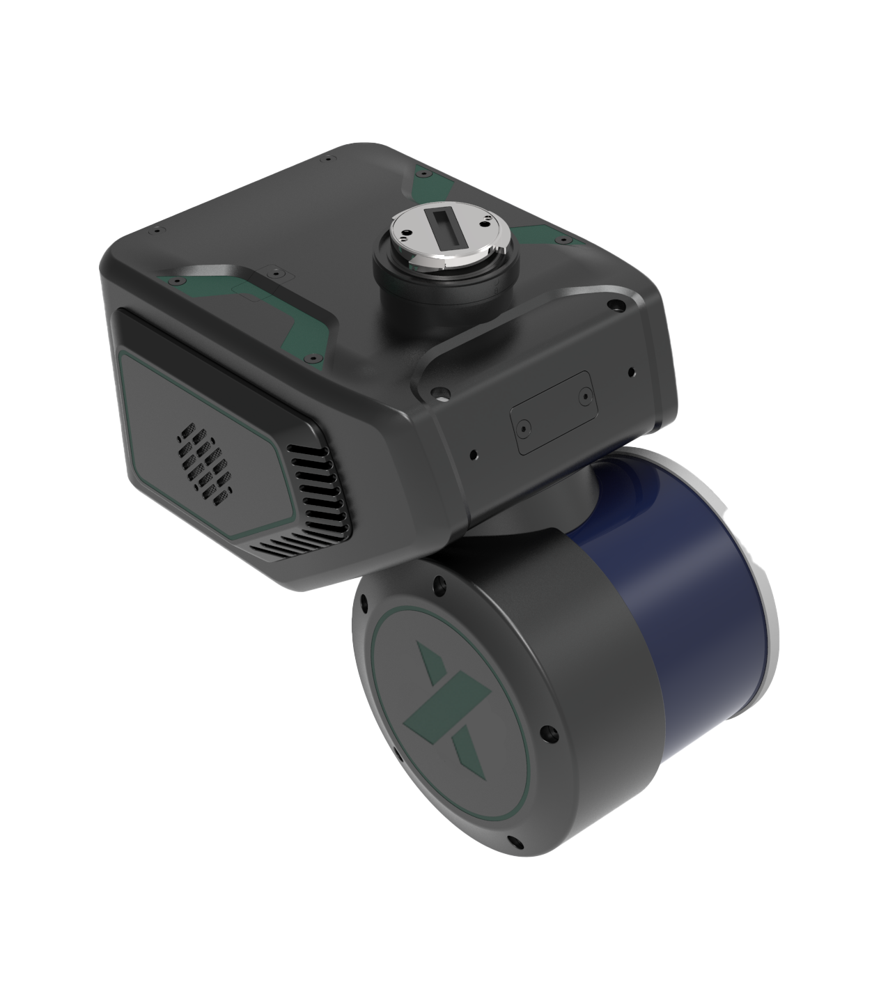
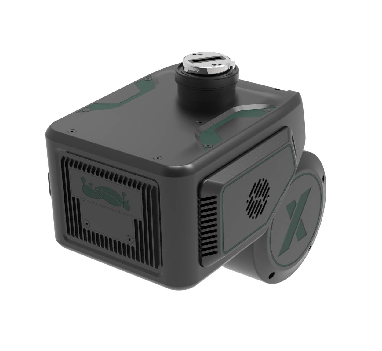
LiAir X4 is GreenValley International’s latest generation autonomous LiDAR data acquisition system. It features a lightweight 32-line rotary laser scanner, high-precision inertial navigation system, a high-resolution camera, and a powerful edge computing platform. With 360-degree scanning and the self-developed AirPilot autonomous flight algorithm, it enables efficient, safe, and cost-effective smart inspections with autonomous obstacle avoidance.


Fully Autonomous Obstacle Avoidance Flight

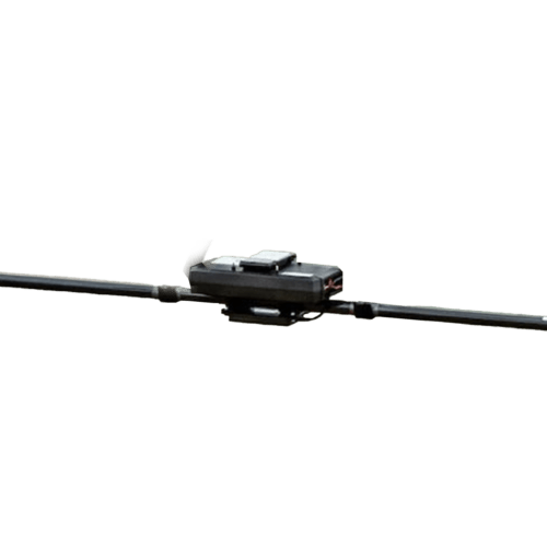
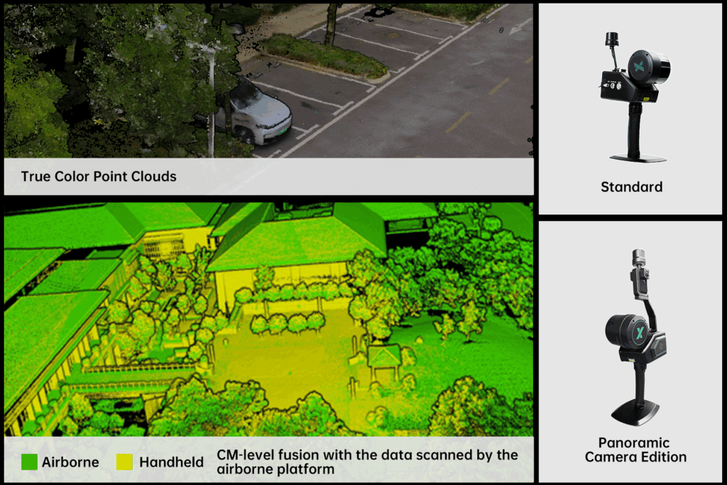
Multi-Platform Compatibility (Airborne/Handheld)

300 m Maximum Measurement Range

5 cm Elevation Accuracy (@100 m)

Automatic line intersection identification, autonomous crossing of intersections, real-time tree obstacle reporting and pole/tower log generation, and automated pole/tower ...
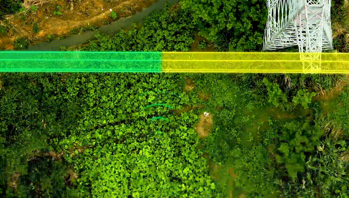
Capture RGB photos of conductors, autonomous tower crossing and line switching.

Real-time DSM construction for terrain-following flight, meet the demand of large height difference terrain data collection for short-range LiDAR system.
Powered by the self-developed high-precision integrated motor, the scanner achieves 360°x 270° omnidirectional scanning. Enhanced point cloud completeness in dense vegetation areas and vertical structures (buildings and bridges), with finer 3D structural reconstruction.
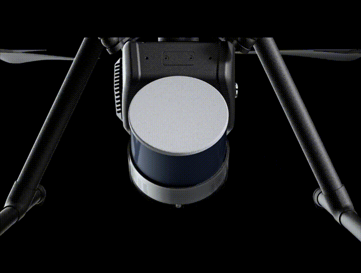
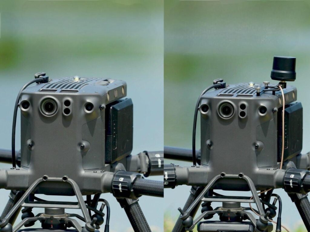
When mounting X4 on DJI M300/M350 RTK aircraft, there is no need to install external antennas, yet it can still acquire high-precision GNSS information. After post-processing software, a centimeter-level high-precision point cloud can be generated.
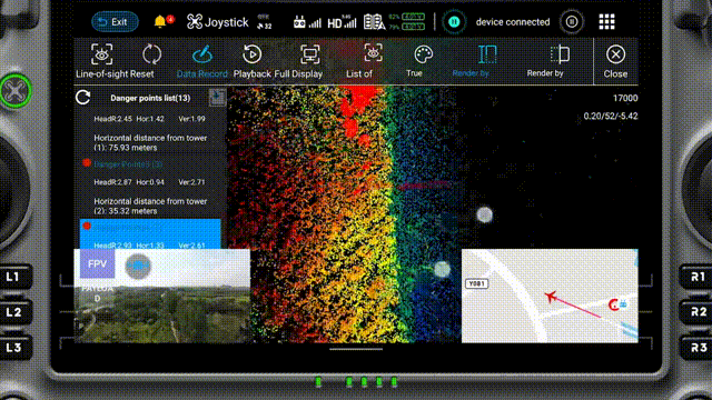
The APP supports real-time viewing of true color point clouds and 720P/30FPS video stream. This allows the flight personnel to clearly view the surrounding environment and better evaluate the point cloud quality.
Optional handheld kit with two configurations (Standard/Panoramic Camera Edition).
By combining GNSS and LiDAR SLAM algorithms, it enables reliable point cloud collection even in GNSS-denied environments and supports 3DGS model generation.
One device, multiple applications—maximize versatility and performance all-in-one solution.
| Detection Range | 80 m @ 10% reflectivity 200 m @ 54% reflectivity 300 m @ 90% reflectivity |
System Accuracy(Vertical) | <5 cm @ 100 m | ||
| Typical Flight Speed | 5-10 m/s | Storage | 256 GB TF Card+512 GB Internal SSD | ||
| Weight | 1.44 kg | Dimensions | 210×120×183 mm | ||
| Voltage | 12~28 V | Power Consumption | 31 W | ||
| Operating Temperature | -20~50 °C | Storage Temperature | -30~60 °C | ||
| LiDAR Sensor Parameters | |||||
| Wavelength | 905 nm | Number of Channels | 32 | ||
| Laser Class | Class1 | FOV | 360° (Horizontal)×40.3° (Vertical) | ||
| Scan Rate | 1,920,000 pts/s (Triple Return) | Number of Returns | 3 | ||
| Inertial Navigation System | |||||
| GNSS | GPS, GLONASS, Galileo, BDS | Azimuth Accuracy | 0.038° | ||
| Attitude Accuracy | 0.008° | IMU Data Frequency | 200 Hz | ||
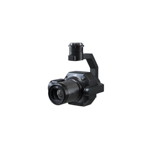
| Camera Parameters | |||||
| Pixels | 26 MP | Focal Length | 16 mm / 24 mm (Equiv. Focal Length) | ||
| Image Resolution | 6252×4168 | ||||
| Software | |||||
| Control Software | GreenValley | Pre-Processing | LiGeoreference | ||
| Post-Processing | LiDAR360 / LiPowerline (Optional) | ||||
| Handheld Accessories | |||||
| System Parameters | |||||
| Handheld Size | 241.3×119.8×378.8 mm (Standard) 222.9×119.8×515.5 mm (Panoramic Camera) | Battery Box Size | 134×64.6×167 mm | ||
| Handheld Weight | 1.7 kg (Standard ,excluding battery) 1.9 kg (Panoramic Camera, excluding battery) |
Panoramic Camera Pixel | 12MP×2 | ||
| Panoramic Camera FPV | H190°×V190° | Voltage | 15.2 V | ||
| Battery Capacity | 5870 mAh | Antenna | HX-CH7609A | ||
| Protection Level | IP54 | Working Time of One Battery Block | 2.5 h | ||
| Maximum Continuous Operation Time | Maximum 55 min | ||||
| Mapping Method | |||||
| Mapping Principle | SLAM、PPK-SLAM | Real-Time Calculation | Not Supported | ||
| Data Results | |||||
| Absolute Accuracy | <5 cm | Point Cloud Thickness | < 2 cm | ||
| Point Cloud Format | LAS, LiData | ||||
Inquire price for GreenValley LiAir X4 Autonomous UAV LiDAR Data Acquisition System