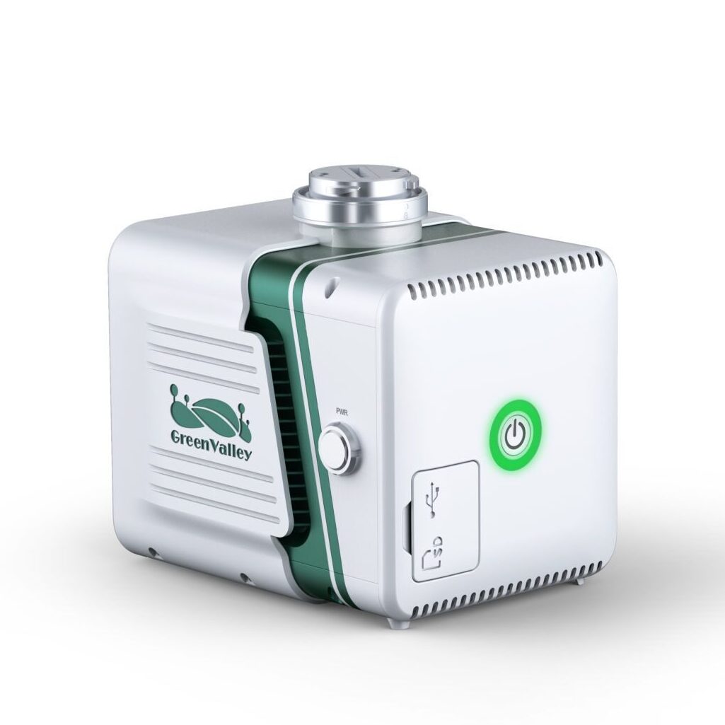
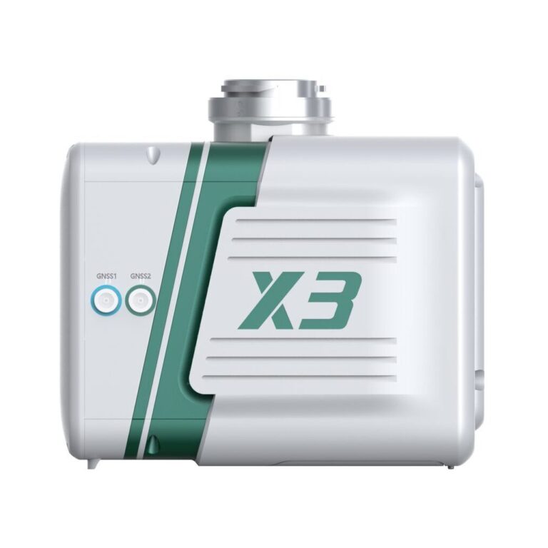
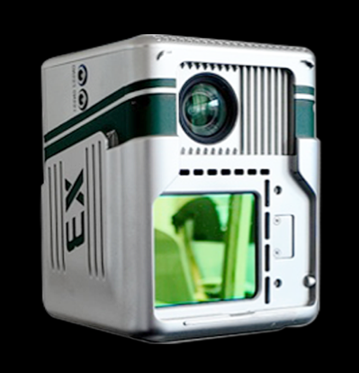
LiAir X3-H is the high-performance unit in the LiAir series by GreenValley International. It adopts a new integrated design style and integrates lightweight LiDAR, self-developed inertial navigation, a high-resolution mapping camera, and onboard computer systems providing new levels of efficiency.


Integrated simple yet rugged design, allowing for protection against the elements with an IP64 rating. The operation interface is straightforward, allowing one-touch operation for maximum efficiency.
Built-in new high-resolution custom mapping camera, the image resolution is upgraded from 24 Megapixels to 26 Megapixels, allowing for high-quality true-color point clouds as well as orthophotos for photogrammetry.
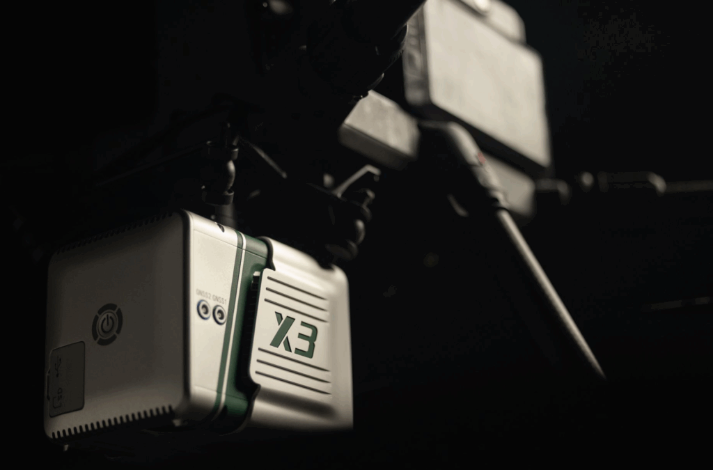
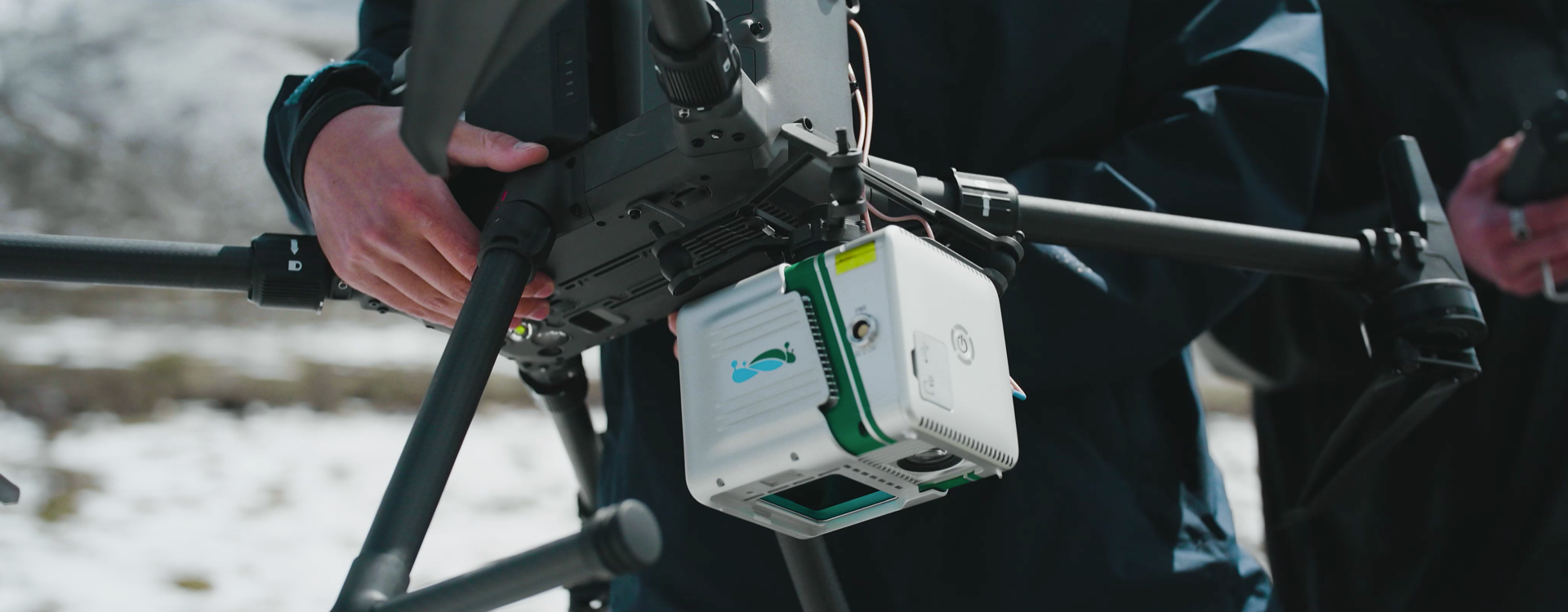
GreenValley flight assistant supports real-time point cloud display, parameter adjustment, and status monitoring. It can be directly installed on the M300/M350RTK remote controller and used in conjunction with the X3 to help operators control the site conditions in real-time.
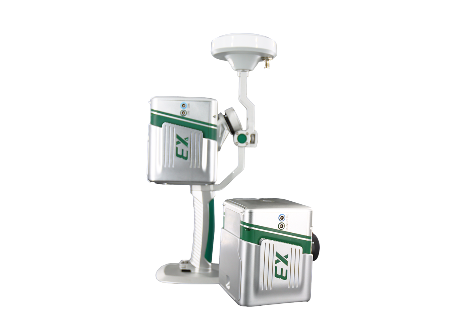
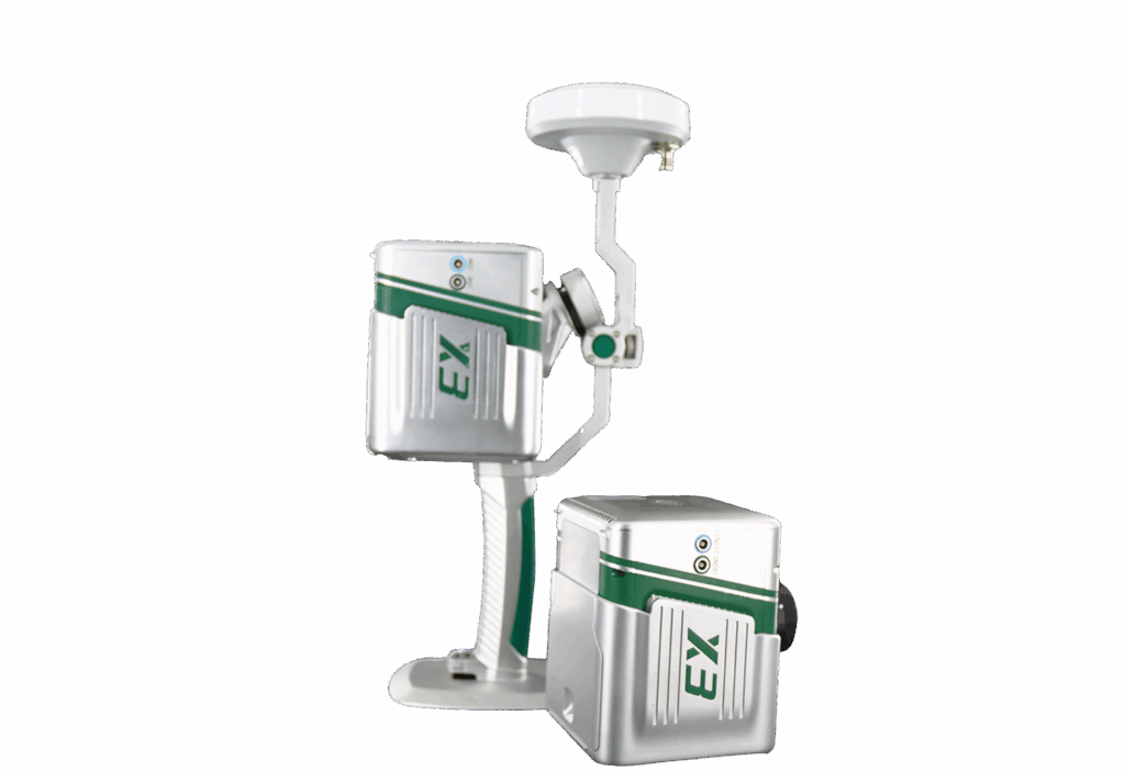
With the handheld kit, LiAir X3-H supports handheld mode to provide more diverse application scenarios.
| Detection Range | 190 m @ 10% reflectivity 450 m @ 80% reflectivity |
System Accuracy(Vertical) | 5 cm @ 70m | |||||
| Dimensions | 136×106×129 mm | Typical Flight Speed | 5-10 m/s | |||||
| Weight | 1.25 kg | Voltage | 12~24 V, 0.9 A @ 24 VDC | |||||
| Power Consumption | 22 W Storage | 256 GB TF Card | ||||||
| Operating Temperature | -20~50 ℃ | Storage Temperature | -30~60 ℃ | |||||
| LiDAR Sensor Parameters | ||||||||
| Wavelength | 905 nm | Laser Class | Class1 | |||||
| Range Accuracy | 2 cm (1σ @ 20m) | FOV | 70.4° (Horizontal)×4.5° (Vertical) | |||||
| Scan Rate | 720,000 pts/s(Triple Return) | Number of Returns | 3 | |||||
| Scan Method | Repetitive Scan | |||||||
| Inertial Navigation System | ||||||||
| GNSS | GPS, GLONASS, Galileo, BDS | Azimuth Accuracy | 0.038° | |||||
| Attitude Accuracy | 0.008° | IMU Data Frequency | 200 Hz | |||||
| Camera Parameters | ||||||||
| Image Sensor | APS-C | Pixels | 26 MP | |||||
| Focal Length | 16 mm / 24 mm (Equiv. Focal Length) | Image Resolution | 6252×4168 | |||||
| Software | ||||||||
| Control Software | GreenValley | Pre-Processing | LiGeoreference | |||||
| Post-Processing | LiDAR360 / LiPowerline (Optional) | |||||||
| Handheld Accessories | ||||||||
| System Parameters | ||||||||
| Handheld Size | 181.8×108×88 mm | Handheld Weight | 0.68 kg(Including Base) | 15.2 V | ||||
| Battery Box Size | 146×57×148 mm | Battery Capacity | 5870 mAh | Antenna | AT-106 | |||
| Single-Flight Continuous Operation Time | Maximum 55 mins | Battery Box Weight | 0.81 kg | Working Time of One Battery Block | 3 h | |||
| Applicable Environment | Applicable to multiple scenarios both indoors and outdoors | |||||||
| Mapping Method | ||||||||
| Mapping Principle | SLAM, PPK-SLAM | Real-Time Calculation | Not Supported | |||||
| Data Results | ||||||||
| Absolute Accuracy | ≤5 cm | Point Cloud Format | LAS, LiData | |||||
Inquire price for GreenValley LiAir X3-H Airborne Laser Scanning