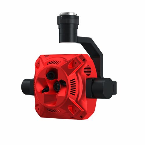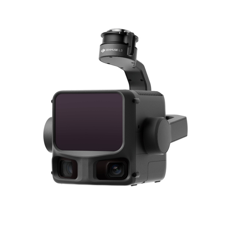
DJI’s next-generation high-accuracy aerial LiDAR system features a long-range LiDAR capable of reaching up to 950 m [1] even on objects with just 10% reflectivity. Dual 100MP RGB mapping cameras and a high-precision POS system accelerate geospatial data acquisition, enabling daily coverage of up to 100 km².
AED 56,799.00
Zenmuse L3 achieves a maximum detection range of 950 m [1] at a pulse rate of 100 kHz, tested under 100 klx ambient light and on objects with 10% reflectivity. The adjustable pulse rate allows for flexible power output and optimal adaptation to different operational scenarios. Typical flight altitudes of 300 to 500 m significantly [3] expand single-flight coverage and boost mapping efficiency.
With a laser beam divergence of just 0.25 mrad (1/e²), the spot size at the same range is about one-fifth that of Zenmuse L2, enabling detection of smaller objects such as power lines and branches. Higher energy density results in stronger penetration capability, significantly increasing ground point density beneath vegetation and enabling high-accuracy reconstruction of complex terrains and structures.
With maximum laser pulse emission frequency of 2 million pulses per second and support for up to 16 returns [4], Zenmuse L3 delivers highly accurate spatial reconstruction. Point cloud density and penetration capability can be adjusted to fit needs from high-accuracy mapping to complex environments.
Supports Linear, Star-Shaped, and Non-Repetitive scanning modes for different operational scenarios:
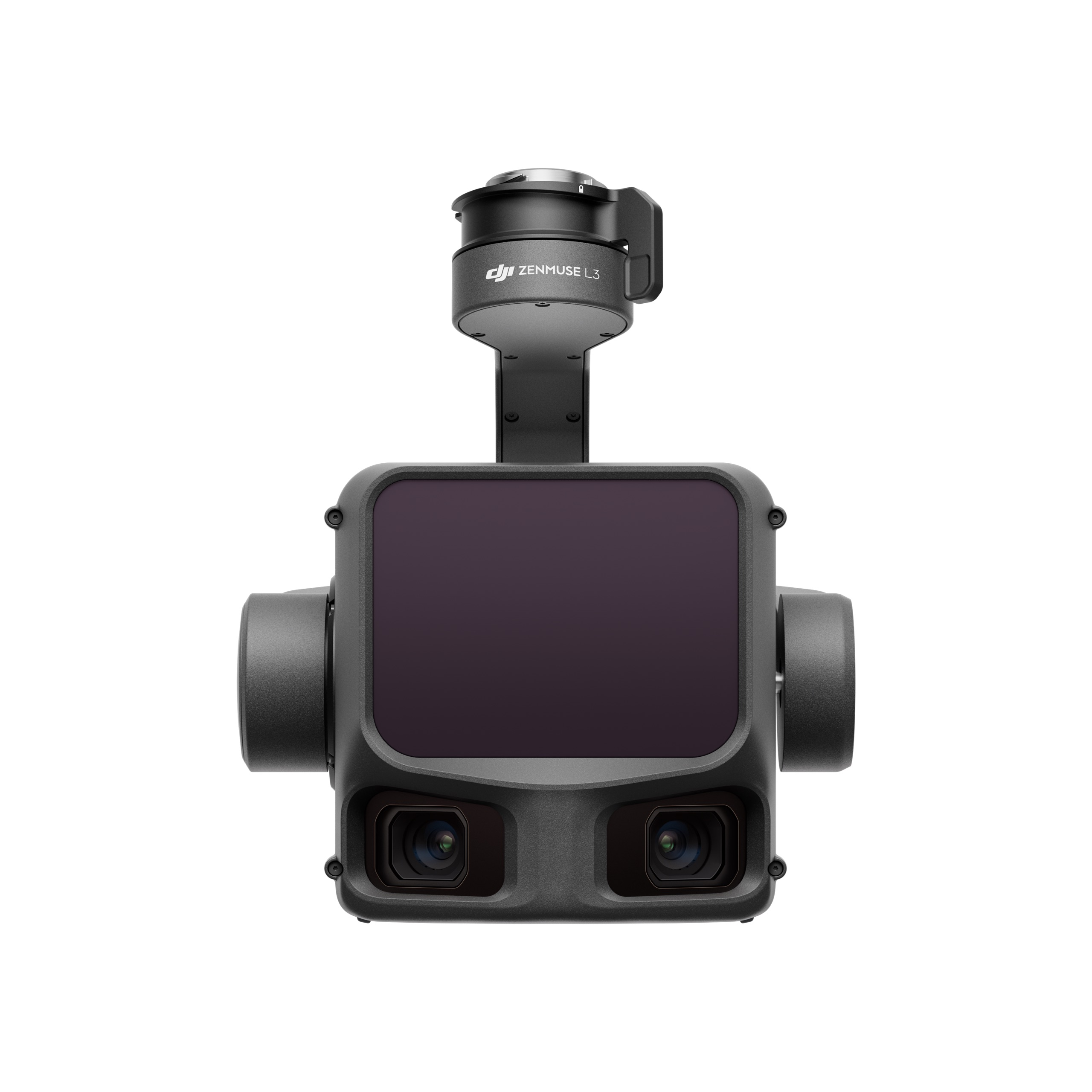
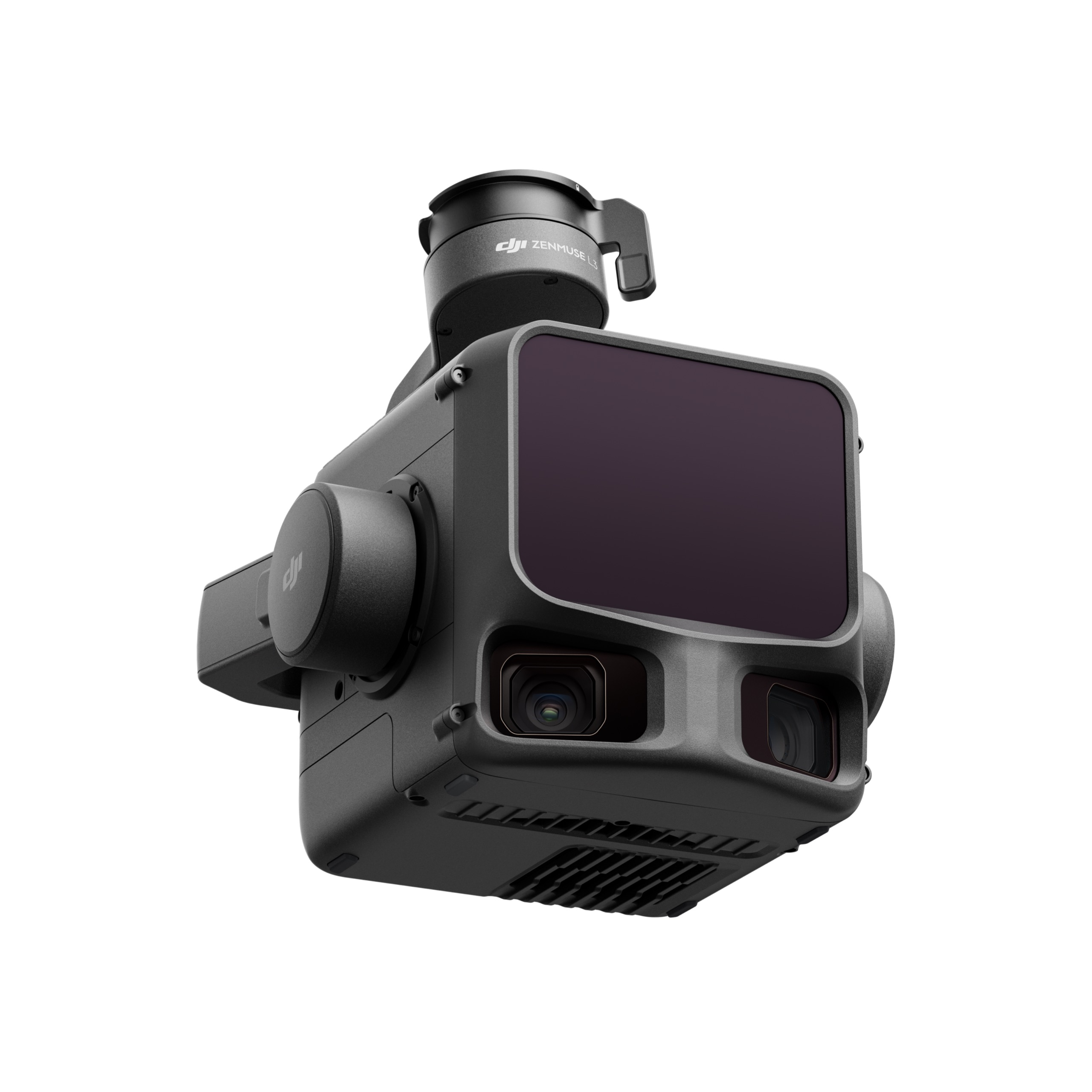
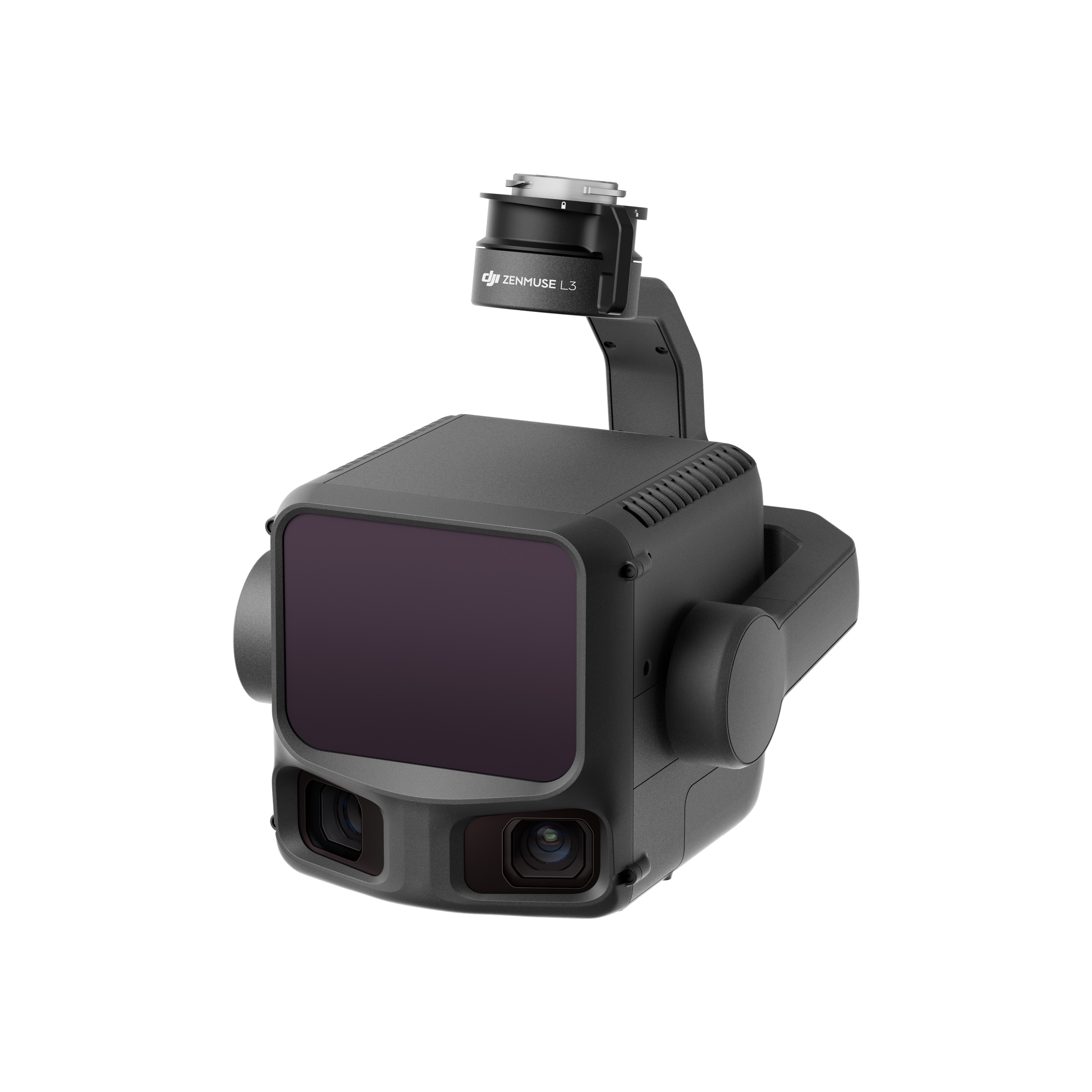
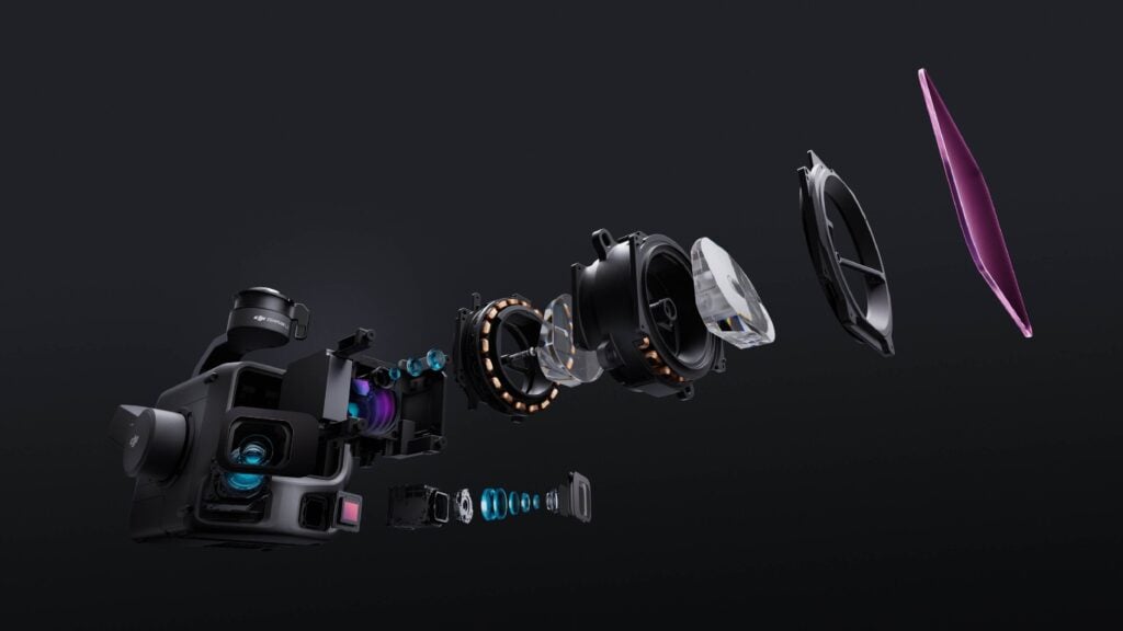
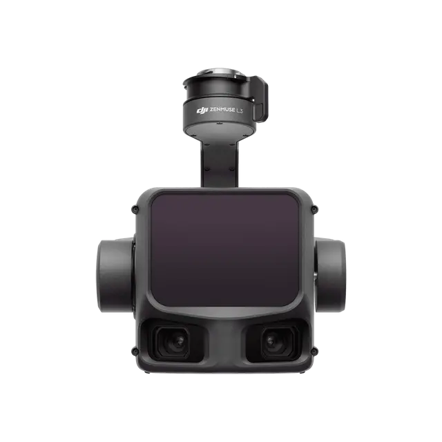
Equipped with dual 100MP 4/3 CMOS RGB sensors and a mechanical shutter, Zenmuse L3 delivers significantly enhanced accuracy and efficiency. Pixel binning supports an effective 25MP resolution with larger pixel size, producing superior color reproduction even under poor lighting conditions.
The dual RGB mapping cameras provide a horizontal field of view (FOV) of up to 107°, allowing each capture to cover a broader area. Even with a 20% LiDAR side overlap ratio, you can capture data for both digital orthophoto maps (DOM) and digital elevation models (DEM) in a single flight, thereby greatly improving operational efficiency.
Zenmuse L3 delivers significant improvements in both point cloud and RGB accuracy, while raising efficiency to new heights. Paired with DJI Matrice 400, a single flight can cover up to 10 km², enabling up to 100 km² of high-accuracy mapping per day. Large-area, high-accuracy results are delivered in a seamless workflow.
The upgraded high-precision POS system achieves heading accuracy of 0.02° and pitch accuracy of 0.01° (post-processed, 1σ). The self-developed LiDAR delivers ranging repeatability of 5 mm at 150 m (1σ) [5] and supports microsecond-level time synchronization. Each unit undergoes rigorous factory calibration to ensure consistently reliable survey results.
Vertical accuracy is better than 3 cm at 120m altitude, better than 5 cm at 300 m, and better than 10 cm at 500 m [6], easily supporting mapping projects at 1:500, 1:1000, and 1:2000 scales. The point cloud thickness produced by Zenmuse L3 is only half that of Zenmuse L2, supporting advanced analysis and high-accuracy applications.
With dual 100MP RGB mapping cameras, Zenmuse L3 achieves a ground sample distance (GSD) of 3 cm even at a 300m flight altitude [7]. Real-time position synchronization enables operation without ground control points (GCPs), ensuring high-quality imagery for precise mapping.
With a smaller laser spot and higher single-pulse energy, Zenmuse L3 offers superior penetration capability. In terrain mapping and similar applications, it captures more ground points with greater completeness, significantly improving the accuracy and integrity of terrain data for precise surface fitting and reconstruction.
When mounted on DJI Matrice 400, Zenmuse L3 delivers outstanding efficiency. At a flight altitude of 300 m, a single flight can cover up to 10 km², enabling up to 100 km² of daily coverage
Simultaneously captures LiDAR and RGB data to generate a range of mapping products from a single flight, including DEM, DOM, and more.
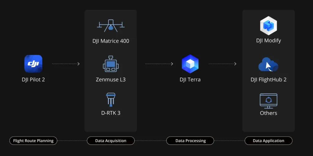
Zenmuse L3 seamlessly integrates with DJI’s ecosystem to deliver an end-to-end mapping solution. From data acquisition and processing to application, this unified workflow is simpler to operate and easier to master than traditional multi-platform setups, helping users efficiently complete a wide range of mapping tasks.
DJI Pilot 2 automatically recommends flight parameters based on user-defined routes and generates a Density Profile Chart and point cloud distribution charts before takeoff, enabling users to preview point cloud results.
Zenmuse L3 significantly enhances Power Line Follow, supporting operations up to 130m altitude. Without bypassing obstacles or crossing lines, Zenmuse L3 enables complete electrical corridor data acquisition in a single straight flight in most scenarios.
DJI Pilot 2 supports split-screen viewing of any two data sources—point cloud, RGB, or Vision Assist—allowing users to freely combine displays to suit their needs. During Power Line Follow or when the RGB cameras face downward, Vision Assist provides real-time forward-facing visuals, reducing flight risks and improving overall efficiency and safety.
Supports real-time point cloud SLAM reconstruction with instant 2D and 3D point cloud previews during operations, allowing users to monitor progress and take measurements as data is being collected. Point cloud results can also sync instantly to the cloud via DJI FlightHub 2 for rapid emergency response and assessment.
Zenmuse L3 point cloud outputs are fully compatible with DJI FlightHub 2. Users can view and manage point cloud data in real time, easily generate detailed flight routes, annotate and share points of interest, and perform advanced line and area measurements directly in the cloud.
DJI Terra features robust built-in PPK (Post-Processed Kinematic) capabilities, compatible with D-RTK 3 and standard base station data. The platform supports local PPK for RGB imagery and LiDAR, providing centimeter-level positioning accuracy even in areas with limited network connectivity or where RTK is unavailable.
DJI Terra enables advanced Gaussian Splatting fusion-based reconstruction of point cloud and RGB data collected by Zenmuse L3, dramatically enhancing the realism and detail of 3D models. This capability broadens the application scope of LiDAR across diverse mapping scenarios and delivers higher-quality 3D model outputs.
DJI Terra enables deep integration of LiDAR and RGB data. With a single acquisition, users can simultaneously generate high-accuracy point clouds, 2D maps, and 3D mesh models. This data fusion approach significantly enhances model completeness and detail, especially in environments with complex structures such as bridges and substations. It meets the needs of industries including energy, transportation, and infrastructure.
DJI Modify supports intelligent semantic classification of point clouds, automatically distinguishing ground, vegetation, buildings, wires, electric towers, and more. After classification, users can efficiently adjust categories using Quick Selection and Structure Selection tools, further enhancing classification accuracy and processing efficiency.
DJI Modify’s Profile tool allows users to flexibly select cross-sectional areas of point cloud models for intuitive analysis of terrain variation, structural features, and elevation profiles.
When paired with DJI Modify, Zenmuse L3 delivers versatile outputs. DJI Modify automatically generates a wide range of mapping products from point cloud data—including semantic point clouds, DEM, TIN, point grids, and contour lines—and supports multi-layer visualization. These outputs meet the diverse needs of engineering and design CAD-related workflows.
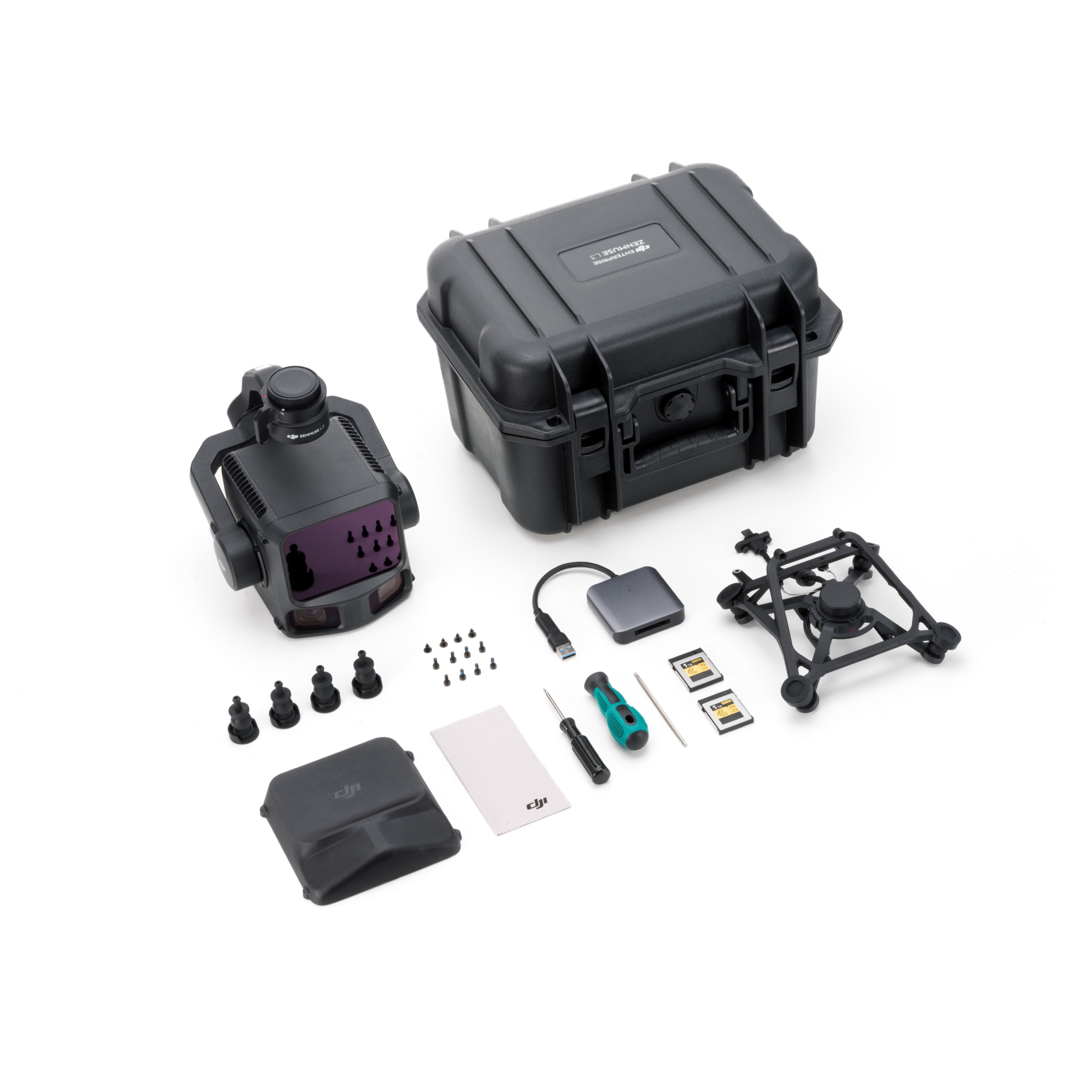
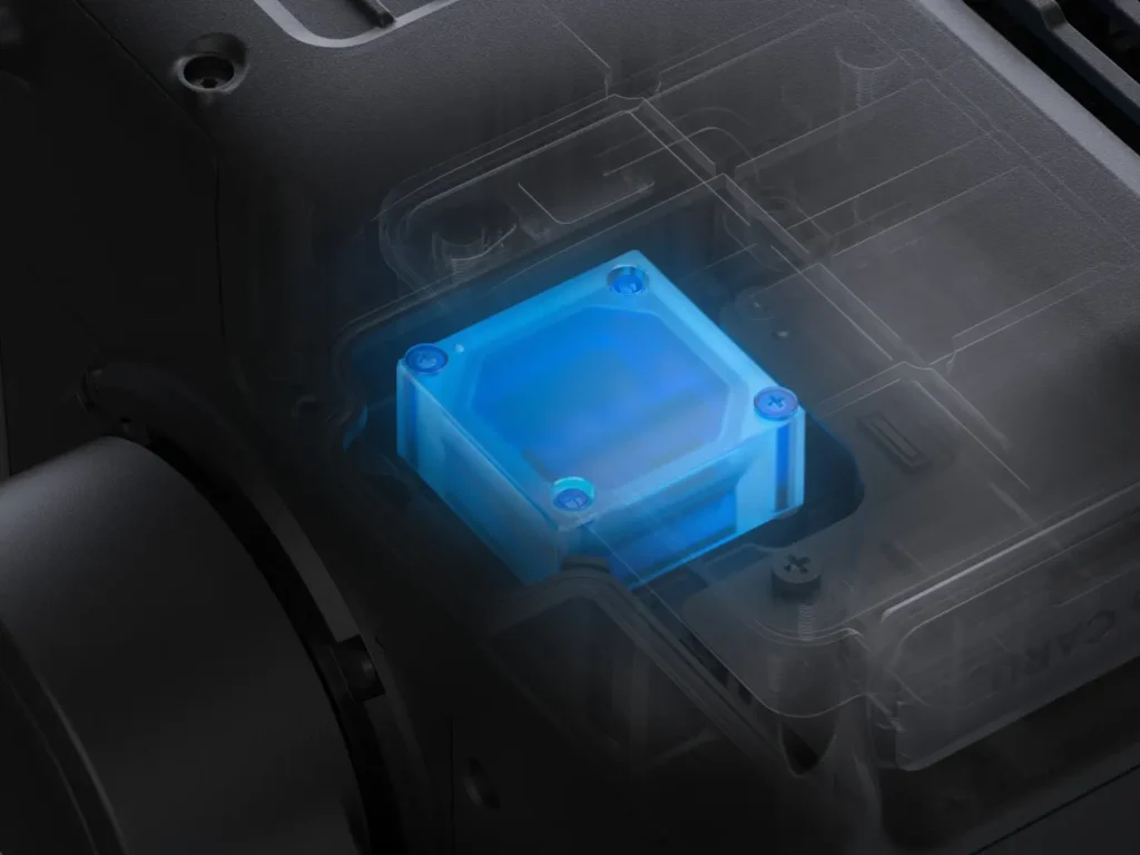
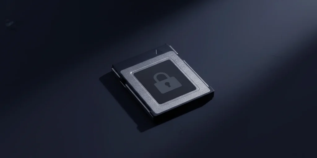
Zenmuse L3 supports CFexpress™ memory card encryption, enabling secure protection of stored data and preventing unauthorized access or data theft. Matrice 400 offers one-click log clearing and AES-256 encryption for video transmission, further ensuring data confidentiality.
What aircraft is Zenmuse L3 compatible with? Which gimbal interface can it be mounted on?
How does the range of Zenmuse L3 change at different laser pulse emission frequencies?
What improvements does Zenmuse L3 have compared to the previous generation?
Hardware performance improvements:
Accuracy and efficiency improvements:
What is the dual 100MP RGB mapping camera system for?
The dual RGB mapping camera system expands the horizontal FOV to 107°, enabling each acquisition to cover a broader area. Even with a 20% LiDAR side overlap ratio, you can capture data for both digital orthophoto maps (DOM) and digital elevation models (DEM) in a single flight, thereby greatly improving operational efficiency.
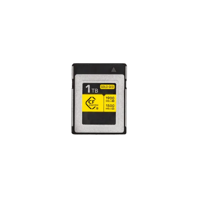
What type of CFexpress™ memory card does Zenmuse L3 require? What if I use a non-bundled card?
It is recommended to use the CFexpress™ Type B memory card (1 TB) that comes with Zenmuse L3. This card is specifically optimized for the unique storage requirements of L3’s point cloud data, images, and calibration files, ensuring ideal write speed, power efficiency, and file management.
Using a non-bundled CFexpress™ card may result in lower write speed or less efficient power management, which could lead to frame drops during operational file storage, thus affecting the accuracy of the results. When a non-bundled card is inserted, the app will display a warning message.
How efficient is the surveying and mapping operation of Zenmuse L3? How is it calculated?
Zenmuse L3 can collect data covering an area of up to 10 km² in a single flight, enabling up to 100 km² of mapping per day.
When paired with DJI Matrice 400, Zenmuse L3 can achieve a daily mapping coverage of up to 100 km² (flat terrain, 300m nadir flight altitude, 20% side overlap, 17m/s flight speed, and a total effective flight time of 6 hours).
What is the typical flight altitude for Zenmuse L3? What is the corresponding accuracy?
At 120m Flight Altitude:
At 150m Flight Altitude:
At 300m Flight Altitude:
Measured under the following conditions in a DJI laboratory environment:
Does Zenmuse L3's real-time point cloud data support cloud sharing?
Yes. After the operation, you can select real-time point cloud results in DJI Pilot 2 and upload them to the relevant project in DJI FlightHub 2 for emergency decision-making.
When DJI Matrice 400 is equipped with Zenmuse L3, what is the supported altitude for Real-Time Follow?
DJI Matrice 400 supports Real-Time Follow at altitudes from 30 to 300 m.
Is a license required to use DJI Terra for processing Zenmuse L3's point cloud data?
Point cloud processing for Zenmuse L3 is a free feature in DJI Terra. Advanced functions, such as point cloud accuracy optimization and generating other deliverables, are also free of charge.
This pricing information is based on DJI Terra V5.1.0. Whether subsequent updated functions will be charged is subject to the release notes at the time of publication.
| Product Name | Zenmuse L3 |
| Point Cloud System Accuracy | At 120m Flight Altitude:
At 300m Flight Altitude:
Measured under the following conditions in a DJI laboratory environment: |
| Point Cloud Thickness |
Measured in Linear scanning mode, using check points on 80% reflectivity objects, with neither point cloud optimization nor downsampling enabled in DJI Terra. For 6σ, multiply the listed thickness by 6. |
| Combined Horizontal FOV (Dual RGB Mapping Cameras) | 107°Composed by merging images from two cameras with a 45° optical axis angle between them. |
| RGB Ground Sampling Distance (GSD) | Average Value: 3 cm (300m nadir flight altitude)For detailed calculation methods, refer to the user manual available on the Downloads page of the official DJI Zenmuse L3 webpage. |
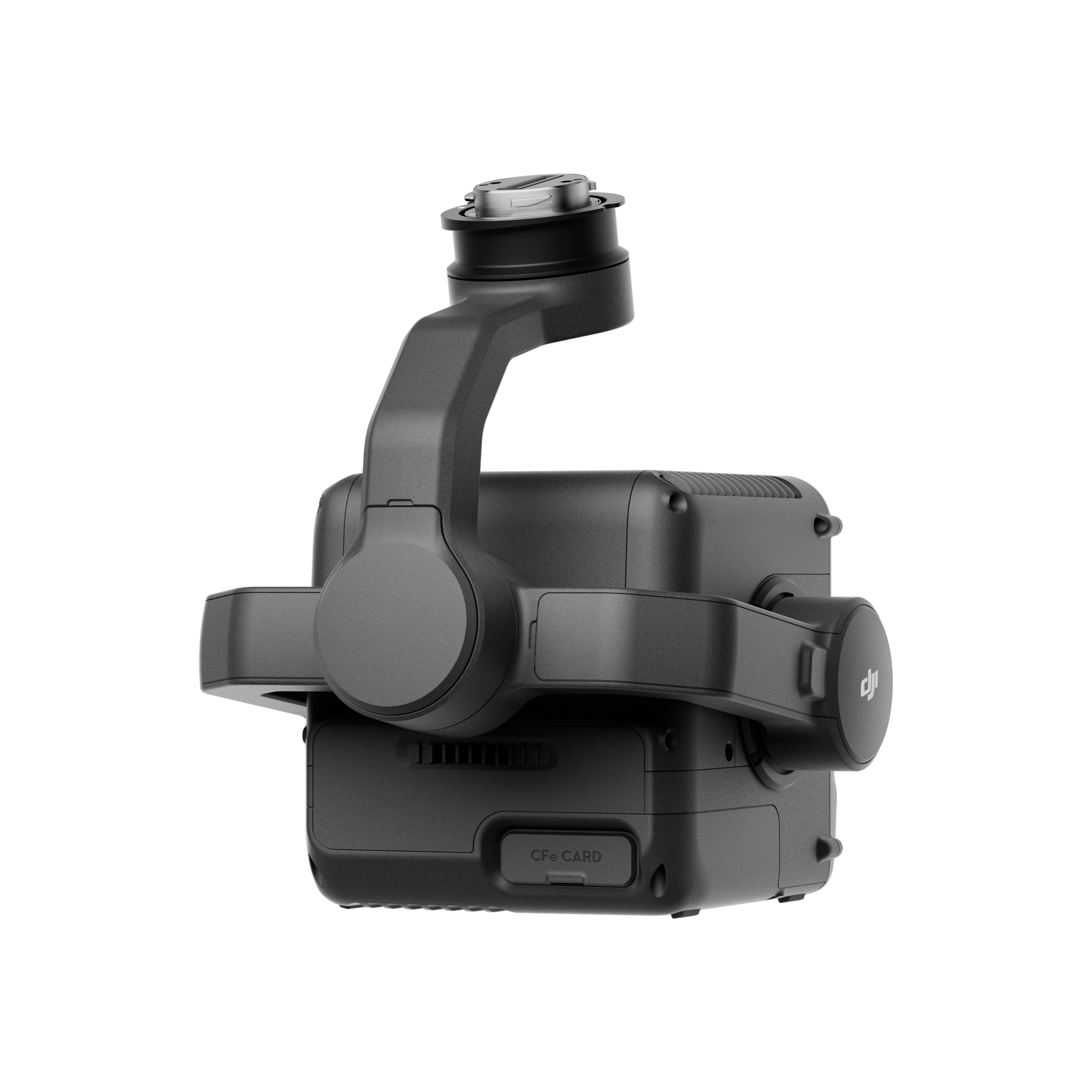
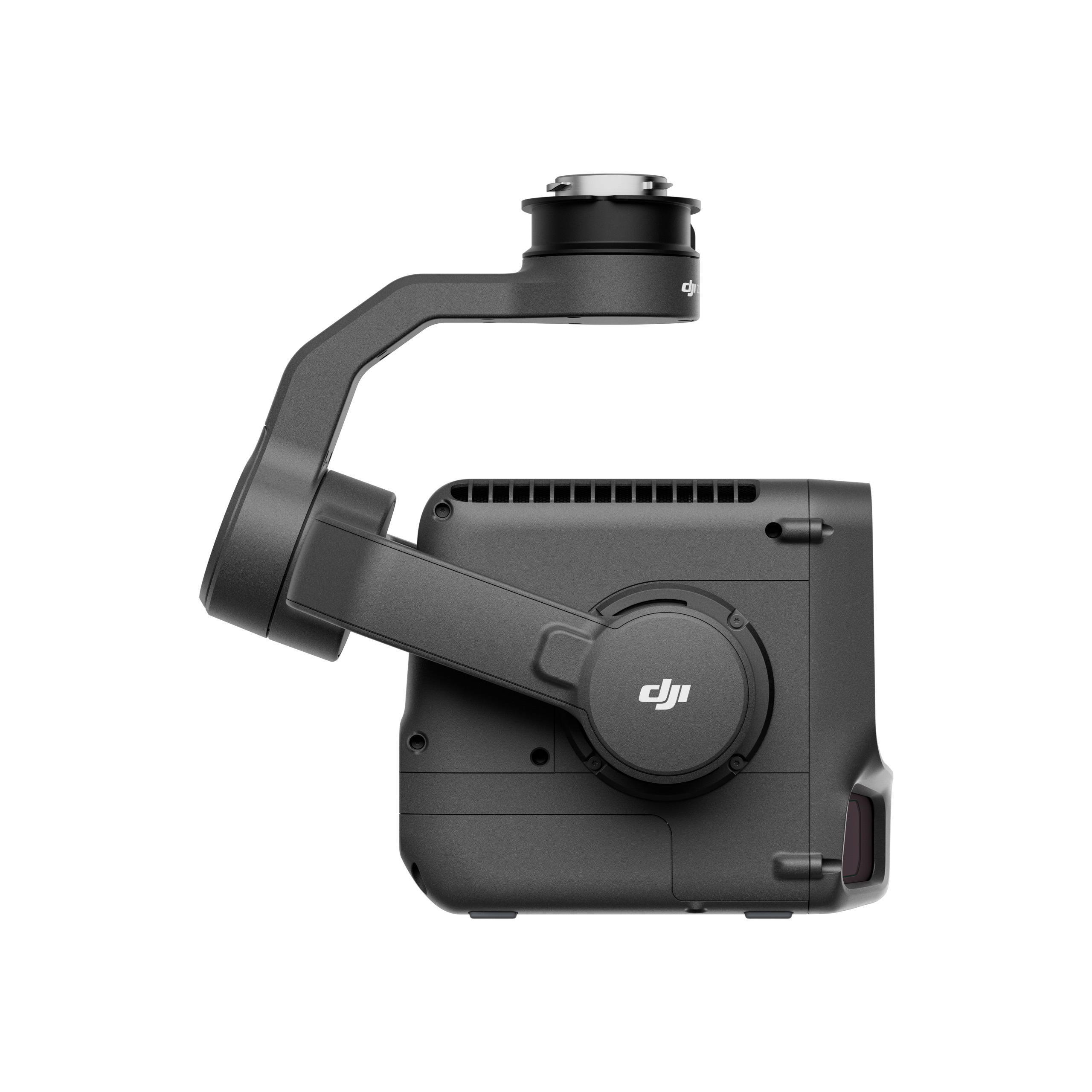
| Weight | 1.60 kg (without single gimbal connector)The Zenmuse L3 single gimbal connector weighs 145 g. |
| Dimensions | 192×162×202 mm (L×W×H)Measured in the default stabilized state after power-on with non-orthogonal gimbal design. |
| Power |
|
| Supported Aircraft | DJI Matrice 400 (requires the Zenmuse L3 single gimbal connector) |
| Ingress Protection Rating | IP54 |
| Operating Temperature | -20° to 50° C (-4° to 122° F) |
| Storage Temperature | -40° to 70° C (-40° to 158° F) |
| Laser Wavelength | 1535 nm |
| Laser Beam Divergence | 0.25 mrad (1/e²) |
| Laser Spot Size |
|
| Detection Range |
1. Range Definition: The range is defined as the distance at which 50% of the emitted laser pulses are detected. If a laser beam hits more than one subject, the total laser transmitter power is split and the achievable range is reduced. |
| Wire Detection Range |
1. Range Definition: The distance at which a fully scanned section of wire in mapping achieves a point density of 4 points per meter. |
| Ranging Accuracy |
The above specifications can be met under test conditions of 25° C (77° F) ambient temperature, 350 kHz pulse rate, 80% object reflectivity, and distances of 120 m and 300 m. The actual environment may differ from the testing environment. The figure listed is for reference only. |
| Minimum Effective Detection Distance | 10 m |
| Laser Pulse Emission Frequency |
|
| Number of Returns |
|
| Cross-Cycle Calculation | 7 times |
| Scanning Mode and FOV |
|
| Laser Safety Classification | Class 1 (IEC 60825-1:2014) |
| Sensor | 4/3 CMOS |
| Lens |
|
| Shutter |
|
| Photo Size |
|
| Minimum Photo Interval | JPEG:
RAW or JPEG + RAW:
|
| Video Specification | Video Format: MP4 (MPEG-4 HEVC/H.265) Resolution:
|
| GNSS Update Rate | 5 Hz |
| POS Update Rate | 200 Hz |
| Attitude Error | Yaw Angle: 0.02° (post-processed, 1σ) Pitch/Roll Angle: 0.01° (post-processed, 1σ) |
| Positioning Accuracy | Horizontal Accuracy: 1.0 cm + 1 ppm (RTK fix) Vertical Accuracy: 1.5 cm + 1 ppm (RTK fix) |
| Supported PPK Differential Data Formats |
For field operation, ensure the distance between the Multifunctional Station and the aircraft does not exceed 15 km, and the Multifunctional Station supports satellite observation with more than two GNSS constellations. |
| Degrees of Freedom | 3-axis (pitch, roll, yaw) |
| Angular Accuracy | ±0.01° |
| Mechanical Range |
Structural limit, not controllable range. |
| Controllable Range |
Roll is uncontrollable, for stabilization only. |
| Self-Check Method |
|
| Mounting Method | Detachable DJI SKYPORT (Zenmuse L3 single gimbal connector) |
| Raw Data Storage | Photo/IMU/Point cloud/GNSS/Calibration files |
| Standard Memory Card | CFexpress™ Type B Memory Card, sequential write speed 1500 MB/s |
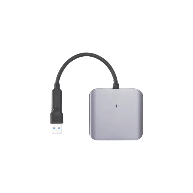
| Standard Card Reader | Read/write speed > 900 MB/s |
| Data Collection | DJI Pilot 2 |
| Data Processing | DJI Terra |
| Data Application | DJI Modify |
| Cloud Application | DJI FlightHub 2 |
| Data Format | DJI Terra supports exporting point cloud models in the following formats: Standard Point Cloud Format: PNTS/LAS/LAZ/PLY/PCD/S3MBDJI Modify supports importing point cloud models in the following formats: Standard Point Cloud Format: LAS |
Inquire price for DJI Zenmuse L3 | DJI L3 Lidar