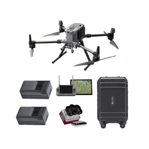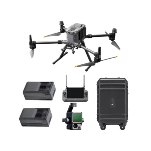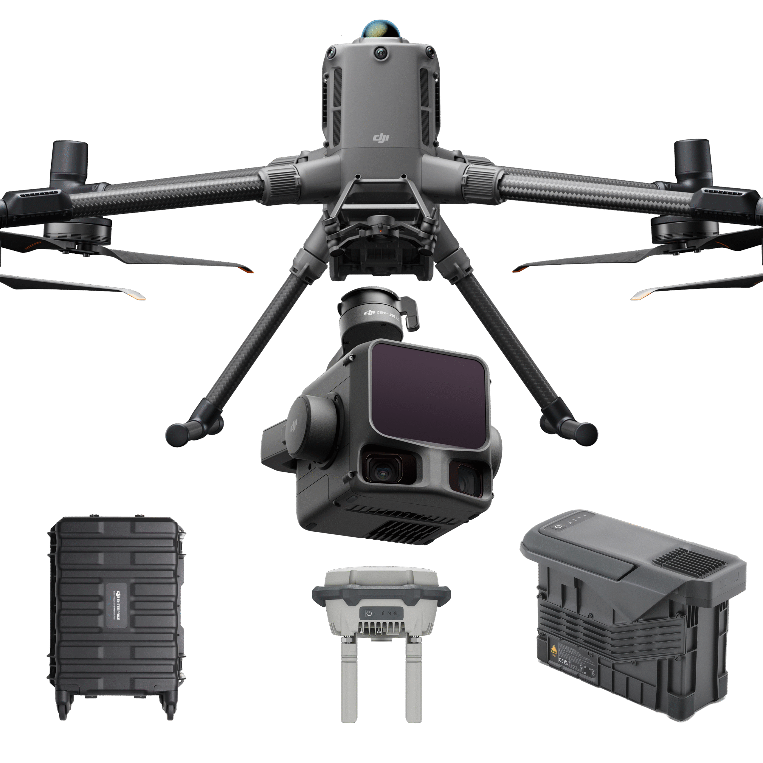
This bundle integrates the DJI Matrice 400 drone, DJI Zenmuse L3 LiDAR sensor, BS100 charging station, TB100 battery, and D-RTK3 GNSS system into a single operational setup.
The result is a complete aerial mapping solution that combines:
It is designed for efficient deployment in surveying, infrastructure inspection, and large-scale mapping projects.
The DJI M400 + L3 LiDAR + BS100 + TB100 + D-RTK3 bundle provides a complete, ready-to-deploy solution for professional aerial surveying and inspection. Available through GNSS.AE as an Authorized distributor DJI Enterprise.
The DJI Matrice 400 (DJI M400) serves as the core platform, offering high payload capacity (up to 6 kg) and extended flight time of up to 59 minutes under optimal conditions. It supports multiple payload configurations, making it suitable for complex and large-scale operations.
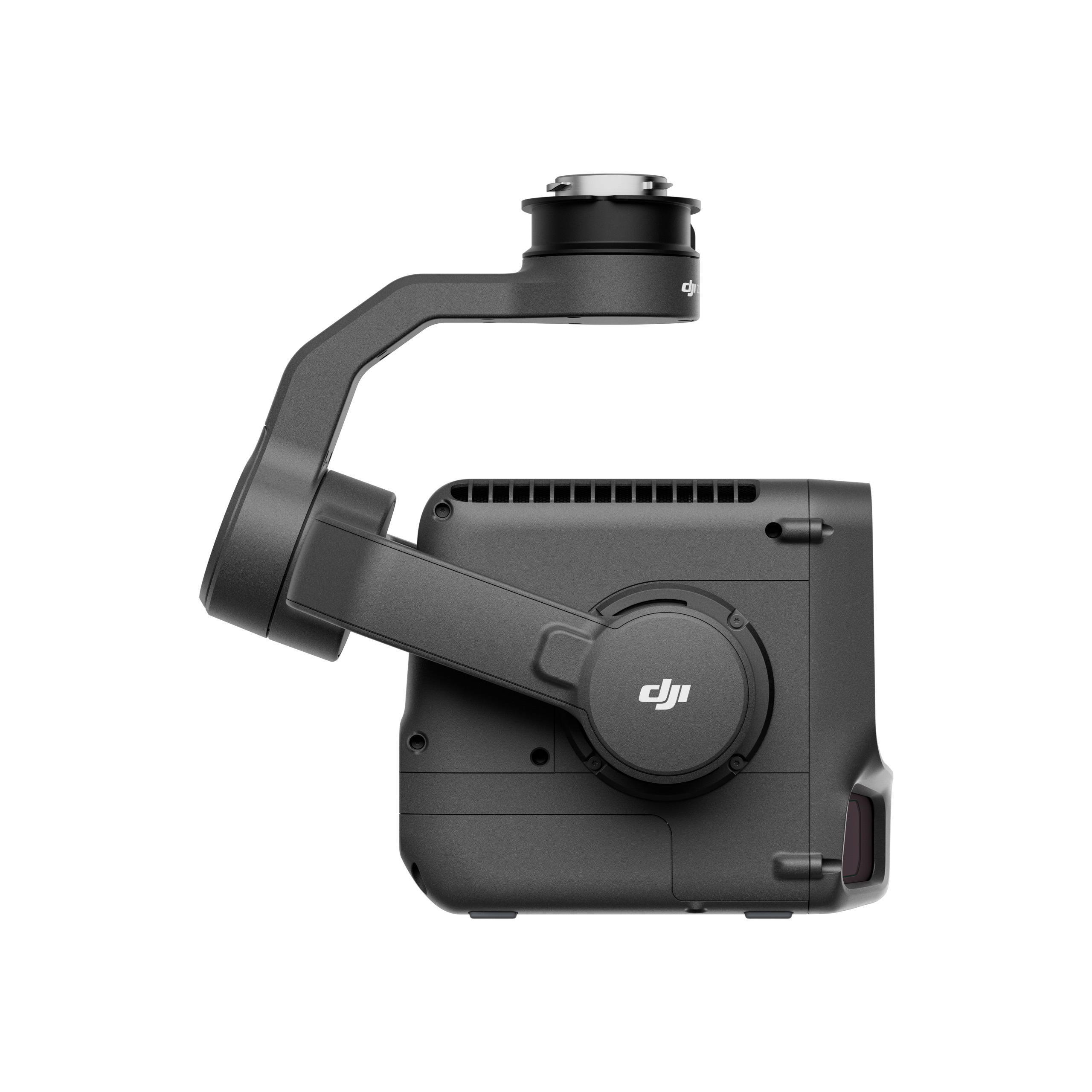
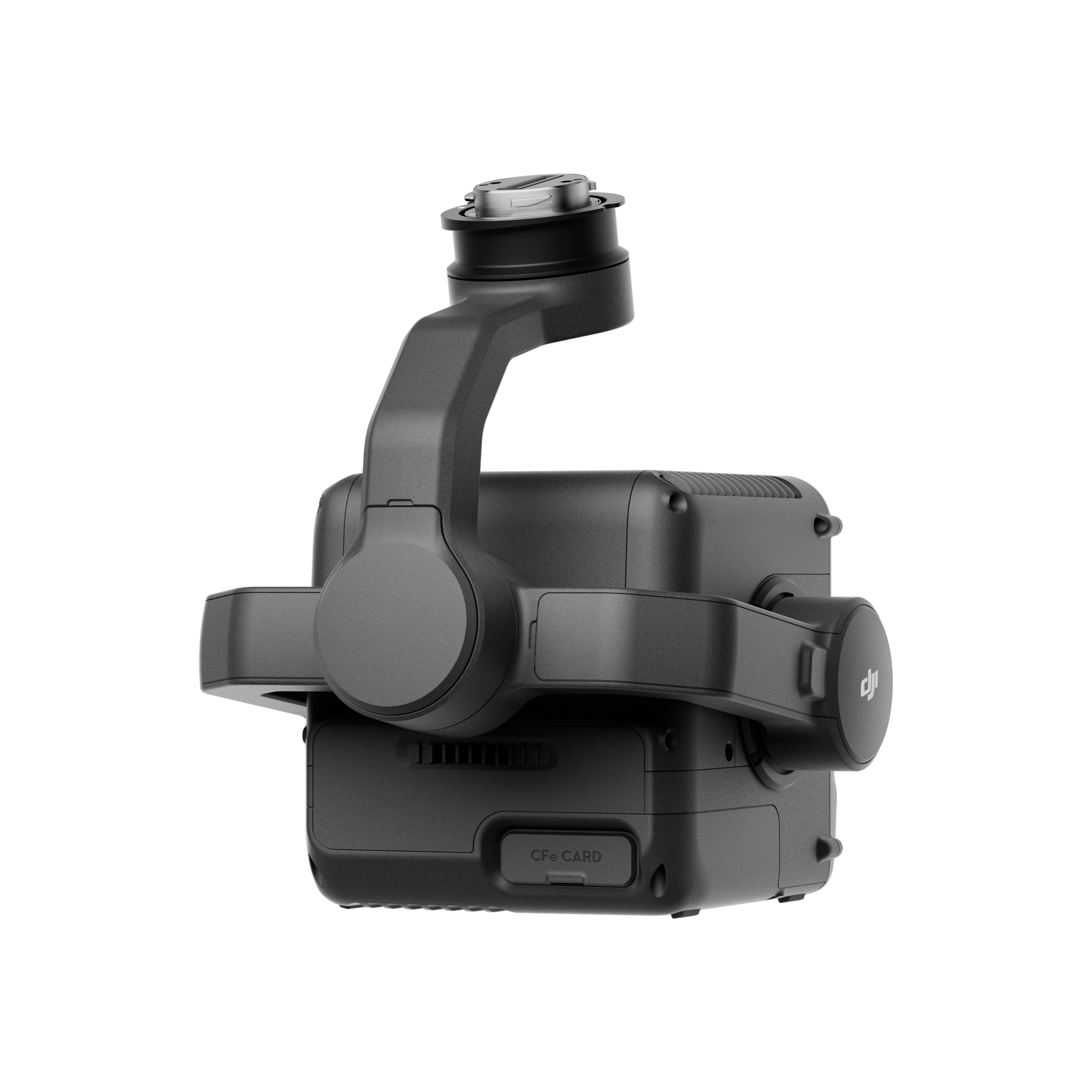
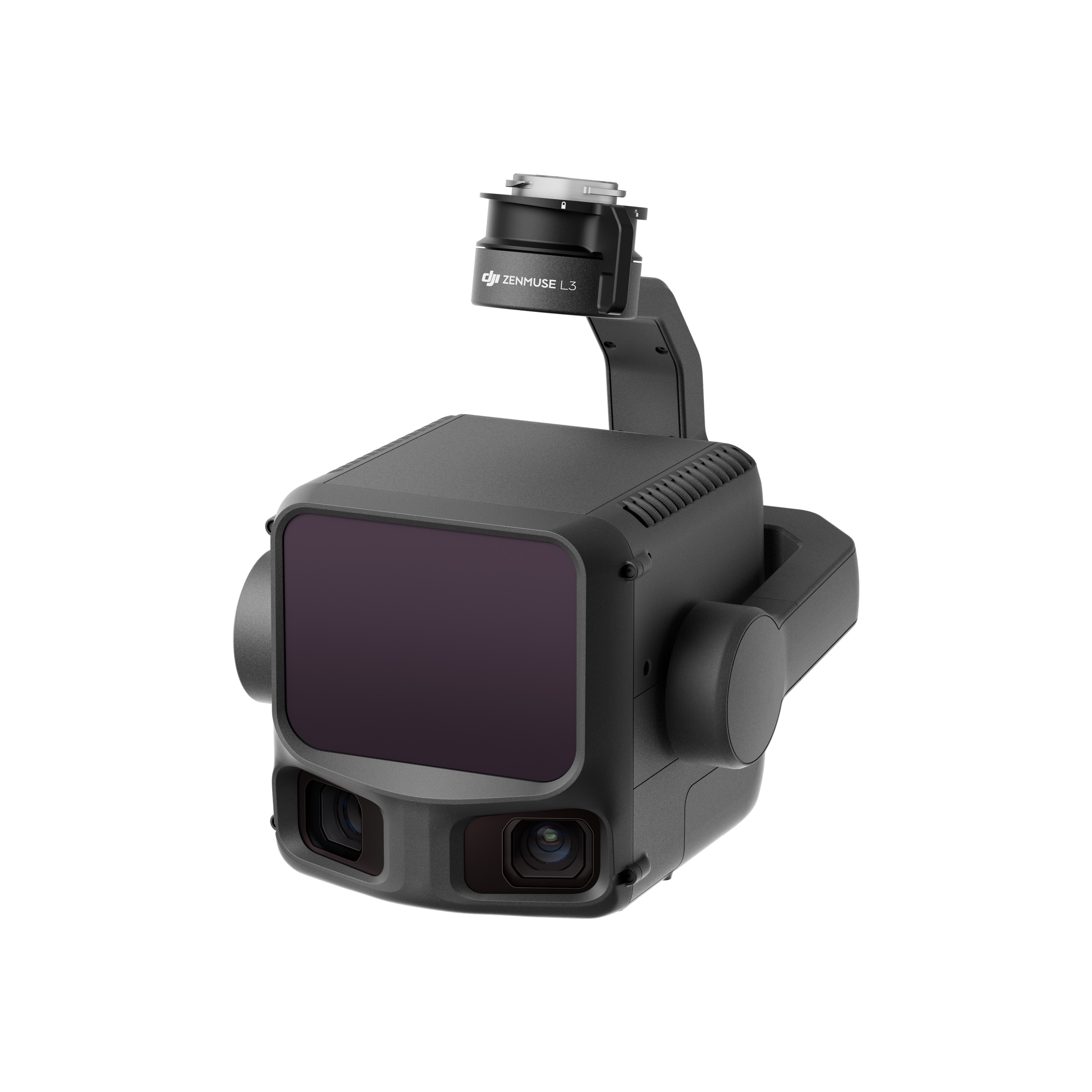
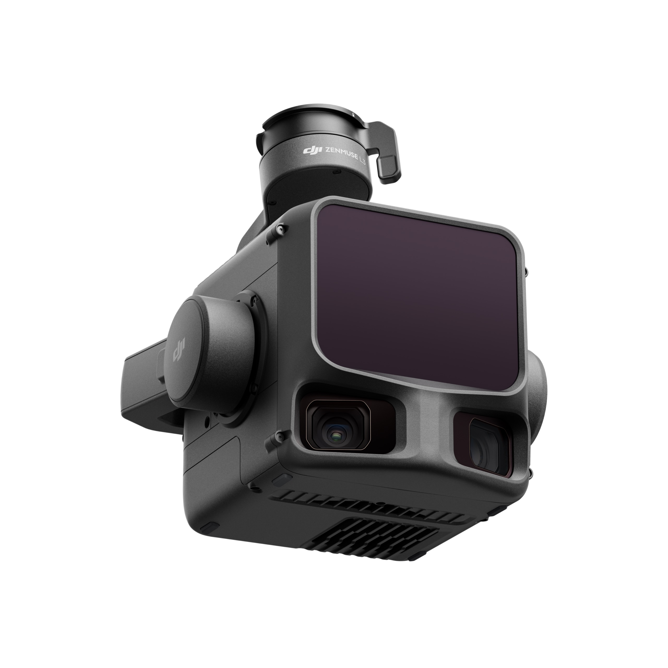
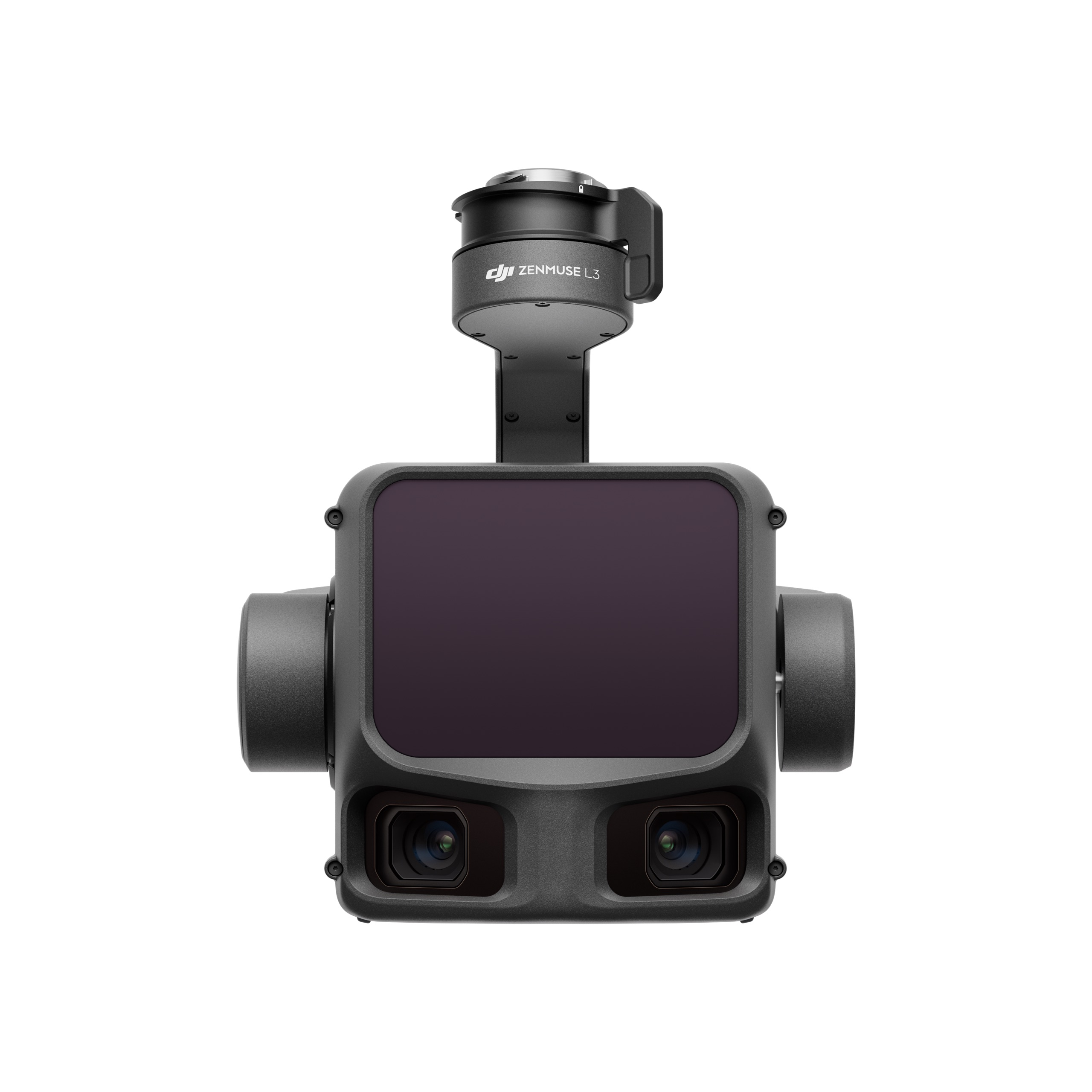
The Zenmuse L3 LiDAR payload enables rapid and accurate terrain and structure scanning, producing dense point clouds for detailed analysis. This configuration ideal for for corridor mapping, infrastructure inspection, and large-area surveys.
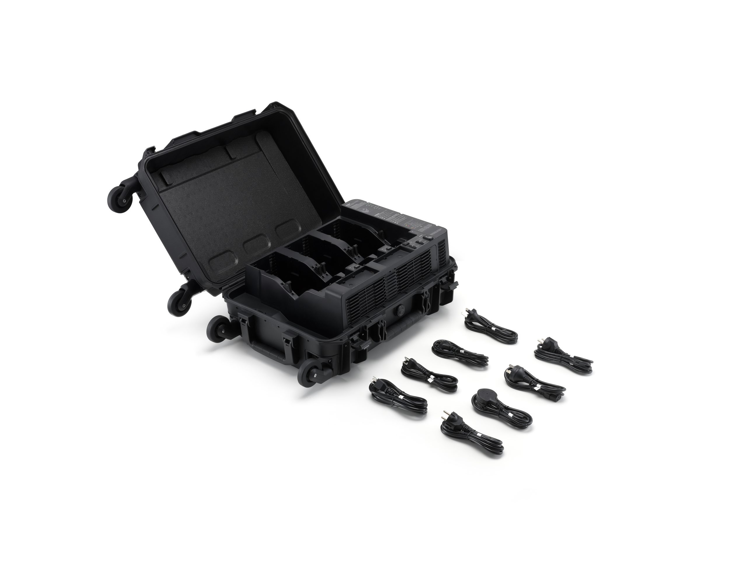
The system is complemented by the DJI BS100 charging station and DJI TB100 intelligent battery, ensuring continuous field operations with reduced downtime. Fast charging and efficient battery management allow teams to maintain productivity throughout the day. For positioning, the D-RTK3 GNSS system provides centimetre-level accuracy.
This bundle covers all key components of a professional workflow:
It is well suited for surveyors, civil engineers, utility companies, and inspection teams working in demanding environments.
| Takeoff Weight (with propellers) |
The actual product weight may vary due to differences in batch materials and external factors. |
| Max Takeoff Weight | 15.8 kg |
| Dimensions |
Maximum dimensions excluding propellers. Aircraft carrying case dimensions: 779×363×528 mm (L×W×H) |
| Max Payload | 6 kg
The 6 kg payload is measured at the third gimbal connector under sea level conditions. Payload capacity decreases as altitude increases. For details, refer to the official user manual. |
| Propeller Size | 25 inches |
| Diagonal Wheelbase | 1070 mm |
| Max Ascent Speed | 10 m/s |
| Max Descent Speed | 8 m/s |
| Max Horizontal Speed (at sea level, no wind) | 25 m/s |
| Max Takeoff Altitude | 7000 m |
| Max Flight Time (no wind) | 59 minutes
Measured with the aircraft flying forward at a constant speed of 10 m/s in a windless environment at sea level, carrying only the H30T (total weight 10,670 g), and from 100% battery level until 0%. Data is for reference only. Actual experience may vary depending on the environment, usage, and firmware version. |
| Max Hover Time (no wind) | 53 minutes
Measured with the aircraft hovering in a windless environment at sea level, carrying only the H30T (total weight 10,670 g), and from 100% battery level until 0%. Data is for reference only. Actual usage time may vary depending on the flight mode, accessories, and environment. |
| Max Flight Distance (no wind) | 49 km
Measured by the aircraft flying forward at a constant speed of 17 m/s in a windless environment at sea level, without external payloads, and from 100% battery level until 0%. Actual experience may vary depending on the environment, usage, and firmware version. |
| Max Wind Speed Resistance | 12 m/s
Max wind speed resistance during takeoff and landing. |
| Max Yaw Angular Velocity | Yaw: 100°/s |
| Max Pitch Angle | 35° |
| Operating Temperature | -20° to 50° C (-4° to 122° F) (without solar radiation) |
| Global Navigation Satellite System (GNSS) | GPS + Galileo + BeiDou + GLONASS**
GLONASS is supported only when the RTK module is enabled. Equipped with standard airborne ADS-B In receiver and dual antennas, supporting reception up to 20 km. |
| Hovering Accuracy Range (with moderate or no wind) | Vertical:
Horizontal:
|
| RTK GNSS Accuracy | RTK Fix: 1 cm + 1 ppm (horizontal), 1.5 cm + 1 ppm (vertical) |
| RTK Heading | Supports RTK heading with an accuracy better than 2° |
| Airborne ADS-B In | Equipped with standard airborne ADS-B In receiver and dual antennas, supporting reception up to 20 km. |
| Internal Storage | N/A |
| Ports |
|
| Propeller Model | 2510F |
| Beacon | Built into the aircraft |
| Ingress Protection Rating | IP55
The rating is not permanently effective and may decrease due to product wear and tear. |
| Maximum Payload for Single Gimbal Connector | 1400 g
If exceeds, the gimbal damper lifespan will decrease from 1000 hours to 400 hours. |
| Maximum Payload for Dual Gimbal Connector | 950 g |
| Maximum Payload for Third Gimbal Connector | 3 kg for quick-release port, 6 kg for screw lock fastening |
| Sensing Type |
|
| Forward |
|
| Backward |
|
| Lateral |
|
| Downward |
|
| Operating Environment |
Downward: * Sufficient lighting conditions refer to an illuminance not lower than that of a nighttime city light scene. |
| Rotating LiDAR |
|
| Upper LiDAR (3D ToF) | 0.5-25 m at night (reflectivity > 10%) The FOV to the up and down is 60° and 60° to the right and left. |
| Downward 3D Infrared Range Sensor | Measurement Range: 0.3-8 m (reflectivity > 10%) The FOV to the front and rear is 60° and 60° to the right and left. |
| mmWave Radar | Measurement Range for Power Line:
The mmWave radar function is unavailable in some countries/regions. |
| Resolution | 1080p |
| Field of View (FOV) |
|
| Frame Rate | 30fps |
| Night Vision | Starlight Grade |
| Video Transmission System | DJI O4 Enterprise Enhanced Video Transmission System |
| Live View Quality | Remote Controller: 3-channel 1080p/30fps |
| Operating Frequency and Transmitter Power (EIRP) |
Operating frequency allowed varies among countries and regions. Refer to local laws and regulations for more information. |
| Max Transmission Distance (unobstructed, free of interference) |
Measured in an unobstructed environment free of interference. The above data shows the farthest communication range for one-way, non-return flights under each standard. During your flight, please pay attention to RTH reminder on the DJI Pilot 2 app. |
| Max Transmission Distance (with interference) |
Data is tested under FCC standard in unobstructed environments of typical interference. Only to serve as a reference and provides no guarantee as to the actual flight distance. |
| Max Download Speed |
The above data was measured under conditions where the aircraft and remote controller were in close proximity without interference. |
| Antenna |
|
| Others | Supports Dual Control Mode and 2-channel Cellular Dongle 2 |
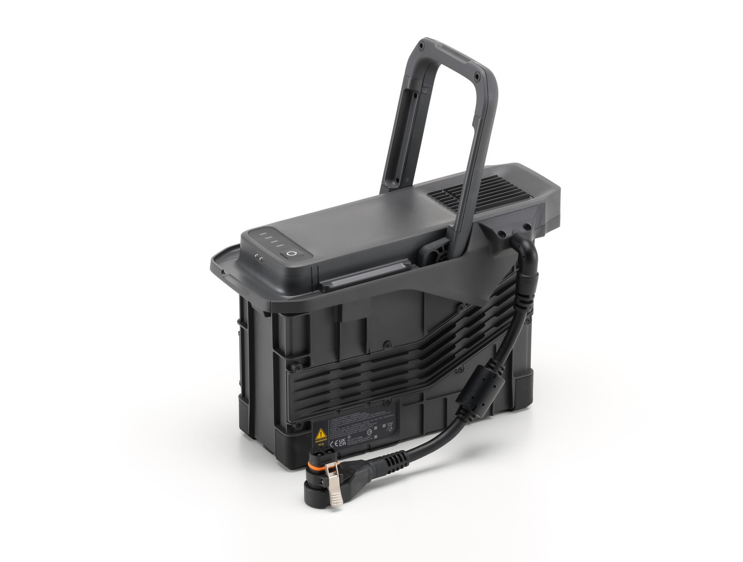
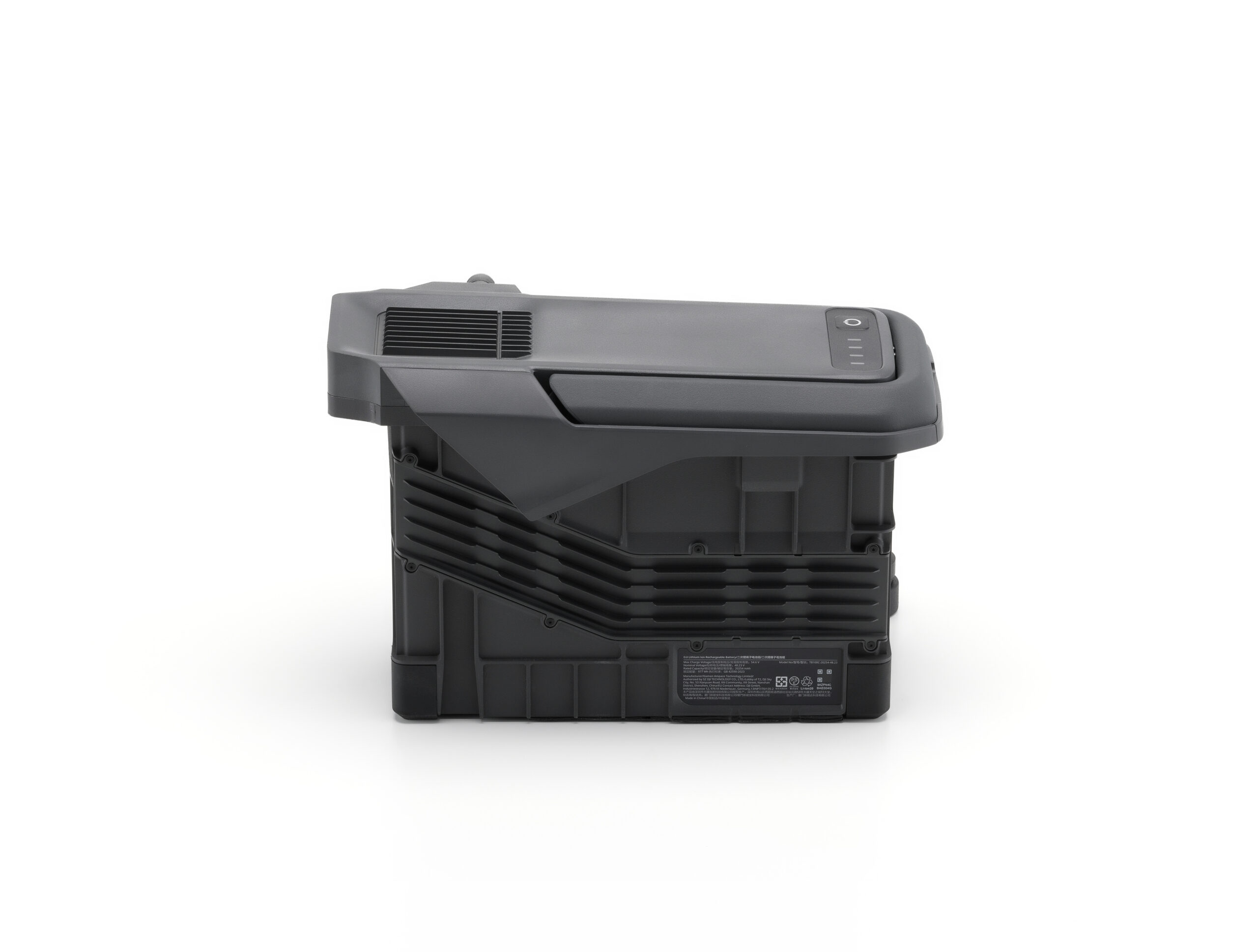
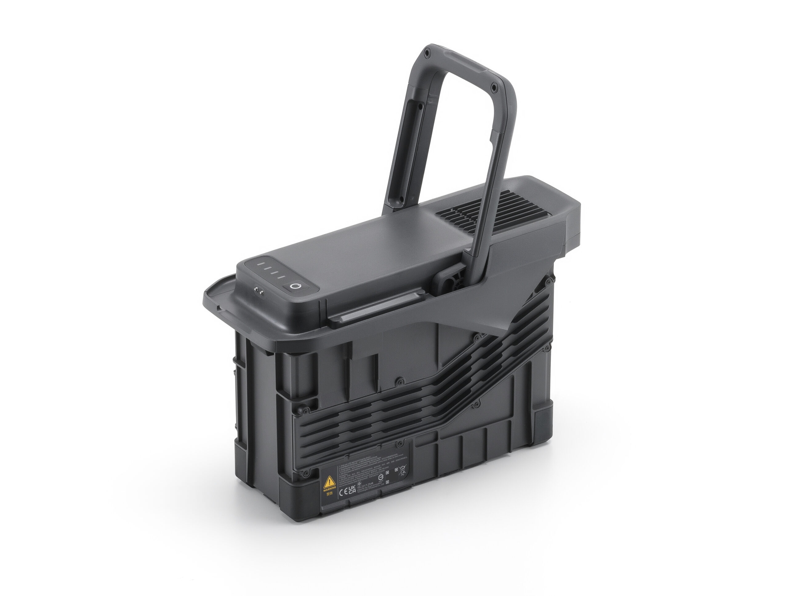
| Model | TB100 |
| Capacity | 20254 mAh |
| Standard Voltage | 48.23 V |
| Max Charging Voltage | 54.6 V |
| Cell Type | Li-ion 13S |
| Energy | 977 Wh |
| Weight | 4720 ± 20 g |
| Charging Temperature | 5° to 45° C (41° to 113° F) |
| Discharging Temperature | -20° to 75° C (-4° to 122° F) |
| Battery Heating |
|
| Discharge Rate | 4C |
| Max Charging Power | 2C |
| Low-Temperature Charging | Supports low-temperature self-heating charging |
| Cycle Count | 400 |
| Model | BS100 |
| Net Weight | 11.8 kg |
| Dimensions | 605×410×250 mm (L×W×H) |
| Supported Batteries | TB100 Intelligent Flight Battery, TB100C Tethered Battery WB37 Battery |
| Operating Temperature | -20° to 40° C (-4° to 104° F) |
| Input | 100-240 V (AC), 50-60 Hz, 10 A |
| Output | USB-C:
USB-C:
|
| Number of Charging Channels | Three TB100 and two WB37 batteries |
| Charging Mode | Ready-to-Fly Mode 90%; Standard Mode 100% Supports Fast Charging Mode and Silent Mode |
| Charging Time | TB100/TB100C Battery From 0% to 100%:
Charging time is measured in a test environment with a temperature of 25° C. |
| Video Transmission System | DJI O4 Enterprise Enhanced Video Transmission System |
| Max Transmission Distance (unobstructed, free of interference) |
Measured in an unobstructed environment free of interference. The above data shows the farthest communication range for one-way, non-return flights under each standard. During your flight, please pay attention to RTH reminder on the DJI Pilot 2 app. |
| Video Transmission Operating Frequency and Transmitter Power (EIRP) |
Operating frequency allowed varies among countries and regions. Refer to local laws and regulations for more information. |
| Antenna |
|
| Enhanced Transmission | Supports DJI Cellular Dongle 2 |
| Wi-Fi Protocol |
|
| Wi-Fi Operating Frequency |
5.2 and 5.8GHz frequencies are prohibited in some countries. In some countries, the 5.2GHz frequency is only allowed for use in indoor. |
| Wi-Fi Transmitter Power (EIRP) |
|
| Bluetooth Protocol | Bluetooth 5.2 |
| Bluetooth Operating Frequency | 2.400-2.4835 GHz |
| Bluetooth Transmitter Power (EIRP) | < 10 dBm |
| Screen Resolution | 1920 × 1200 |
| Screen Size | 7.02 inches |
| Screen Frame Rate | 60fps |
| Brightness | 1400 nits |
| Touchscreen Control | 10-Point Multi-Touch |
| Built-in Battery | 2S2P High Energy Density 18650 Lithium-ion Battery (6500 mAh @ 7.2 V) 46.8 Wh |
| External Battery | Optional, WB37 (4920 mAh @ 7.6 V) 37 Wh |
| Charging Type | Supports PD fast charging, with a maximum 20V/3.25A USB Type-C charger |
| Storage Capacity | RAM 8G + ROM 128G UFS + expandable storage via microSD card |
| Charging Time | 2 hours for internal battery; 2 hours for internal plus external batteries.
When remote controller is powered off and using a standard DJI charger. |
| Internal Battery Runtime | 3.8 hours |
| External Battery Runtime | 3.2 hours |
| Output Port | HDMI 1.4 |
| Indicators | Status LED, battery level LED, connection status LED, tricolor light, brightness adjustable according to ambient light |
| Speaker | Supports buzzer |
| Audio | Array MIC |
| Operating Temperature | -20° to 50° C (-4° to 122° F) |
| Storage Temperature |
|
| Charging Temperature | 5° to 40° C (41° to 104° F) |
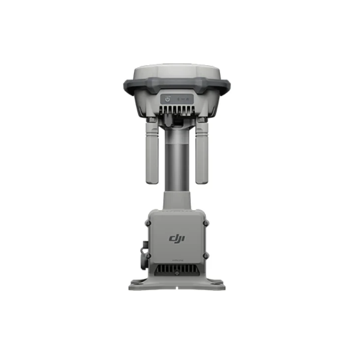
| Supported Aircraft Model | Matrice 400 |
| Global Navigation Satellite System | GPS + Galileo + BeiDou |
| Dimensions | 268×163×94.5 mm (L×W×H)
Width including external antenna folded, thickness including handle and controller sticks. |
| Weight | 1.15 kg (without external battery) |
| Model | TKPL 2 |
| System Version | Android 11 |
| External Interfaces | HDMI 1.4, SD 3.0, USB-C with OTG support, max 65W PD charging, USB-A with USB 2.0 support |
| Accessories | Strap/waist support |
| DJI Products Compatible With Matrice 400 |
|
| Product Name | Zenmuse L3 |
| Point Cloud System Accuracy | At 120m Flight Altitude:
At 300m Flight Altitude:
Measured under the following conditions in a DJI laboratory environment: |
| Point Cloud Thickness |
Measured in Linear scanning mode, using check points on 80% reflectivity objects, with neither point cloud optimization nor downsampling enabled in DJI Terra. For 6σ, multiply the listed thickness by 6. |
| Combined Horizontal FOV (Dual RGB Mapping Cameras) | 107°Composed by merging images from two cameras with a 45° optical axis angle between them. |
| RGB Ground Sampling Distance (GSD) | Average Value: 3 cm (300m nadir flight altitude)For detailed calculation methods, refer to the user manual available on the Downloads page of the official DJI Zenmuse L3 webpage. |
| Weight | 1.60 kg (without single gimbal connector)The Zenmuse L3 single gimbal connector weighs 145 g. |
| Dimensions | 192×162×202 mm (L×W×H)Measured in the default stabilized state after power-on with non-orthogonal gimbal design. |
| Power |
|
| Supported Aircraft | DJI Matrice 400 (requires the Zenmuse L3 single gimbal connector) |
| Ingress Protection Rating | IP54 |
| Operating Temperature | -20° to 50° C (-4° to 122° F) |
| Storage Temperature | -40° to 70° C (-40° to 158° F) |
| Laser Wavelength | 1535 nm |
| Laser Beam Divergence | 0.25 mrad (1/e²) |
| Laser Spot Size |
|
| Detection Range |
1. Range Definition: The range is defined as the distance at which 50% of the emitted laser pulses are detected. If a laser beam hits more than one subject, the total laser transmitter power is split and the achievable range is reduced. |
| Wire Detection Range |
1. Range Definition: The distance at which a fully scanned section of wire in mapping achieves a point density of 4 points per meter. |
| Ranging Accuracy |
The above specifications can be met under test conditions of 25° C (77° F) ambient temperature, 350 kHz pulse rate, 80% object reflectivity, and distances of 120 m and 300 m. The actual environment may differ from the testing environment. The figure listed is for reference only. |
| Minimum Effective Detection Distance | 10 m |
| Laser Pulse Emission Frequency |
|
| Number of Returns |
|
| Cross-Cycle Calculation | 7 times |
| Scanning Mode and FOV |
|
| Laser Safety Classification | Class 1 (IEC 60825-1:2014) |
| Sensor | 4/3 CMOS |
| Lens |
|
| Shutter |
|
| Photo Size |
|
| Minimum Photo Interval | JPEG:
RAW or JPEG + RAW:
|
| Video Specification | Video Format: MP4 (MPEG-4 HEVC/H.265) Resolution:
|
| GNSS Update Rate | 5 Hz |
| POS Update Rate | 200 Hz |
| Attitude Error | Yaw Angle: 0.02° (post-processed, 1σ) Pitch/Roll Angle: 0.01° (post-processed, 1σ) |
| Positioning Accuracy | Horizontal Accuracy: 1.0 cm + 1 ppm (RTK fix) Vertical Accuracy: 1.5 cm + 1 ppm (RTK fix) |
| Supported PPK Differential Data Formats |
For field operation, ensure the distance between the Multifunctional Station and the aircraft does not exceed 15 km, and the Multifunctional Station supports satellite observation with more than two GNSS constellations. |
| Degrees of Freedom | 3-axis (pitch, roll, yaw) |
| Angular Accuracy | ±0.01° |
| Mechanical Range |
Structural limit, not controllable range. |
| Controllable Range |
Roll is uncontrollable, for stabilization only. |
| Self-Check Method |
|
| Mounting Method | Detachable DJI SKYPORT (Zenmuse L3 single gimbal connector) |
| Raw Data Storage | Photo/IMU/Point cloud/GNSS/Calibration files |
| Standard Memory Card | CFexpress™ Type B Memory Card, sequential write speed 1500 MB/s |
| Standard Card Reader | Read/write speed > 900 MB/s |
| Data Collection | DJI Pilot 2 |
| Data Processing | DJI Terra |
| Data Application | DJI Modify |
| Cloud Application | DJI FlightHub 2 |
| Data Format | DJI Terra supports exporting point cloud models in the following formats: Standard Point Cloud Format: PNTS/LAS/LAZ/PLY/PCD/S3MBDJI Modify supports importing point cloud models in the following formats: Standard Point Cloud Format: LAS |
Inquire price for DJI Matrice 400 + DJI L3 LiDAR + BS 100 + TB100 + D-RTK 3 Bundle