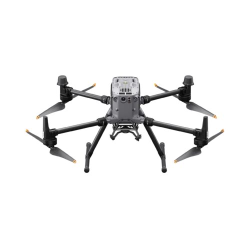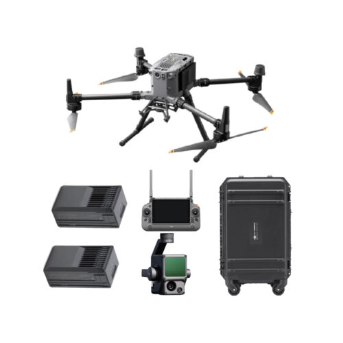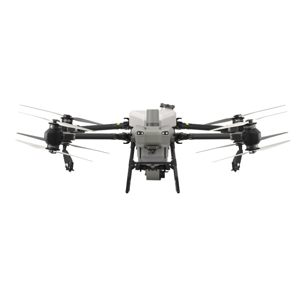
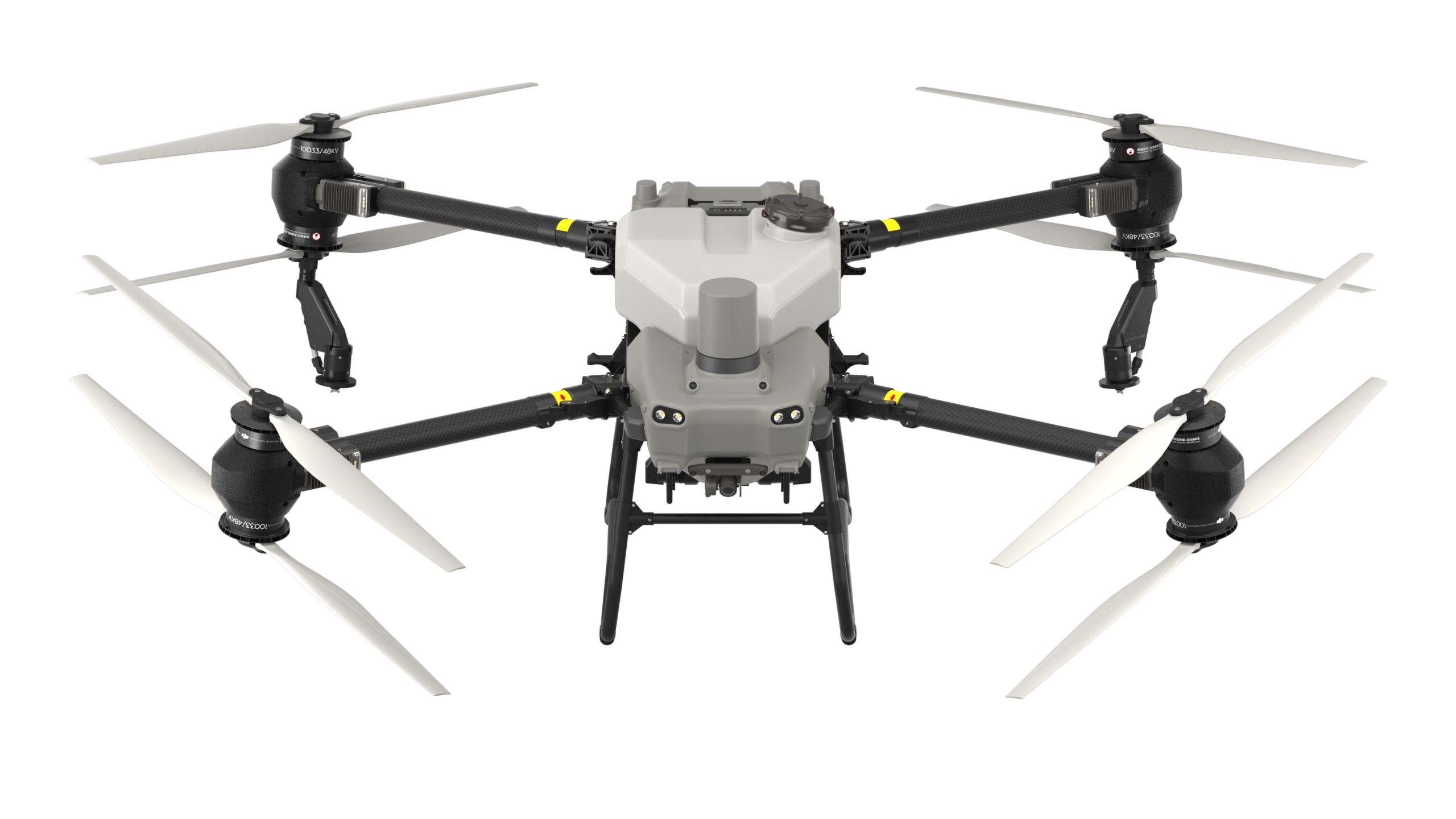
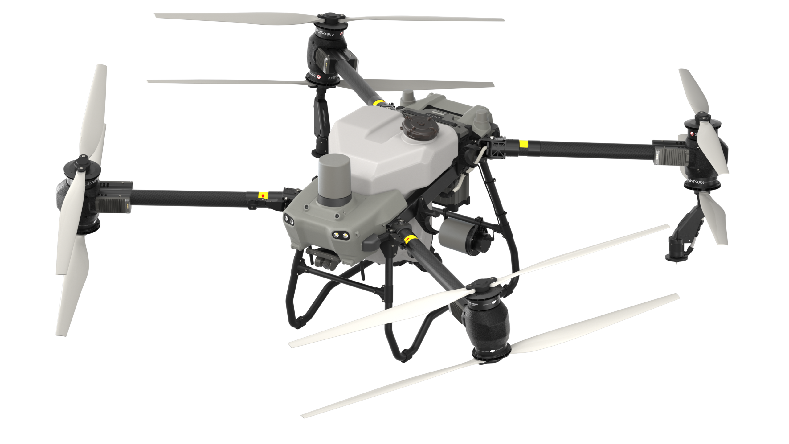
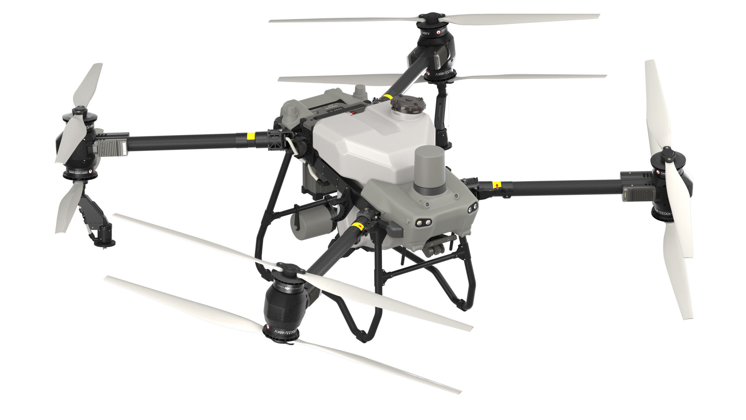

The DJI Agras T50 is a top-of-the-line agricultural drone that features a 40-liter spray tank and a spreading capability with a 50 kg load capacity. With its dual spray system, it offers optimal options and performance for agricultural applications… The DJI Agras T50 ensures smooth and efficient work in the field thanks to its improved parts and added functions.
AED 39,890.00
Available on back-order
The DJI Agras T50 is a top-of-the-line agricultural drone that features a 40-liter spray tank and a spreading capability with a 50 kg load capacity. With its dual spray system, it offers optimal options and performance for agricultural applications… The DJI Agras T50 ensures smooth and efficient work in the field thanks to its improved parts and added functions.
DJI AGRAS T50 is equipped with front and rear activated phase radars with double the number of RF channels[17] for more accurate detection. These devices enable multidimensional scanning of obstacles[6], which increases the overall safety of the operation. Two sets of binocular sensors allow the DJI AGRAS T50 to accurately map terrain and display obstacles in greater detail, which is essential for automatic obstacle avoidance[11] and terrain tracking[11] on steep slopes.
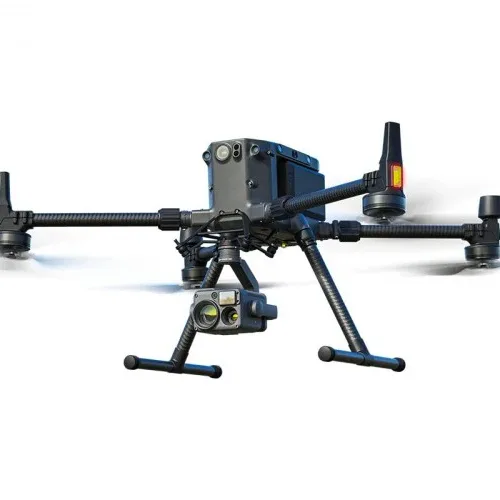
The DJI AGRAS T50 combines aerial surveying, spraying and spreading in one drone. Its stabilized high-resolution FPV camera enables real-time scanning of fields and orchards. With the support of DJI RC Plus and RTK services, you can create detailed maps that can then be used for automatic flight routes. With the DJI AGRAS T50, you can start and control automatic operations with a simple press of a button.
DJI AGRAS T50 supports obstacle avoidance and terrain tracking to survey[2] orchards on slopes up to 20°[5]. With DJI RC Plus and its real-time mapping capabilities, it can automatically identify fruit trees and obstacles. Based on the distribution of fruit trees, it can generate accurate and fully automatic 3D flight paths.
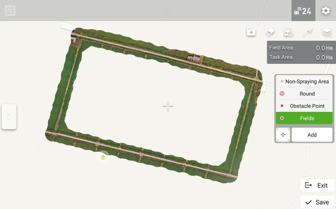
5 hectare orchard mapped in 10 minutes[12]. 3D map
Mapping the entire area (with obstacles) – with this mode, thanks to the powerful remote control, it is possible to map 13 hectares in 10 minutes with the creation of a reconstruction
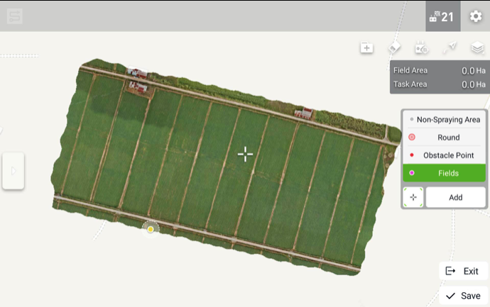
Mapping the boundaries of the field (if the field has no obstacles) – with this mode you can map 13 hectares in 3 minutes
DJI RC Plus has a 7-inch screen with high brightness and an 8-core processor for smooth operations. Intelligent route planning minimizes the distances flown with a full tank, which significantly increases operational efficiency. Manual mode allows you to control operations at will.
The new and improved O3 transmission system with four antennas works offline even in areas without cellular coverage and offers a transmission range of 2 km [13]. Its anti-jamming capability helps ensure high signal quality during tall crop operations.
DJI Relay ensures smooth real-time video transmission for safer flights even in difficult operational scenarios with signal obstacles.
[1] Data were measured at sea level. Payload is significantly affected by ambient temperature and altitude. The take-off weight must be reduced by 10 kg for every 1000 m of altitude. The DJI Agras app will recommend the weight of the payload according to the current state and surroundings of the aircraft. When adding materials, the maximum weight should not exceed the recommended value, otherwise flight safety may be compromised.
[2] RTK required.
[3] The maximum spray flow with two sprayers is 16 l/min. The maximum spray flow with four sprayers is 24 l/min.
[4] Data measured with 4 mm diameter urea. The maximum flow rate may vary depending on the granule size, density and surface smoothness of different fertilizers.
[5] To ensure a high success rate of surveying and mapping, the DJI AGRAS T50 can automatically adjust the flight speed based on the slope of the hill. The steeper the slope, the lower its speed.
[6] The effective sensing range and its ability to avoid and bypass obstacles will vary depending on ambient light, rain, fog and the material, location, shape and other characteristics of the obstacles. Downward sensing is used for terrain tracking and altitude stabilization. Scanning in other directions is used to avoid obstacles.
[7] Charging from 30% to 95%. Factors affecting the charging time: Altitude of the charging station; The charging cable meets the requirements for fast charging; Battery temperature range is 15° to 70° C (59° to 158° F)
[8] Data measured using DJI AGRAS T50 and may vary depending on operating environment and parameters. Flight parameters for this test: Dosage 15 l/ha, spray width 11 m, flight speed 7 m/s, height 3 m.
[9] Data measured with DJI AGRAS T50 and may vary depending on operating environment and parameters. Flight parameters for this test: Dosage 90 l/ha, spray width 4 m, flight speed 4 m/s and height 3 m.
[10] Data were measured with urea and may vary by granule type, operating environment and parameters. Spreading parameters for this test: Dosing 225 kg/ha, spread 8 m, flight speed 10 m/s, height 4 m, rotating disc speed 1,000 rpm.
[11] Avoiding obstacles is supported in the forward direction. Terrain tracking and obstacle avoidance are not supported at night or in low light. Fly carefully. Bridging obstacles is not recommended around electrical or anchor wires.
[12] Refers to mapping time after completion of aerial survey. Time varies depending on firmware version, type of aerial survey and other factors.
[13] Measured at a flight height of 2.5 meters, without obstacles or electromagnetic interference.
[14] Batteries are guaranteed for up to 1,500 charge cycles or 12 months, whichever comes first.
[15] Compared to third-party general-purpose generators equipped with a smart charger.
[16] To achieve fast charging, the C10000 smart charger, C8000 smart charger, generator or public grid output power must use a fast charging connection method that meets the requirements.
[17] Compared to the T40 active phased array omnidirectional radar.
| Weight | 39.9 kg (excl. battery) 52 kg (incl. battery) |
| Max Takeoff Weight[1] | Max takeoff weight for spraying: 92 kg (at sea level) Max takeoff weight for spreading: 103 kg (at sea level) |
| Max Diagonal Wheelbase | 2200 mm |
| Dimensions | 2800×3085×820 mm (arms and propellers unfolded) 1590×1900×820 mm (arms unfolded and propellers folded) 1115×750×900 mm (arms and propellers folded) |
| Hovering Accuracy Range (with strong GNSS signal) | RTK enabled: Horizontal: ±10 cm, Vertical: ±10 cm RTK disabled: Horizontal: ±60 cm, Vertical: ±30 cm (radar module enabled: ±10 cm) |
| RTK/GNSSOperating Frequency | RTK: GPS L1/L2, GLONASS F1/F2, BeiDou B1I/B2I/B3I, Galileo E1/E5b, QZSS L1/L2 GNSS: GPS L1, GLONASS F1, BeiDou B1I, Galileo E1, QZSS L1 |
| Max Configurable Flight Radius | 2000 m |
| Max Wind Resistance | 6 m/s |
| Stator Size | 100×33 mm |
| KV | 48 rpm/V |
| Power | 4000 W/rotor |
| Material | Nylon carbon fiber filament |
| Dimension | 54 in (1371.6 mm) |
| Propeller Rotation Diameter | 1375 mm |
| Quantity | 8 |
| Material | Plastic (HDPE) |
| Volume | 40 L |
| Operating Payload [1] | 40 kg[1] |
| Quantity | 1 |
| Model | LX8060SZ |
| Quantity | 2 |
| Nozzle Distance | 1570 mm(Rear Nozzles) |
| Droplet Size | 50-500 μm |
| Effective Spray Width [2] | 4-11 m (at a height of 3 m above the crops) |
| Type | Impreller pump (magnetic drive) |
| Quantity | 2 |
| Single Pump Flow Rate | 0-12 L/min |
| Max Flow Rate | 16 L/min (2 sprinklers); 24 L/min (4 sprinklers) |
| Compatible Material Diameter | 0.5-5 mm dry granules |
| Spread Tank Volume | 75 L |
| Spread Tank Internal Load [10] | 50 kg |
| Spread Width | 8 m |
| Model | RD241608RF (forward phased array radar); RD241608RB (rear phased array radar) |
| Terrain Follow | Max slope in mapping-free operation: 50° Altitude detection range: 1-50 m Stabilization working range: 1.5-30 m |
| Obstacle Avoidance [4] | Obstacle sensing range (multidirectional): 1-50 m FOV: Forward phased array radar: horizontal 360°, vertical ±45°, upward ±45° (cone) Rear phased array radar: vertical 360°, horizontal ±45° Working conditions: flying higher than 1.5 m over the obstacle at a horizontal speed no more than 10 m/s and vertical speed no more than 3 m/s. Safety limit distance: 2.5 m (distance between the front of propellers and the obstacle after braking) Sensing direction: 360° multidirectional sensing |
| Measurement range | 0.5-29 m |
| Effective Sensing Speed | ≤10 m/s |
| FOV | Horizontal: 90°, Vertical: 106° |
| Operating Environment | Adequate light and discernible surroundings |
| Model | RM700B |
| Operating Frequency [5] | 2.4000-2.4835 GHz, 5.725-5.850 GHz |
| Max Transmission Distance | 7 km (FCC), 5 km (SRRC), 4 km (MIC/CE); (unobstructed, free of interference, and at an altitude of 2.5 m) |
| Wi-Fi Protocol | Wi-Fi 6 |
| Wi-Fi Operating Frequency [5] | 2.4000-2.4835 GHz, 5.150-5.250 GHz, 5.725-5.850 GHz |
| Bluetooth Protocol | Bluetooth 5.1 |
| Bluetooth Operating Frequency | 2.4000-2.4835 GHz |
| GNSS | GPS+Galileo+BeiDou |
| Screen | 7.02-in LCD touchscreen, with a resolution of 1920×1200 pixels, and high brightness of 1200 cd/m2 |
| Operating Temperature | -20° to 50° C (-4° to 122° F) |
| Storage Temperature Range | Less than one month: -30° to 45° C (-22° to 113° F) One to three months: -30° to 35° C (-22° to 95° F) Six months to one year: -30° to 30° C (-22° to 86° F) |
| Charging Temperature | 5° to 40° C (41° to 104° F) |
| Internal Battery Runtime | 3 hours 18 minutes |
| External Battery Runtime | 2 hours 42 minutes |
| Charging Type | It is recommended to use a locally certified USB-C charger at a maximum rated power of 65 W and maximum voltage of 20 V such as the DJI 65W Portable Charger. |
| Charging Time | 2 hours for internal battery or internal and external battery (when remote controller is powered off and using a standard DJI charger) |
| Model | DB1560 Intelligent Flight Battery (BAX702-30000mAh-52.22V) |
| Weight | Approx. 12.1 kg |
| Capacity | 30000 mAh |
| Nominal Voltage | 52.22 V |
| Output Channel | 1.DC charging output 42-59.92V/9000W 2.Power supply for Air-Cooled Heat Sink 12 V/6 A 3.AC output 230V/1500W or 120V/750W [8] |
| Battery Charging Time[11] | To fully charge one battery (DB1560 battery) takes 9-12 mins |
| Fuel Tank Capacity | 30 L |
| Starting Method | Starting the Generator via the One-Button Start Switch |
| Max Power of Engine | 12000 W |
| Fuel Type | Unleaded gasoline with RON ≥91 (AKI ≥87) and alcohol content less than 10% (*Brazil: unleaded gasoline with RON ≥ 91 and alcohol content of 27%) |
| Reference Fuel Consumption [9] | 500 ml/kWh |
| Engine Oil Model | SJ 10W-40 |
| Model Number | CSX702-9500 |
| Dimensions | 400 × 266 × 120 mm |
| Weight | Approx. 11.4 kg |
| Input/Output | Input (Main): 220-240 VAC, 50/60 Hz, 24 A MAX Input (Auxiliary): 220-240 VAC, 50/60 Hz, 24 A MAX Output: 59.92 VDC MAX, 175 A MAX, 9000 W MAX Input (Main): 100-120 VAC, 50/60 Hz, 16 A MAX Input (Auxiliary): 100-120 VAC, 50/60 Hz, 16 A MAX Output: 59.92 VDC MAX, 60 A MAX, 3000 W MAX |
| Charging Time[11] | Fully charges a battery in 9 to 12 minutes (DB1560 Intelligent Flight Battery) |
| Protection Functions | Over-voltage, over-charge, under-voltage and over-temperature protection. |
| Charging Safety | AC wire protection, power wire protection, and charge connector protection |
| Model | RL01-65 |
| Dimensions | 120×110×100 mm |
| Weight | ≤575 g |
| Input Voltage [6] | 9 V3 A / 12 V2.5 A / 15 V2 A |
| Power Consumption | 9 W (SRRC), 12 W (FCC) |
| Capacity | 6500 mAh |
| Operating Time | 4 hours |
| Operating Frequency [5] | 2.4000-2.4835 GHz, 5.725-5.850 GHz |
| Max Transmission Distance | 5 km (SRRC), 4 km (MIC/KCC/CE), 7 km (FCC) (unobstructed, free of interference, and at a flight altitude of 2.5 m) |
| Charging Time | 2 hours and 20 minutes (when using a standard DJI charger) |
| IP Rating [6] | IP55 |
[1] Data was measured at sea level. The payload weight is greatly affected by the ambient temperature and altitude. The payload weight needs to be reduced by 10 kg for every 1,000m increase in altitude. The DJI Agras app will recommend the payload weight according to the current status and surroundings of the aircraft. When adding materials, the maximum weight should not exceed the recommended value, otherwise flight safety may be compromised.
[2] The spray width of the spraying system depends on the operating scenario and demand for coverage evenness.
[3] The spread width of the spreading system depends on the operating scenario and demand for coverage evenness.
[4] The effective sensing range and its ability to avoid and bypass obstacles will vary depending on the ambient light, rain, fog, and the material, position, shape, and other properties of the obstacles. Downward sensing mainly assists in Terrain Follow and Altitude Hold. The sensing in other directions is used for Obstacle Avoidance.
[5] 5.8 GHz frequency is unavailable in some contries. Check local regulations for more information.
[6] Use chargers or external power supplies that meet the specifications. Otherwise, the device may not work normally.
[7] The protection rating may be reduced due to improper use and damage caused by external forces or environmental factors.
[8] The actual power and voltage may vary according to local regulations.
[9] Measured using RON 92 gasoline at near sea level with an ambient temperature of 25° C, while charging at 9 kW.
[10] The DJI Agras app will intelligently recommend the payload weight limit for the spread tank according to the current status and surroundings of the aircraft. DO NOT exceed the recommended payload weight limit when adding material to the spread tank. Otherwise, the flight safety may be affected.
[11]Factors impacting charging time: Altitude of the charging station; Charging cable meets requirements for fast charging; Battery cell’s temperature is in the range of 15° to 70° C (59° to 158° F)
Inquire price for DJI Agras T50