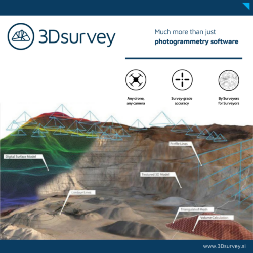
3Dsurvey is a developer of photogrammetry software for land surveying and drone data processing. The platform converts aerial imagery into point clouds, orthophotos, and survey-ready maps. It supports terrain modeling, volume calculations, and cross-sections, helping streamline field-to-office workflows in construction, mining, and engineering projects.