Create Maps offline with UAV Drone Photogrammetry
Mapper is a lightweight software tool for making 2D maps and elevation out of drone imagery and video – purely offline.
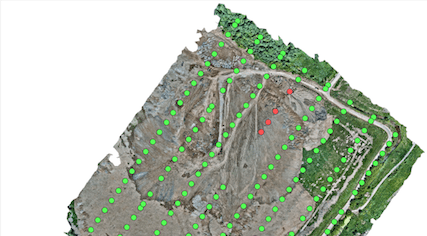
Increase surveying productivity – validate the quality of dataset – collected images are suitable for map stitching, before leaving the survey area.
Higher flight safety – create up to date 3D map and elevation data, i.e., when default map sources are not accurate enough for safe mission planning.
AED 2,360.00

Work offline in the field
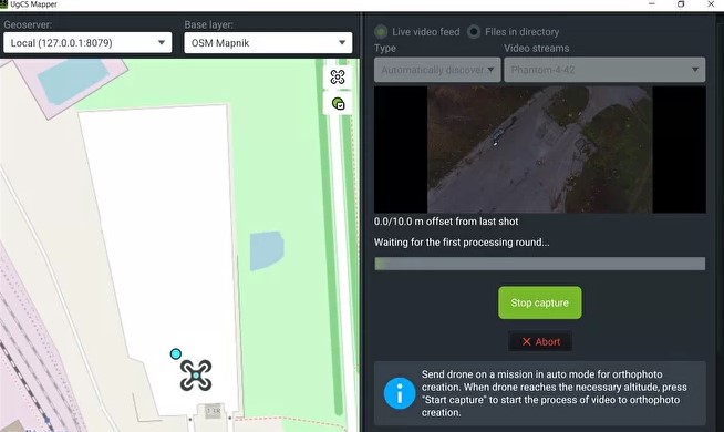
UgCS Mapper is capable of working purely offline so that you can quickly stitch the map and validate the quality and density of survey data before leaving the survey area.
Stitch multispectral RGN JPEG
Upload multispectral 3- channel RGN JPEG images of the field into UgCS Mapper for stitching and generate NDVI indexes to assess crop health

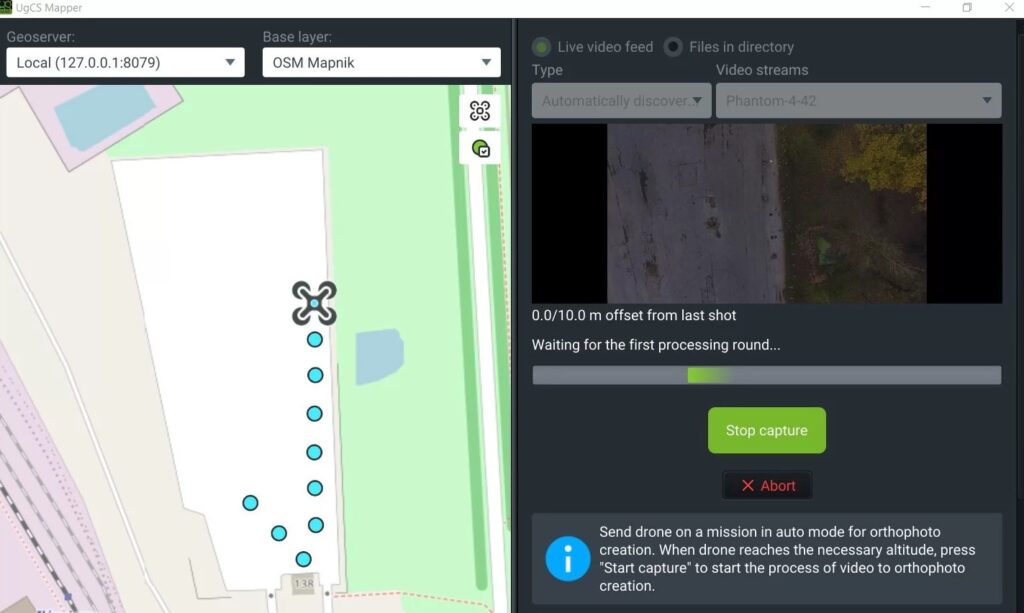
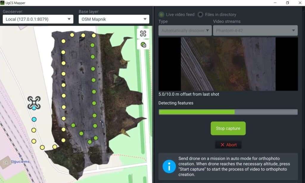
Stitch on the fly
When default map sources are not available or obsolete, create up-to-date maps and elevation data on the fly. They are accurate enough for safe mission planning and guiding first response teams.
How it works
UgCS Mapper is extremely easy to use. Run processing and create a map and elevation in just three clicks.
Georeferenced JPEG (standard for DJI cameras) or video stream with UgCS ENTERPRISE
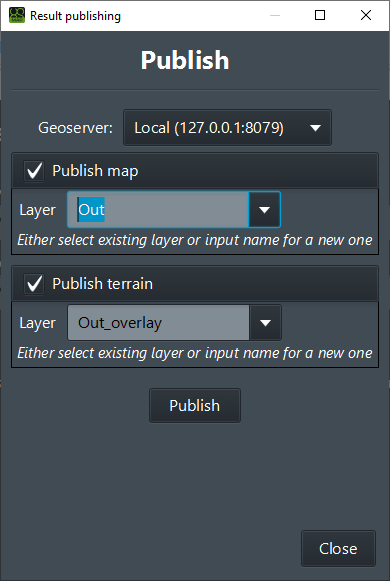
Create map and elevation Geotiff
Export to use with UgCS or other GIS software
Industries
Features
Orthophoto generation
Stitching orthophoto from georeferenced JPG images
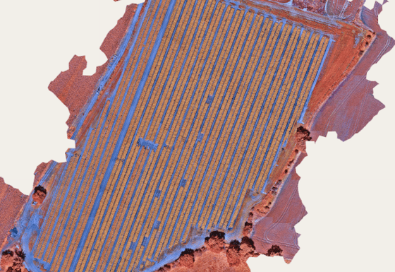
Multispectral cameras
Stitch multispectral 3-channel RGN JPEG images to generate NDVI indexes. Compatible with Micasense RedEdge-M, RedEdge-MX
Integration
A new map one click away and DSM export from UgCS Mapper into UgCS
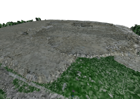
DSM/elevation data
Generate DSM/elevation data from georeferenced JPG images
Live mapping from the video stream
The desktop-based image/video stitching software UgCS Mapper can run on: Windows, Mac OS, Linux (on request)
Inquire Now
Read more
Inquire Now
Read more
Inquire Now
Read more
Inquire Now
Read moreInquire price for UgCS Mapper