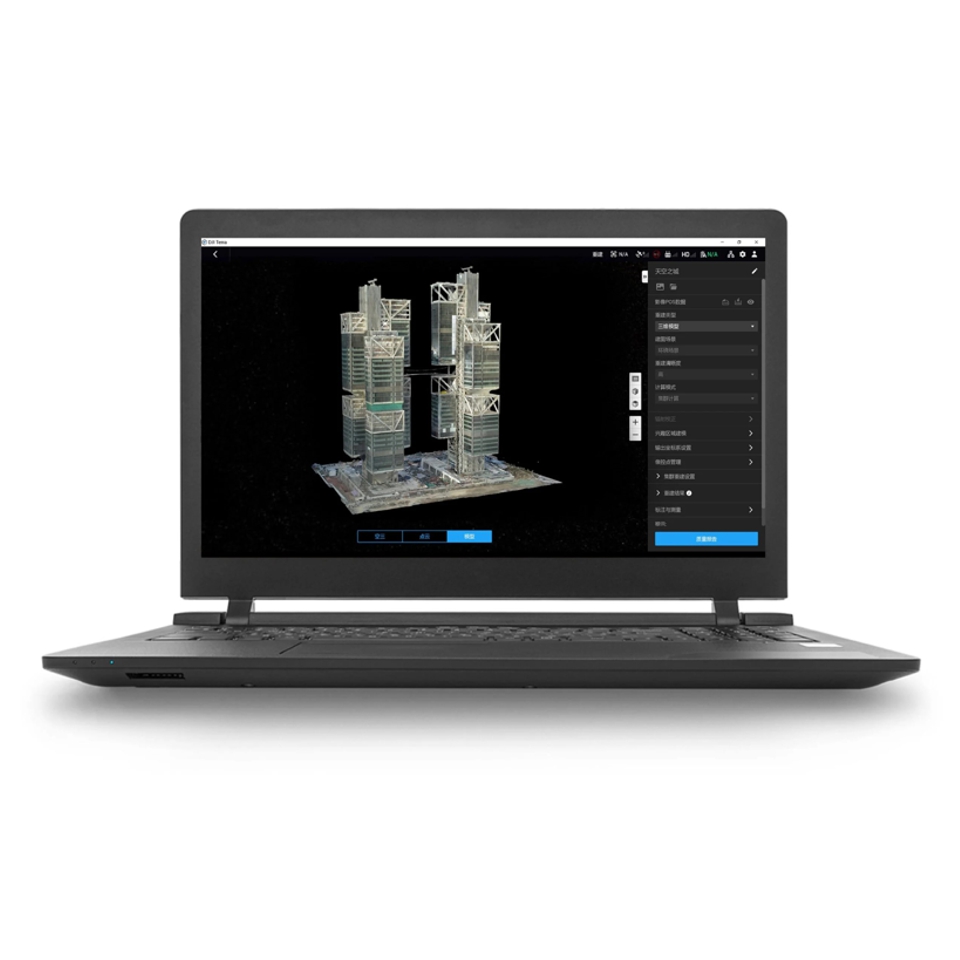
DJI Terra is 3D model reconstruction software that has photogrammetry as its core technology. It supports a range of accurate and efficient 2D and 3D reconstruction of visible light, and data processing through DJI LiDAR.
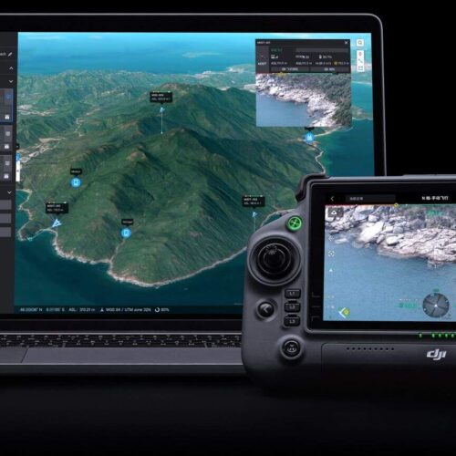
DJI Terra is a perfect match for DJI Enterprise drones and payloads. It works in conjunction to build a complete application solution that caters to verticals such as land surveying and mapping, power transmission, emergency services, construction, transportation, and agriculture.
Inquire Now
DJI Terra is 3D model reconstruction software that has photogrammetry as its core technology. It supports a range of accurate and efficient 2D and 3D reconstruction of visible light, and data processing through DJI LiDAR.
DJI Terra is a perfect match for DJI Enterprise drones and payloads. It works in conjunction to build a complete application solution that caters to verticals such as land surveying and mapping, power transmission, emergency services, construction, transportation, and agriculture.
400 photos/1GB
(single computer)
6,000 photos/1GB
(cluster processing)
30,000 photos/3 days
(single computer)
30,000 photos/21 hours
(cluster processing)
400 photos/1GB
(single computer)
6,000 photos/1GB
(cluster processing)
5,000 photos/2 hours
(single computer)
5,000 photos/80 minutes
(cluster processing)
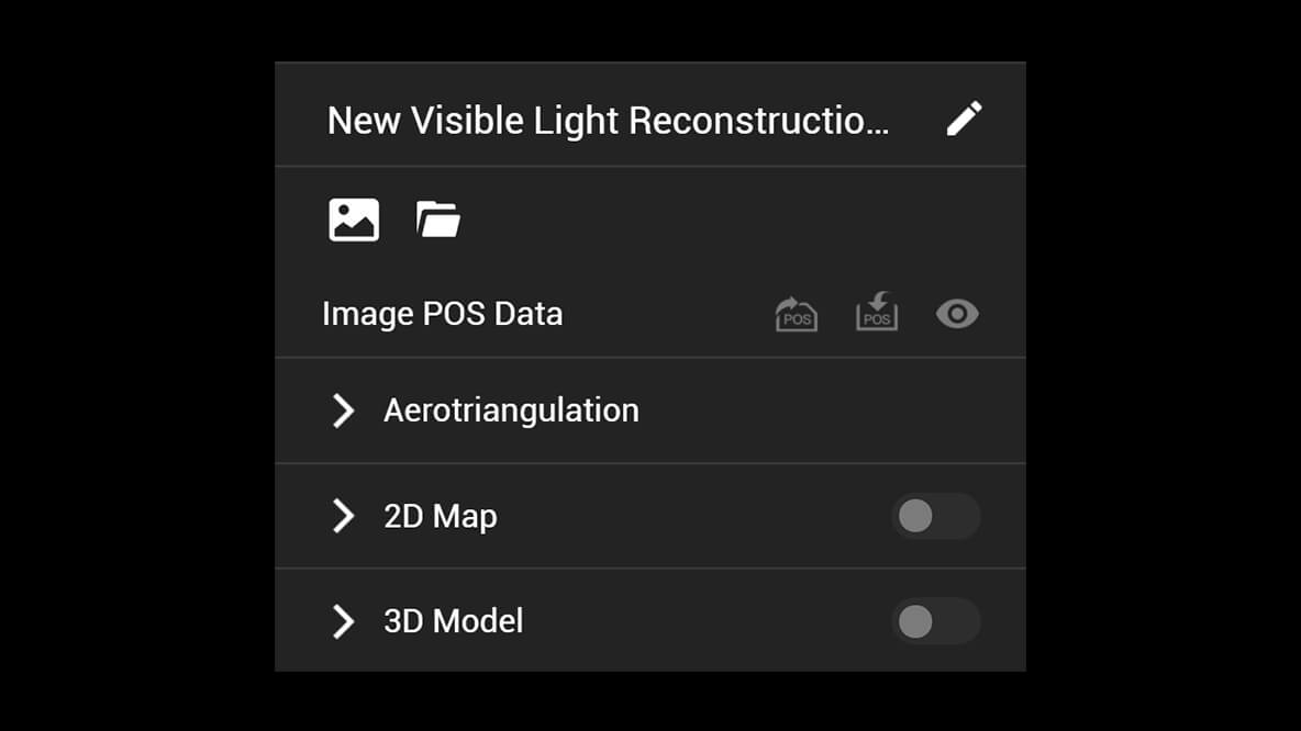
A simple and intuitive interface that gets you flying in no time.
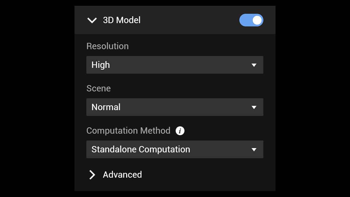
Run reconstruction missions by employing multiple graphics cards simultaneously to improve efficiency.
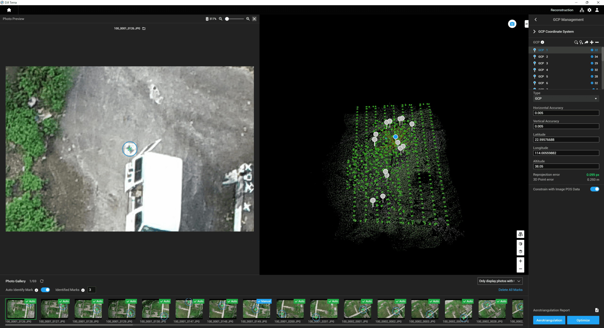
Incorporate POS data, GCPs, or both sets of data to create georeferenced maps and models with enhanced accuracy directly in the target coordinate system required by the project.
Convert the coordinates of your maps and models into 8500+ major coordinate systems by simply selecting the output that fits your needs.
View a quality report of your mission to ensure the results meet your accuracy standards.
Support the auto GCPs for automatic identification of more photos with marking points by simply marking one photo.
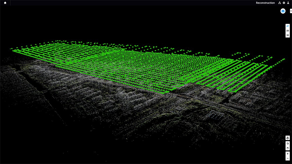
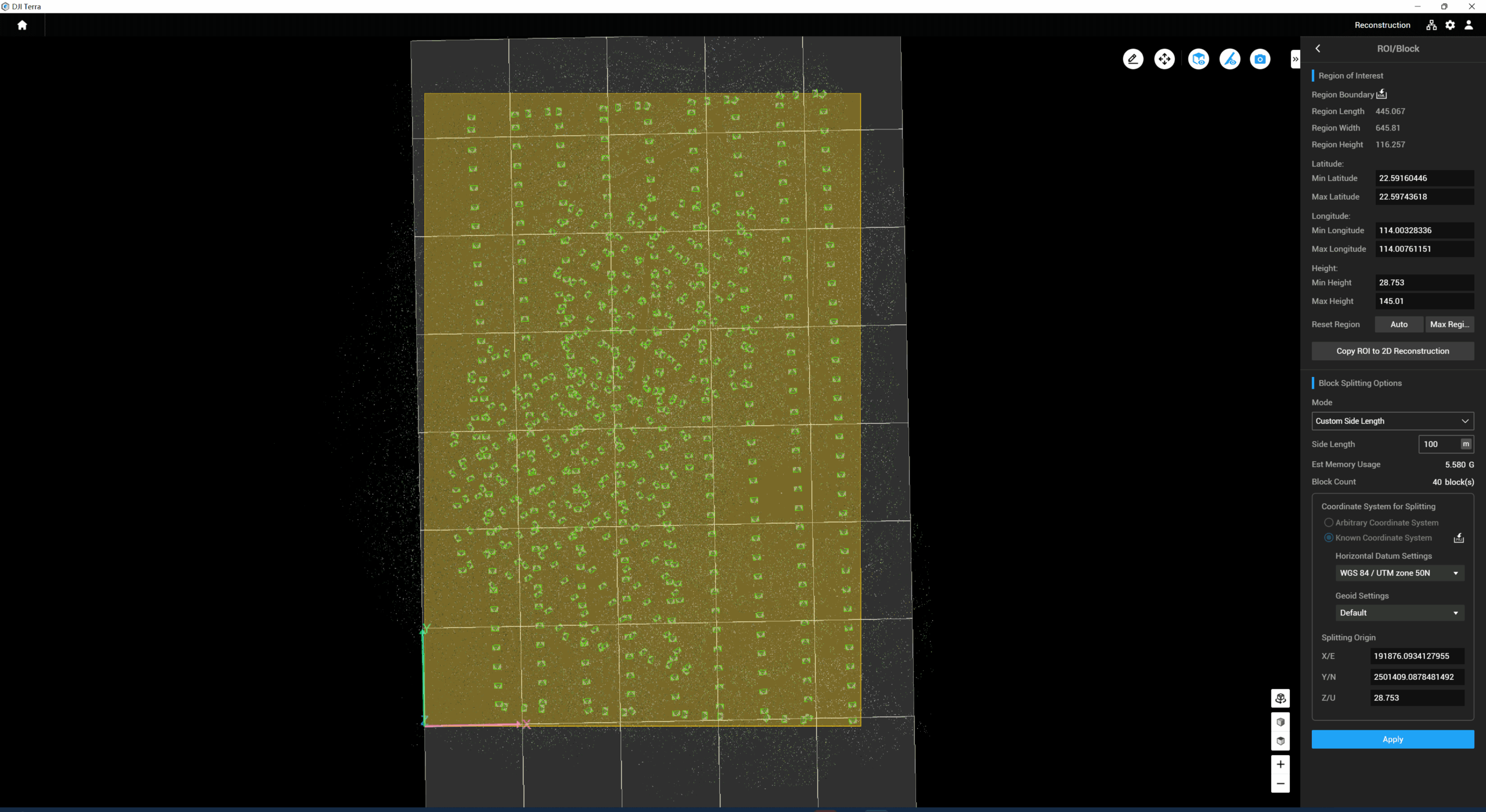
With the Region of Interest (ROI) and block, image reconstruction can be performed to specific target region. In turn, this saves processing time and improves efficiency, while generating a clearer model or point cloud, and completing the large-scale block reconstruction and montage.
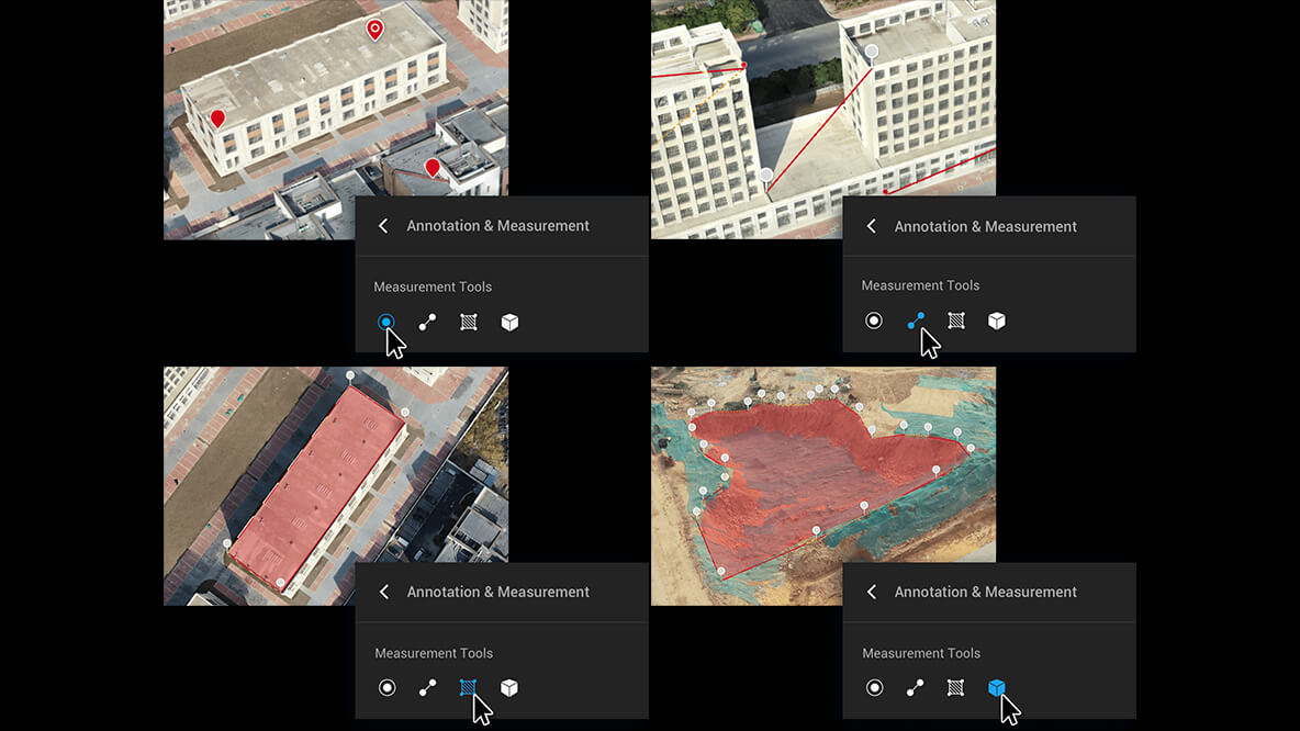
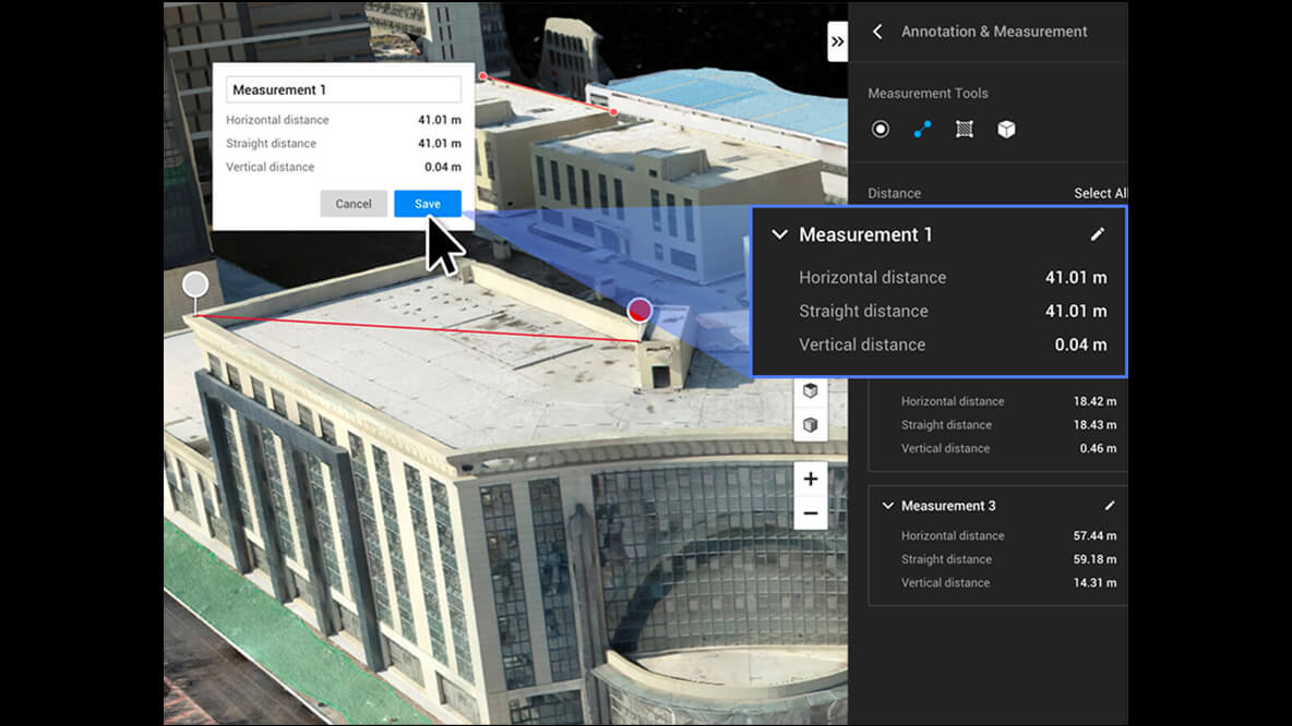
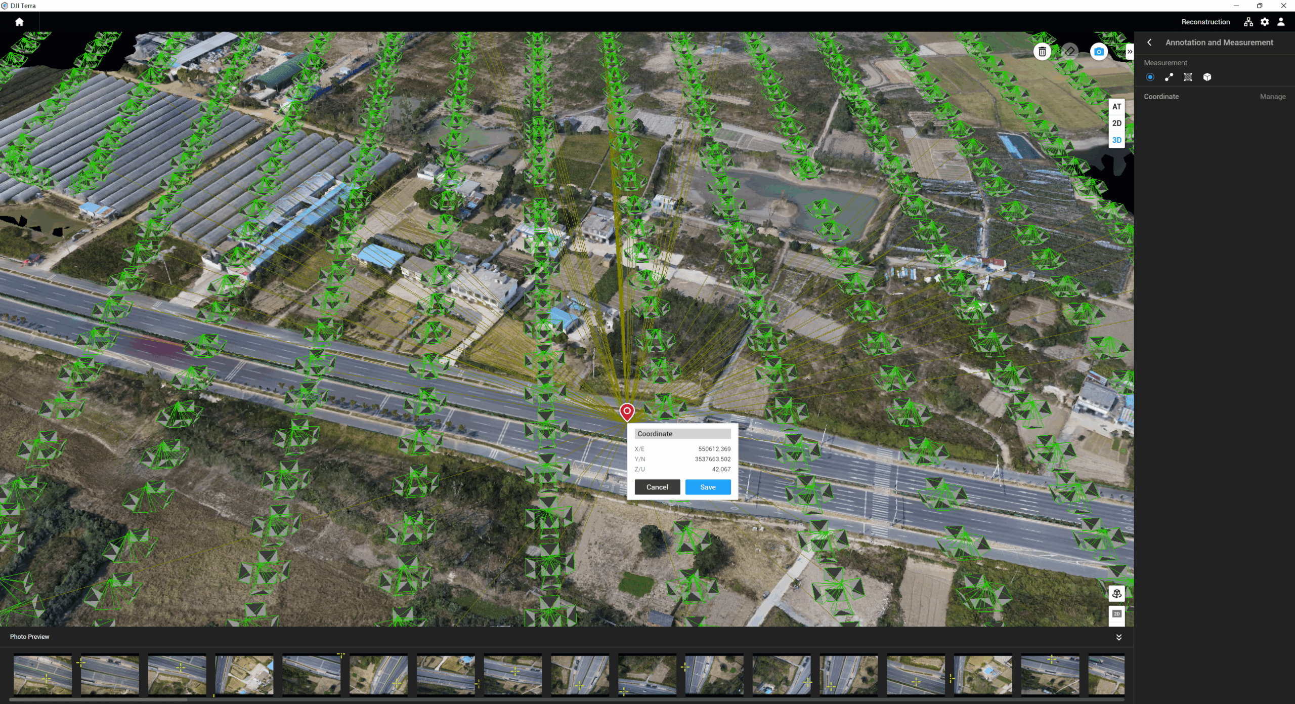
Acquire key dimensions across an array of terrains with easy-to-use analysis tools that enable you to obtain a variety of measurement data based on linear, area and volumetric measurements.
Edit labels of measurements on existing models, which can be used for reporting and improving communication throughout ongoing projects.
| Feature/Version | Agriculture | Pro | Electricity | Cluster | Education |
|---|---|---|---|---|---|
| Real-time 2D Mapping | |||||
| Agricultural application | |||||
| 2D Reconstruction (Field) | |||||
| 2D Multispectral Reconstruction | |||||
| 2D Reconstruction (Urban) | |||||
| KML file import | |||||
| Output Coordinate System | |||||
| ROI Reconstruction | |||||
| Image POS import | |||||
| Multi-GPU Reconstruction | |||||
| 3D Reconstruction | |||||
| 3D Mission planning | |||||
| Real-time 3D Mapping | |||||
| GCPs | |||||
| LiDAR Point Cloud Accuracy Optimization | |||||
| LiDAR Point Cloud Smoothing | |||||
| Categories of ground points of LiDAR point cloud | |||||
| Electricity Application | |||||
| Detailed Inspection | |||||
| Cluster Computation | |||||
| Bind Device 16 | 3 devices | 1 device | 1 device | 1 Device 3 nodes | Contact Us |
| Authorization mode13 | Online | Online/Offline | Online | Offline | Online |
| Validity Period | 1 year | 1 Year / Permanent14 (Free update for the first year, paid update from the next year) |
1 year | Permanent14(Free update for the first year, paid update from the next year) | Permanent |
Inquire price for DJI Terra