A practical guide for professional drone operations
The commercial UAV market has matured significantly over the past decade. As a result, client expectations have evolved as well. While early drone projects often focused on acquiring aerial imagery itself, today the true value of a UAV mission lies in the quality, structure, and usability of the data delivered at the end of the project.
In most professional use cases, drone data is not an end product. Instead, it becomes an input for engineering workflows, spatial analysis, asset management systems, and decision-making processes. This is where GIS deliverables play a critical role.
Understanding what GIS deliverables are — and how UAV data fits into GIS environments — is no longer optional for professional UAV pilots. It is a key factor that separates recreational flying from professional geospatial services.
Geographic Information Systems (GIS) are designed to manage, analyze, and visualize spatially referenced data. In real-world projects, GIS environments typically combine multiple data sources, including:
aerial imagery and orthophotos,
digital surface and terrain models,
point clouds,
cadastral and topographic data,
engineering and design layers,
ground survey measurements,
historical and monitoring datasets.
Drone data is rarely used in isolation. Instead, it must align spatially and technically with existing datasets. If UAV outputs cannot be accurately integrated into a GIS environment, their practical value drops dramatically — regardless of image quality or resolution.
This is why clients increasingly evaluate UAV service providers not by how well they fly, but by how well their deliverables integrate into GIS workflows.
GIS deliverables are final project outputs prepared in a form that allows immediate use within a GIS environment.
They are:
structured,
georeferenced,
spatially accurate (to the level required by the project),
delivered in professional formats,
accompanied by correct metadata.
In other words, GIS deliverables are not raw files, but ready-to-use geospatial products.
| GIS Deliverable Type | Description | Typical Applications | Key Technical Requirements |
|---|---|---|---|
| Orthomosaic | Georeferenced, orthorectified image produced within a unified coordinate reference system | Construction, land administration, area monitoring | CRS definition, spatial accuracy, absence of geometric distortions, GeoTIFF format |
| Digital Terrain Model (DTM) / Digital Surface Model (DSM) | Three-dimensional elevation model of the ground surface or surface objects | Engineering design, volume calculations, terrain analysis | Vertical reference system, elevation accuracy, consistent units |
| Point Cloud | Three-dimensional spatial dataset representing terrain and objects as discrete points | BIM integration, 3D analysis, surveying applications | LAS/LAZ formats, point density, accurate spatial referencing |
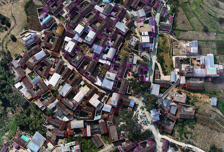
| Vector Layers | Spatial features represented as points, lines, and polygons with attribute data | GIS analysis, asset inventory, infrastructure projects | CRS consistency, attribute structure, standardized GIS format |
Accurate georeferencing is the single most fundamental requirement for GIS-compatible UAV data.
Without reliable spatial positioning:
datasets cannot be overlaid correctly,
measurements cannot be trusted,
integration with engineering or cadastral layers becomes impossible.
Even visually impressive imagery loses its value if its spatial position is incorrect. For GIS users, where the data is located matters as much as what it shows.
Professional UAV pilots must therefore treat georeferencing not as a post-processing option, but as a core part of mission planning and execution.
One of the most frequent issues in UAV-to-GIS workflows is the incorrect use of coordinate systems or map projections.
Different countries,regions, industries, engineering standards may rely on different spatial reference systems. A mismatch between the client’s GIS environment and the UAV deliverables can result in spatial shifts, scale distortions, or elevation errors.
To avoid this, UAV pilots should clarify before the flight:
which coordinate system the client uses,
which projection is required,
whether a local, national, or project-specific system is expected.
Resolving coordinate system issues after delivery is often time-consuming and, in some cases, requires reprocessing or re-flying the mission.
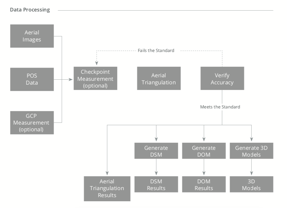
Not all UAV projects require the same level of accuracy. Some applications focus on visualization, while others demand engineering-grade precision.
For projects with strict accuracy requirements, GIS deliverables often rely on:
Ground Control Points (GCPs),
RTK-enabled positioning,
PPK workflows,
independent accuracy validation.
Without these methods, UAV data may be suitable for visual interpretation but insufficient for tasks such as:
volume calculations,
deformation monitoring,
construction verification,
infrastructure planning.
Understanding accuracy expectations — and communicating them clearly with the client — is essential for successful GIS deliverables.
Delivering data in a “convenient” format for the pilot does not necessarily mean it is usable for the client.
GIS deliverables must be provided in formats that:
preserve spatial reference information,
support large datasets,
are widely accepted in professional GIS environments.
Raster products, point clouds, and vector layers each have their own professional standards. Choosing the correct format is part of delivering a complete geospatial product, not merely exporting files.
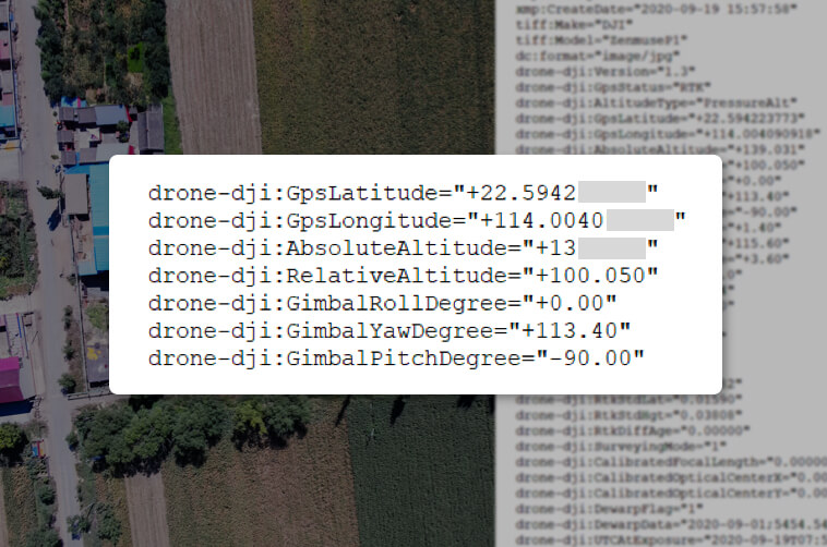
Metadata is often underestimated, yet it is a core element of any GIS deliverable.
Metadata provides essential context, including:
coordinate reference systems,
acquisition date and time,
flight parameters,
processing methods,
accuracy limitations,
sensor and platform information.
Without metadata, even correctly formatted GIS data can be misinterpreted or misused. For long-term projects, monitoring programs, or multi-vendor environments, metadata becomes essential for data continuity and reliability.
UAV pilots are not expected to become full GIS specialists. However, a solid understanding of GIS deliverables allows pilots to:
better understand client expectations,
define realistic project scopes,
reduce revisions and rework,
deliver higher-value results,
position themselves as professional geospatial service providers.
As competition in the commercial drone market increases, technical flying skills alone are no longer enough. The ability to deliver GIS-ready geospatial data has become a decisive competitive advantage.
In modern UAV operations, the mission does not end when the drone lands. It ends when the client receives usable, accurate, and well-structured geospatial data that fits seamlessly into their GIS workflows.
GIS deliverables represent the bridge between aerial data collection and real-world decision-making. UAV pilots who understand this bridge — and know how to build it properly — will remain relevant and in demand as the industry continues to evolve.