Across the GCC region, spanning the UAE, Oman, and now Saudi Arabia, drone technology is rapidly reshaping how organisations acquire, analyse and utilise geospatial data. Few professionals have witnessed this evolution as closely as Behroze Ullah Zafar, a Senior GIS Specialist, UAV Pilot and Photogrammetry Expert whose work spans agriculture, construction, urban mapping and advanced environmental monitoring.
With extensive field experience and a strong technical background, Behroze has become a key voice in the integration of drones into geospatial workflows. In this interview, he shares insights into how drone technology transformed his work, the techniques he uses in professional mapping projects, and the future he envisions for the industry.
Behroze’s journey into drone-based geospatial work began early in his career while working on an agriculture and livestock monitoring project. At the time, he served as a GIS Specialist and was tasked with geodatabase development and dashboard creation for drone-processed data.
“I first began using drones in my work during a project at my company where I was working as a GIS Specialist. The project focused on agriculture and livestock monitoring using high-resolution drone imagery.” he recalls. “The features in the imagery were extracted using AI-based object detection.”
This early exposure not only expanded his technical skillset but opened the door to more advanced remote sensing and photogrammetry applications.
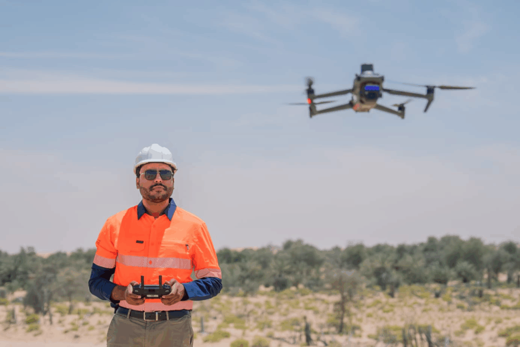
For Behroze, drones have become indispensable to modern geospatial operations. The shift from manual field surveys to aerial data acquisition radically accelerated productivity.
“Drone technology has significantly improved my daily workflow by allowing me to acquire large-scale, high-resolution data much more quickly than traditional methods,” he explains.
Tasks that used to require days of labour-intensive surveying can now be completed in hours, delivering higher accuracy and richer datasets. This efficiency is especially valuable in fast-paced construction, environmental and urban development projects across the GCC.
As a specialist who has worked in multiple countries with diverse terrain and regulatory environments, Behroze has seen the drone industry mature quickly.
“From my experience, the main advantages of using drones include their ability to support accurate mapping and detailed inspections, such as building façades and powerlines.”
He highlights improvements in sensors, flight stability and data quality, noting that previous technological constraints no longer hinder modern operations:
“While there were limitations in the past, such as lower image quality, limited flight time, or less reliable sensors, the rapid improvements and advancements in drone technology have greatly reduced these challenges. Today, I find that many of the previous restrictions are no longer significant obstacles.”
Behroze’s methodology is grounded in precision, particularly when projects require high absolute or relative accuracy.
Post-flight, Behroze processes imagery using industry-standard photogrammetry tools such as:
He emphasises that high accuracy goes beyond software:
“Achieving high accuracy also requires a clear understanding of the benchmark and the geodetic network used in the area.”
This holistic approach ensures reliable outputs whether he is producing orthomosaics, DTMs, or full 3D models.

Behroze has applied drone technology across a range of large-scale and specialised projects. The applications demonstrate the transformative role drones play in the region’s development.
Drone-based surveys for road and infrastructure projects, generating high-accuracy DTMs support:
Drones capture detailed aerial imagery used to:
Close-range flights enable:
Executed forest surveys to acquire:
Using multispectral imagery over coastal mangrove areas to evaluate:
Producing accurate 3D representations for:
Looking ahead, Behroze is enthusiastic about the technological trajectory of the UAV industry.
“What excites me about the future is the rapid advancement of drone capabilities such as improved sensors, longer flight times, enhanced AI for automated analysis, and better integration with GIS.”
He is particularly keen to explore:
These advancements, he believes, will unlock new levels of precision and open opportunities across smart agriculture, environmental stewardship, infrastructure inspection, and disaster management.
“I believe drones will continue to transform how we understand and manage our world.”
Behroze Ullah Zafar’s experience across the UAE, Oman and Saudi Arabia underscores the transformative impact drones have on modern geospatial practices. His work demonstrates that UAVs are no longer optional tools: they are essential instruments for accurate, efficient and high-value data acquisition.
From agriculture to urban development, environmental protection to digital twin creation, Behroze’s insights reflect the direction in which the industry is headed: toward smarter automation, deeper integration, and a future where drones play a central role in shaping sustainable and data-driven decision-making.