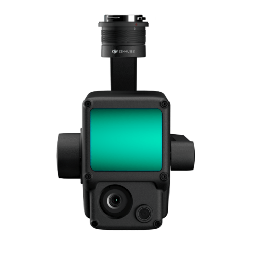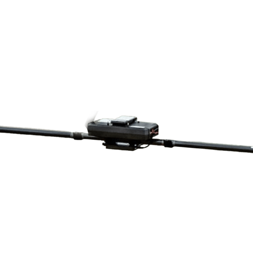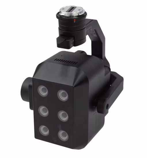
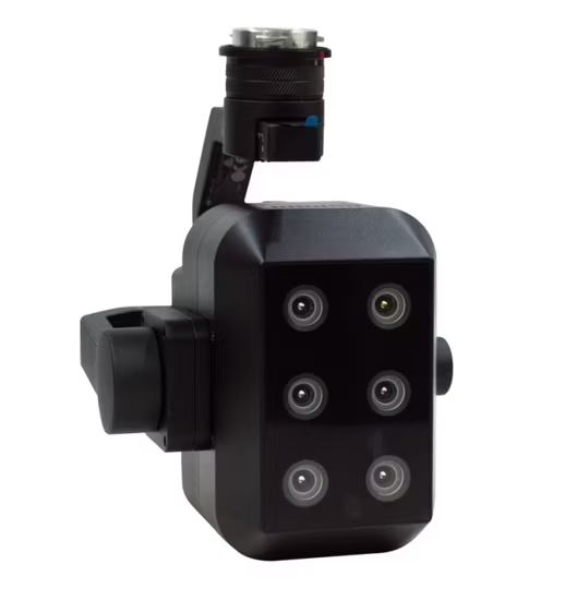
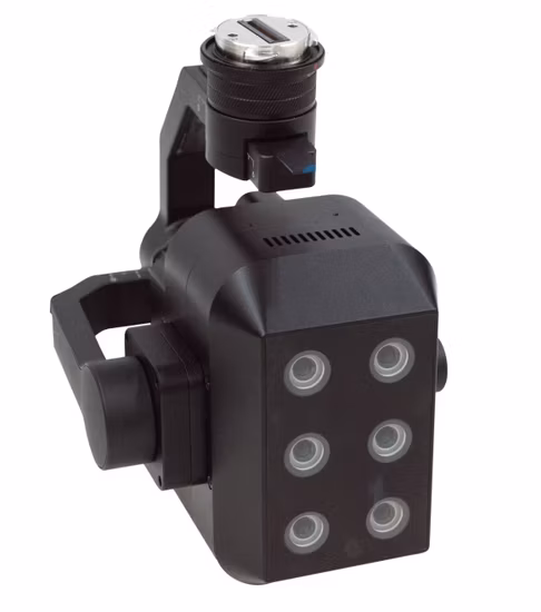
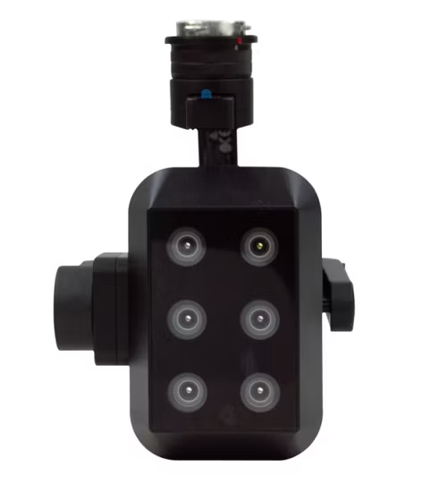
FigSpec® series multispectral cameras of CHNSpec Technology . include FS-600. FS-600 has 6-channel multispectral, and the effective pixel can reach 1.3 million pixels.
FigSpec® series multispectral cameras of CHNSpec Technology. include FS-600. FS-600 has 6-channel multispectral, and the effective pixel can reach 1.3 million pixels.
FigSpec Studio software has built-in NDVI and other vegetation factors, which can accurately quantify the status of vegetation canopy at different spatial scales, quantitatively evaluate the health, stress and growth of crops and vegetation, and provide data support for crop growth assessment, yield estimation, pest and disease detection, etc.
Based on the plant spectral fingerprint information, the plants in the region are accurately classified and the crop area is counted, providing quantitative vegetation density data to provide data support for scientific research and production in the agricultural and forestry ecological industries.
The analysis model is constructed using water spectral data and chemical analysis results to achieve classification of black and odorous water bodies and inversion of water quality parameters. The impact of domestic sewage, industrial wastewater, etc. on surrounding water bodies is monitored in combination with spatial information to assist in the investigation of pollution sources and water environment assessment.
Spectral data is used to form a classification index, conduct water eutrophication monitoring and spatial information statistics, follow the water eutrophication status evaluation standards, assist in the analysis of water pollution sources such as farmland, aquaculture, and fisheries, and provide data and powerful data collection tools for pollution source investigation and water environment assessment.
| Model | FS-600 |
| Assembly method | 6-channel multispectral |
| Target size | 1/2” |
| Effective pixels | 1.3Mpx |
| Shutter type | Global |
| Quantization bit number | 12bit |
| Field of view | 54.2°×44.5° |
| Ground resolution | 9.6cm@h120m |
| Coverage Width | 123m×98m@h120m |
| Spectral channel[1] | 450nm@30nm, 555nm@27nm, 660nm@22nm, 720nm@10nm, 750nm@10nm, 840nm@30nm |
| Optical Window | Sapphire optical glass window |
| Host size | 182mmx169mmx129mm (including gimbal) |
| Host weight | ≤940g (including gimbal) |
| Mounting interface | X-Port |
| Powered by | X-Port |
| Power consumption | ≤43W |
| Image Format | 16bit raw TIFF (including GPS) |
| Storage Media | Standard 512G solid state drive |
| Processing software | FigSpec UAV-MS,FigSpec Merge-MS,FigSpec Studio |
| Parameter settings | DJI Pilot |
| Shooting trigger | Timing trigger |
| Shooting frequency | Maximum support 10HZ |
| Operating temperature | -10℃~+50℃(Relative wind speed≥1m/s) |
| Storage temperature | -30℃~+70℃ |
| Ambient humidity | RH(%)≤85%(non-condensing) |
[1] Standard wavelengths allow customization of the following 18 wavelength combinations (please contact sales staff for details on combination methods and costs): 410nm@35nm, 450nm@30nm, 490nm@25nm, 530nm@27nm,555nm@27nm, 570nm@32nm, 610nm@30nm, 650nm@27nm, 660nm@22nm, 680nm@25nm,720n-m@10nm, 720nm@15nm (Qualcomm), 750nm@10nm, 780nm@13nm, 800nm@35nm, 840nm@30nm, 900nm@35nm, 940nm@30nm (tolerance ±5nm).
Inquire price for CHN FS-600 Multispectral camera