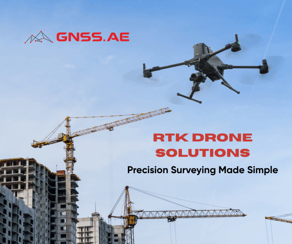
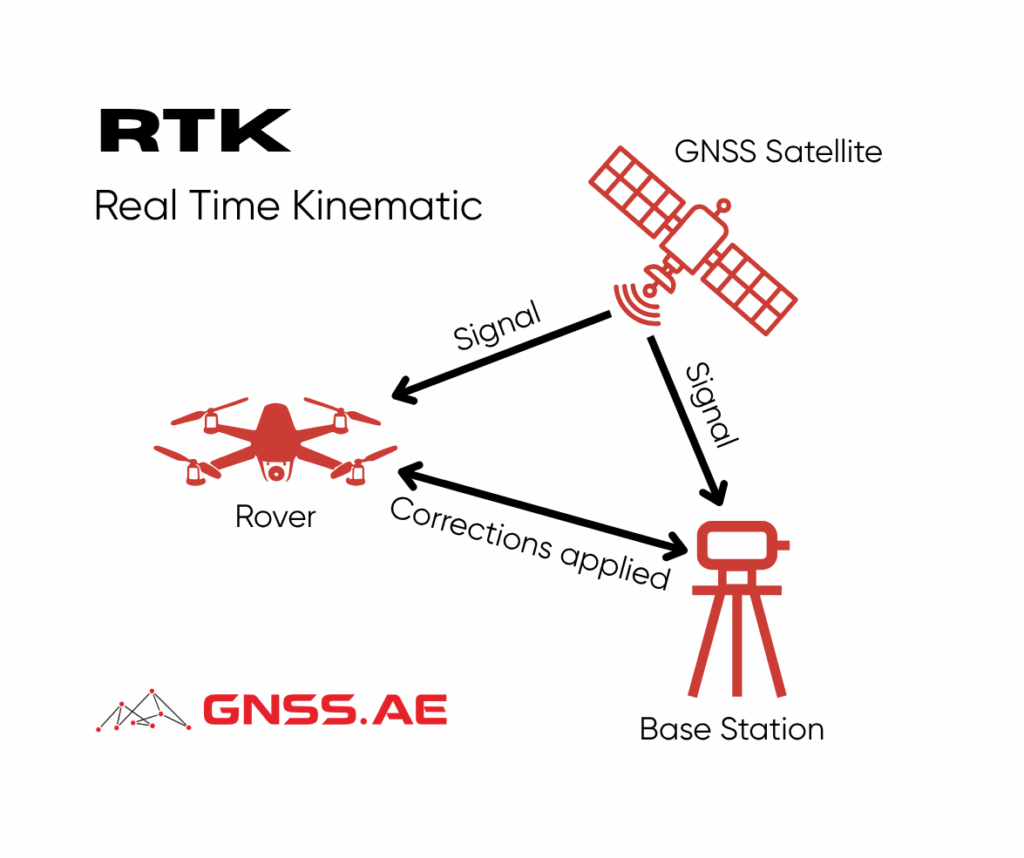
RTK surveying has revolutionized modern construction and infrastructure projects by dramatically improving both efficiency and accuracy. Construction drones equipped with RTK (Real-Time Kinematic) technology enable professionals to tackle surveying and mapping challenges with unprecedented speed and precision. While traditional surveying methods can take days or weeks, RTK-equipped drones deliver high-precision data within hours.
RTK-based survey drones provide substantial advantages that directly address industrial requirements. Through their combination of advanced technology, time efficiency, and accurate results, these drones have become the top choice for surveying professionals:
High Precision for Construction Projects: RTK drones deliver centimeter-level accuracy, which is essential for land surveying, volume measurement, and contour analysis. This technology ensures that every construction detail can be planned and executed with minimal risk of error.
Versatile Applications: RTK survey drones excel at surveying road infrastructure, bridges, and monitoring construction project progress with remarkable effectiveness.
Significant Time and Cost Savings: Compared to manual measurements or heavy equipment deployment, drone mapping can reduce surveying time by up to 70%. This efficiency translates to lower operational costs and faster project completion without compromising quality.

Modern drone technology incorporates several key features that make it highly effective for mapping applications:
The RTK system provides real-time corrections to ensure exceptional position accuracy. Wide-angle cameras support rapid 0.5-second interval shooting with 5-directional oblique capture capabilities, enabling mapping coverage of up to 2.8 km² in a single flight for maximum efficiency. Advanced software platforms like DJI Terra simplify geospatial analysis and produce high-quality 3D models.
This technological combination enables drones to handle diverse terrain and scenarios that previously presented significant challenges for surveying professionals.
RTK survey drones extend far beyond basic topographic data collection, offering significant benefits across multiple areas:
Land Surveying and Mapping creates high-precision 3D models for detailed land contour analysis, supporting effective rail and road planning projects.
Structural Inspection produces high-precision structure maps, enabling comprehensive analysis and accurate documentation of tall towers and bridges.
Real-Time Project Monitoring provides visual observation of project progress, facilitating quick decision-making based on live drone data.
Construction Documentation records every construction phase in high resolution, ensuring that all changes are thoroughly documented.
Here are the leading RTK survey drone options designed to meet construction and infrastructure industry demands:
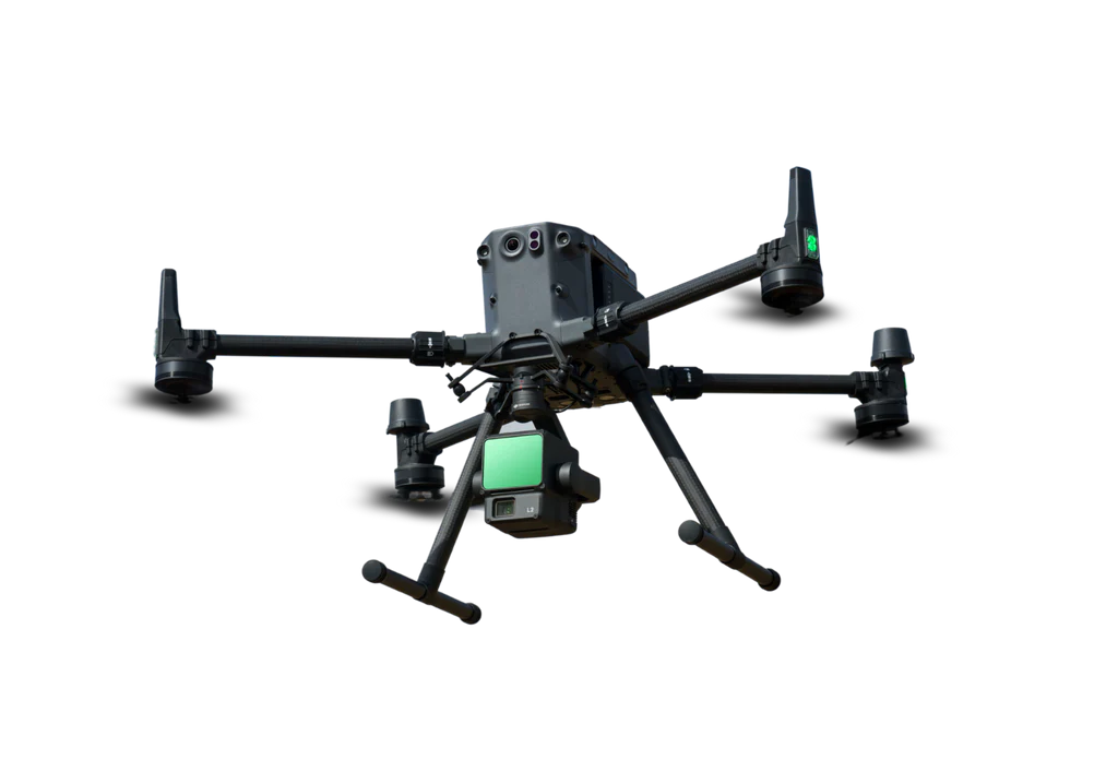
DJI Matrice 350 RTK serves as the flagship industrial drone, delivering centimeter-level RTK accuracy with flight times up to 55 minutes. Its compatibility with LiDAR and dedicated photogrammetry sensors makes it the ideal solution for large-scale surveys.
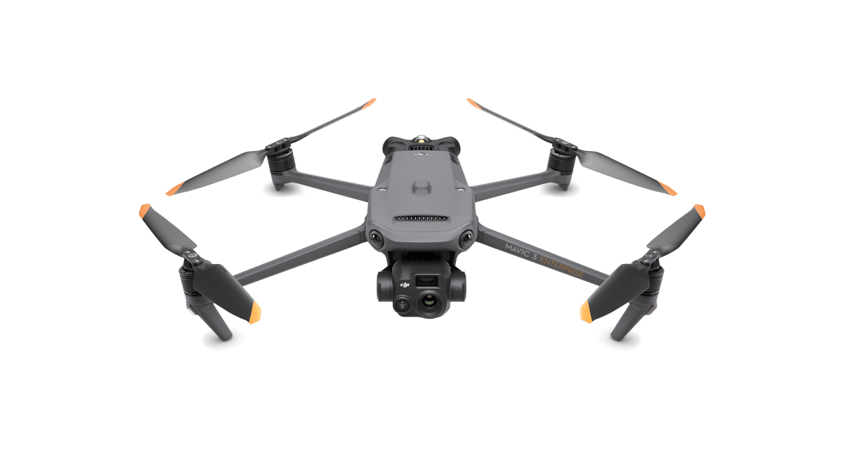
DJI Mavic 3 Enterprise offers the best choice for high mobility applications. This drone features a 45-minute flight time, 20MP camera, and RTK capability for superior accuracy. Its lightweight design enables easy deployment in remote locations.
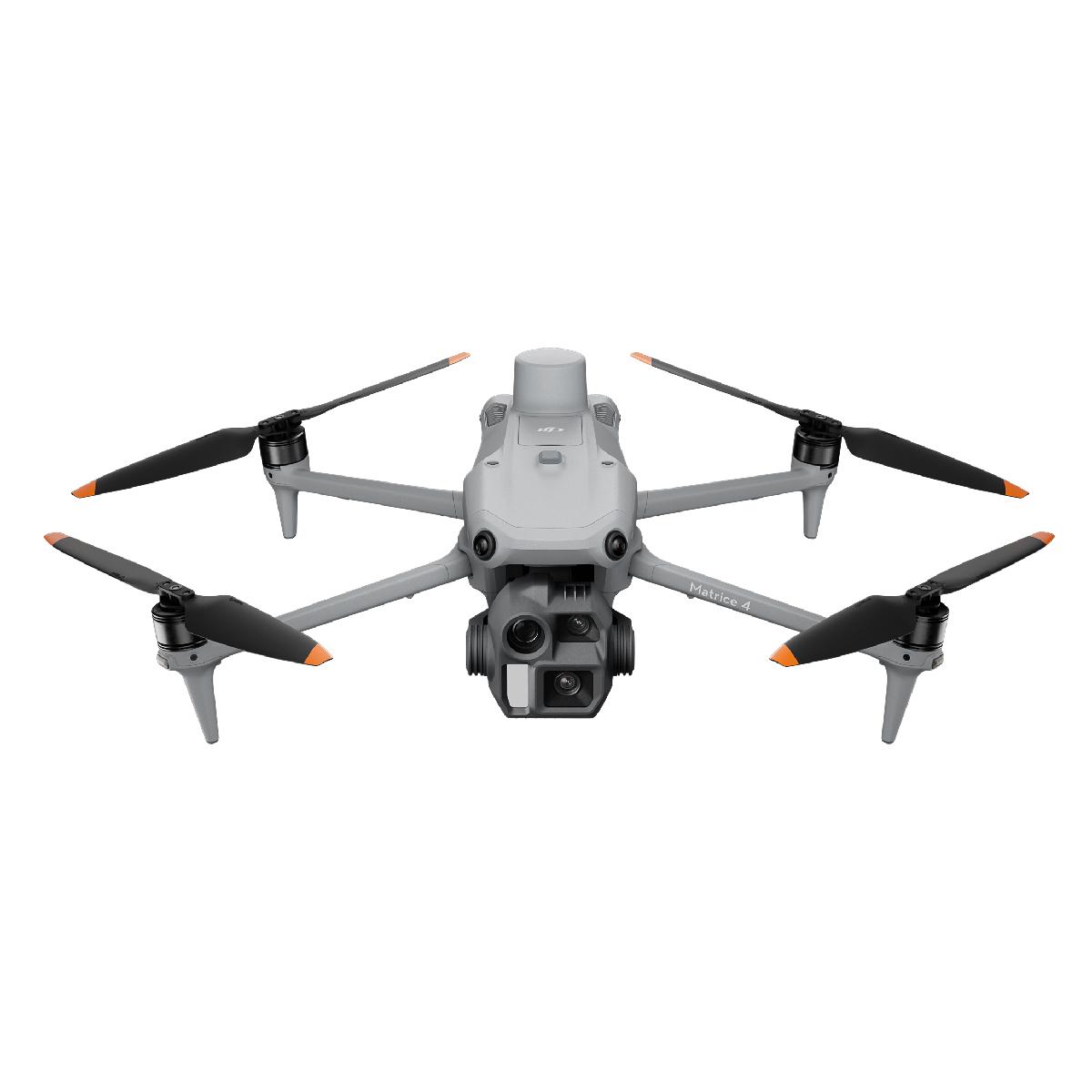
DJI Matrice 4 Enterprise supports rapid 0.5-second interval shooting in both orthophoto and oblique modes, enabling high-speed aerial surveys at speeds up to 21 meters per second from multiple angles. This efficiency makes it an ideal solution for saving time and resources on large-scale construction projects.
RTK survey drones have demonstrated their superiority as modern mapping solutions for construction and infrastructure professionals. Through cutting-edge technology, these devices deliver highly accurate data while providing unmatched time and cost efficiency. As the authorized dealer of DJI Enterprise RTK survey drones for modern construction and infrastructure projects in the Middle East and North Africa, GNSS.AE stands ready to help you identify the optimal solution for your surveying and mapping requirements.