Real-Time Kinematic (RTK) is one of the most advanced technologies in the field of Global Navigation Satellite Systems (GNSS). It is a method of high-precision surveying and real-time positioning that enables centimeter-level accuracy in coordinate determination. In this article, we will take a detailed look at what RTK mode is, how it works, its features and benefits, and where it is applied in practice.
RTK is a technology that allows for obtaining highly accurate coordinates of objects on the Earth’s surface in real time. The main advantage of RTK lies in its ability to compensate for errors that occur when using GNSS signals.
These errors may result from:
By minimizing the impact of these factors, RTK ensures extremely precise positioning.
RTK technology was developed in the late 1980s, when the limitations of Differential GNSS (DGPS) became evident, particularly in achieving high accuracy over short baselines.
The emergence of RTK became possible due to:
advances in computational power,
improvements in real-time data transmission,
the development of more sophisticated models and algorithms for processing satellite signals.
These advances significantly enhanced the accuracy of GNSS positioning and enabled real-time precision that was previously unattainable.
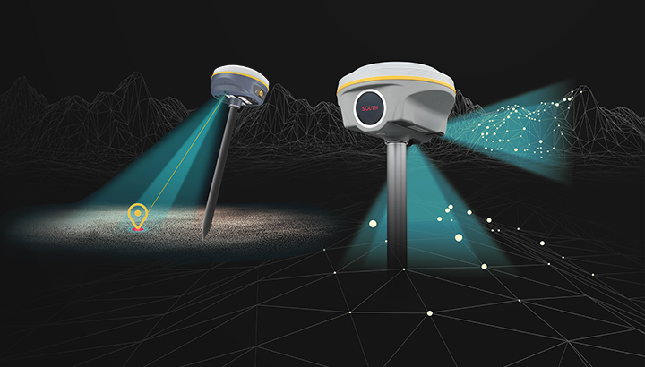
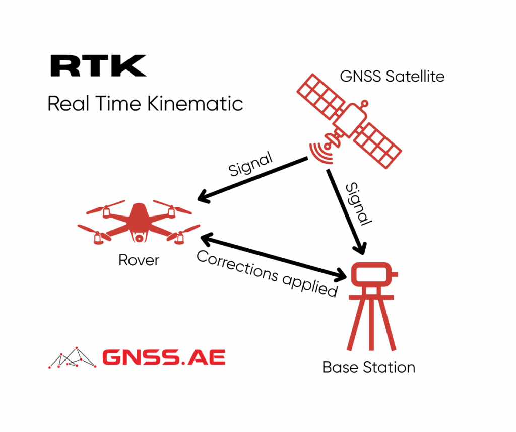
The operation of RTK relies on two types of receivers: a reference (base) receiver and a rover (mobile) receiver.
The base station is installed at a fixed, precisely known location. It receives GNSS signals and calculates its position, simultaneously identifying errors in the signals. These error corrections are then transmitted to the rover via radio link or internet connection.
The rover also receives GNSS signals while simultaneously applying the corrections received from the base. Using specialized algorithms, it adjusts its calculated coordinates, achieving centimeter-level precision.
This level of accuracy is critically important for a wide range of professional applications.
RTK offers several significant benefits over traditional GNSS positioning methods:
RTK is widely used across industries where high-precision positioning is critical. Key applications include:
Surveying and Cartography – A vital tool for cadastral engineers and land surveyors, used in creating high-accuracy maps and conducting topographic surveys.
Construction – Enables precise positioning of construction elements and supports machine control systems, reducing errors during building and infrastructure projects.
Agriculture – Applied in precision farming for automated guidance of tractors and harvesters, helping optimize seeding, reduce crop losses, and increase productivity.
Mining – Ensures accurate positioning of equipment and ore bodies, improving operational efficiency and safety in quarries and mines.
Autonomous Transportation – Plays a key role in self-driving technologies, where real-time, centimeter-level accuracy is essential for safety and reliability.
RTK is a cornerstone technology in the toolkit of modern GNSS professionals. Its ability to deliver real-time, high-accuracy positioning unlocks enormous potential across industries—from surveying and construction to agriculture and autonomous vehicles.
As technology continues to evolve, RTK systems are becoming even more advanced, precise, and accessible. The future promises further innovations that will expand the boundaries of what is possible in precision positioning and geodesy.