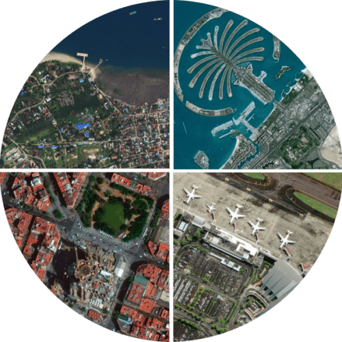
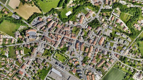
PIX4Dmatic is the next-generation photogrammetry solution, ready to handle datasets of over 10,000 images. Ready for the future of surveying with the capability of BVLOS flights as well as specializations for the corridor and large scale mapping. Unleash the potential for surveying with drones like never before.
Inquire Now
The optimized software for the next surveying and mapping challenges

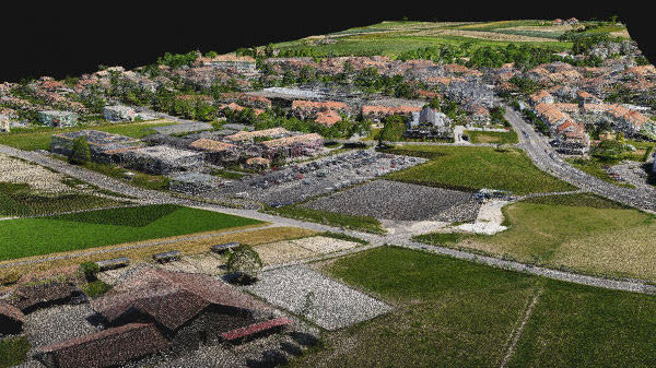
PIX4Dmatic processes thousands of images while maintaining survey-grade accuracy, halving the processing time, without the trouble of splitting and merging.

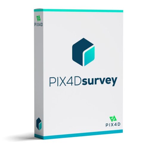
Developed in close-collaboration with surveyors and mapping professionals to streamline your workflow: import, process and assess the quality of a project in just a few clicks, and move seamlessly from PIX4Dmatic to PIX4Dsurvey.

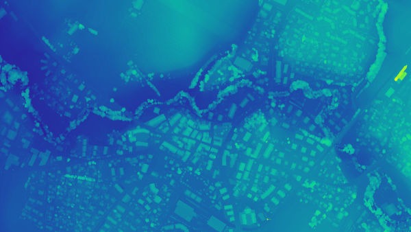
Leverage the benefits of both photogrammetry and LiDAR technology. Process LiDAR and RGB image outputs from PIX4Dcatch for a full terrestrial workflow. Easy and desktop-based.
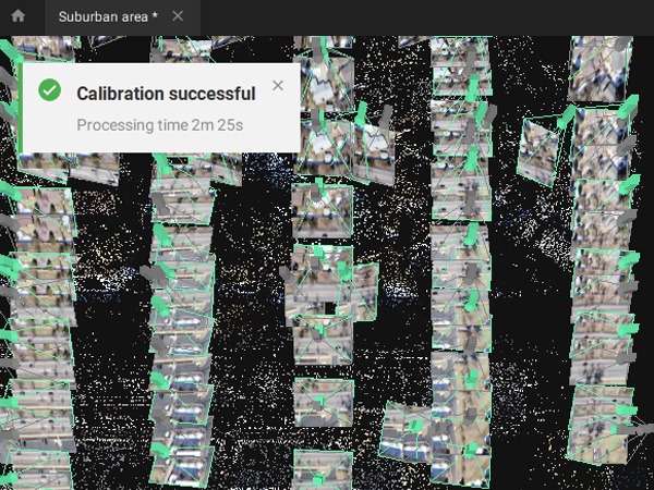
Handling and processing large amounts of data is easy with PIX4Dmatic.
Get your results up to 50% faster, while keeping a survey-grade accuracy.
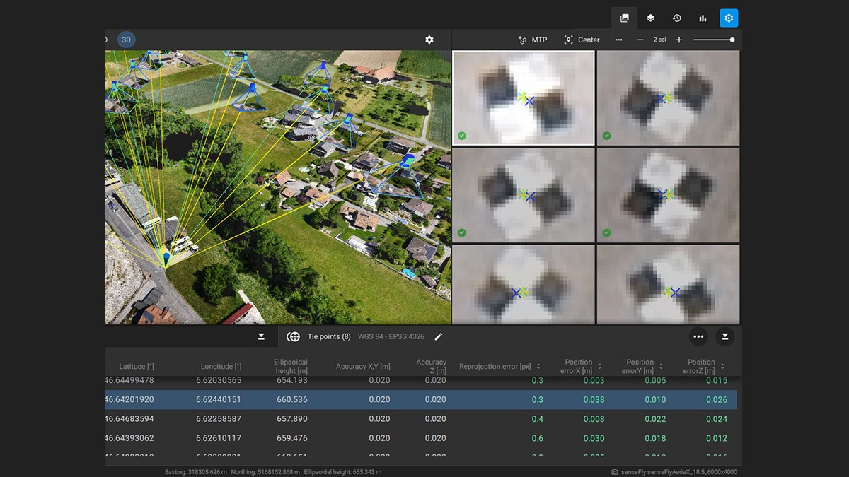
Ensure the accuracy of your project with GCPs, Checkpoints, or Manual Tie Points. Accuracy metrics are available in a dedicated tie points table and in an exportable quality report.
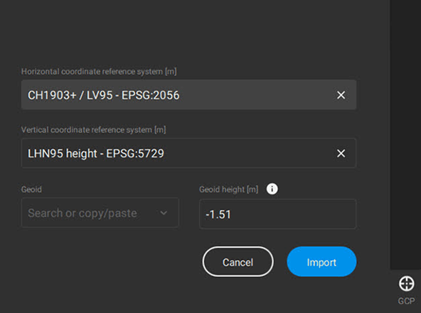
PIX4Dmatic supports the most frequently used vertical coordinate systems and their corresponding geoids.
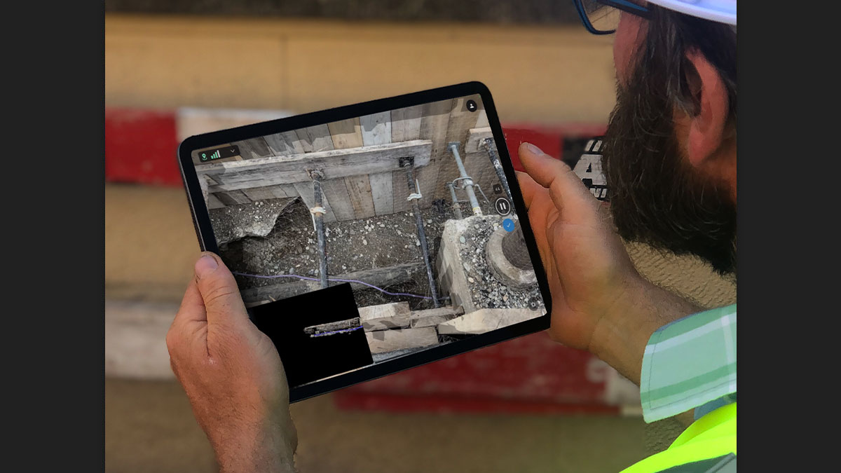
Process both LiDAR and RGB image outputs from PIX4Dcatch.
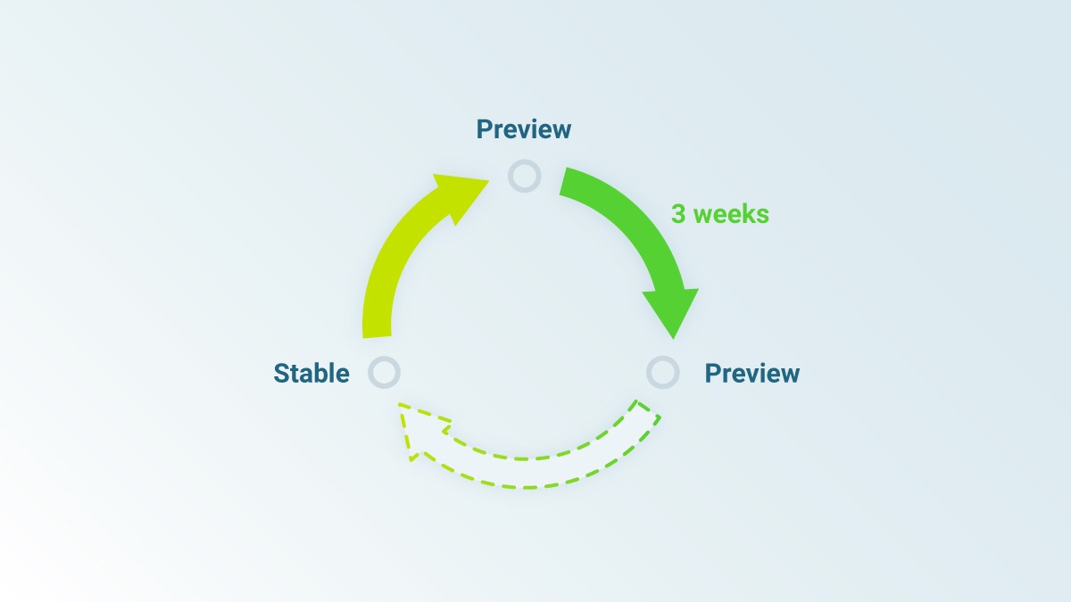
Updates are released every three weeks in a new preview or stable version, ensuring you get all the latest improvements and features.
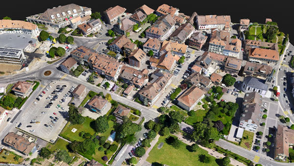
Seamless export of processed projects into PIX4Dsurvey to transform point clouds into actionable CAD-ready data. Pix4D’s proprietary .bpc file format is optimized for loading and manipulation of big point clouds.
| Operating system(s) | Windows 10, 64 bit or macOS Catalina. |
| CPU (min.) | Quad-core or hexa-core Intel i5 |
| CPU (preferred) | Intel i7/ i9/ Xeon, AMD Threadripper |
| Min. RAM memory [Mb] | 32 |
| Preferred RAM memory [Mb] | 64 |
| 64-bit version of software available | Y |
| GPU based calculations | Y |
| Min. data storage capacity [Gb] | 100 |
| Preferred data storage capacity [Gb] | 150 |
| Min. graphic card | NVIDIA GPU that supports OpenGL 4.1 |
| Hardware handling of big data sets | GeForce GTX series , RTX series |
| Input image formats | jpeg |
| Export data formats | .tiff, (GeoTIFF), .las, .txt, .bpc |
| Digital Aerial Nadir Frames | Y |
| Oblique Images | Y |
| Optical Satellite Images | Y |
| UAS Images | Y |
| Automatic matching | Pointcloud based. Colour balanced. |
| Mosaicing of orthoimages | Y |
| True orthoimage generation | Y |
| Dense DSM creating capability | Y |
| Dense Image Matching | Y |
| Year of introduction | 2020 |
| Year of last update | 2021 |
| Regional settings available | EN |
| License configuration | Monthly or Yearly Subscription |
| Automatic interior | Y |
| Relative | Y |
| Automatic aerotriangulation | Y |
| Automated blunder detection | Y |
| Self calibration | Y |
| images simultaneously processed | Y |
| Distinguishable features | Fast processing, Accuracy Control, Large Datasets |
Pay securely with your Card, Apple Pay, or Google Pay via Paymob.
![]()
A payment link, also known as a checkout link, is a shareable URL that allows customers to make payments online.
Cash/Cheque payment/Bank transfer
Inquire price for PIX4Dmatic